1940s Maps of Florida
Explore 832 historic maps of Florida from the 1940s. These maps offer a rare glimpse into what life looked like during the 1940s — showing old roads, neighborhoods, homes, and landmarks that have changed or disappeared over time.
Whether you're researching your family's past, planning a metal detecting trip, or studying how Florida's landscape evolved across the 1940s, these high-resolution maps are a powerful tool for exploring the history of this region.
- Focus on a specific era: All maps on this page are from the 1940s, giving you a focused view of this time period.
- See what’s changed: Compare century-old streets, trails, and buildings to today's modern landscape using overlays and satellite layers.
- Research with precision: Use these maps for genealogy, historical research, land use analysis, or educational projects.
- View, download, or print: Maps are fully viewable online in high resolution, and can be downloaded or printed for your own records.
Start exploring Florida's history through authentic maps from the 1940s. This is your window into the past.
Florida maps
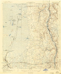
- 1940 Map of Tallahassee, 1958 Print
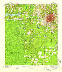 1940 Tallahassee1958 Print · USGSFlorida's capital city and the surrounding Leon County pine forests are captured here just before the mid-century expansion. Genealogists and local historians can trace rural communities like Hilliardville and Woodville alongside landmarks like Richardson Sch and Lake Talquin.2 unique versions available
 - 1940 Map of Arran, 1966 Print
 1940 Arran1966 Print · USGSWakulla County's coastal forests and rail-linked settlements are captured here in the era just before the Second World War. Researchers can locate family landmarks like Roddenberry Cem, the historic Wakulla Springs, and rural hubs such as Sopchoppy and Panacea.
 - 1941 Map of Fort Barrancas
 1941 Fort Barrancas1941 Print · USGSCoastal Florida and Alabama meet at the Perdido River during the early 1940s, showing a landscape of bayous, naval aviation, and growing bayside towns. Genealogists and historians can trace old homesteads near Millview, Fort Barrancas, and schools like Oakfield Sch.3 unique versions available
 - 1941 Map of Starke, 1942 Print
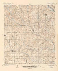
 1941 Starke1942 Print · USGSNorth Florida at the start of the 1940s reveals a region rapidly transforming with the mobilization for war. Genealogists and historians can trace old rail lines like the Seaboard Air Line and find communities like Sampson City or the expansive Camp Blanding Military Reservation.
 - 1941 Map of Middleburg, 1943 Print
 1941 Middleburg1943 Print · USGSClay County at the dawn of the motorized era reveals a landscape of ferry crossings and rural schoolhouses connected by early roads. Researchers can trace the legacy of the Middleburg area through sites like the Rideout Ferry, Black Creek Church, and several named family schools.
 - 1941 Map of Muscogee, 1956 Print
 1941 Muscogee1956 Print · USGSThe Florida-Alabama borderlands come alive in the early 1940s as the Perdido River and major rail lines dictate the rhythm of local commerce. Researchers can trace family roots through numerous rural landmarks like Barrineau Park, the Mission Cem, and Quintette Sch.2 unique versions available
 - 1941 Map of Robertsdale, 1956 Print
 1941 Robertsdale1956 Print · USGSCoastal Alabama's agricultural heartland is documented here just before mid-century, following the rail lines and river bends of the lower Perdido basin. Researchers can pinpoint early rural infrastructure from Old Mill Bridge to the Chandler Fire Tower and rural landmarks like Bethel Chapel or the CCC Camp.3 unique versions available
 - 1941 Map of Pensacola, 1956 Print
 1941 Pensacola1956 Print · USGSPensacola and its surrounding bays are seen here just before the mid-century boom, detailing a landscape defined by naval aviation and maritime rail. Trace the historic city grid, explore the U S Naval Reservation, or locate Oakland Ch and Black Hammock Cem.
 - 1941 Map of Milton, 1956 Print
 1941 Milton1956 Print · USGSSanta Rosa County at the start of the 1940s is shown here as a landscape of timber-towns and tidewater rail junctions. Genealogists can trace family names at Allen Cem, Robinson Sch, and the riverside settlements of Bagdad and Floridatown.2 unique versions available
 - 1941 Map of Century, 1962 Print
 1941 Century1962 Print · USGSThe Florida-Alabama borderlands come alive in the early 1940s as a landscape of river-bottom wetlands and upland rail towns. Genealogists can trace family roots at Coon Hill Cem, Kays Chapel, and long-standing schools like Pine Barren Sch.2 unique versions available
 - 1941 Map of Foley, 1964 Print
 1941 Foley1964 Print · USGSCoastal Baldwin County in the early 1940s shows the working landscape of the Gulf before the era of major development. Researchers can trace the Louisville and Nashville Railroad line, find local landmarks like Stone Quarry Bayou, and locate early community sites such as Miflin Sch.3 unique versions available
 - 1942 Map of Pensacola
 1942 Pensacola1942 Print · USGSCoastal Florida is captured here in the early years of the war, showing the maritime and rail infrastructure that shaped the Panhandle. Genealogists and historians can trace family locations near Oakland Ch, the Black Hammock Cem, and the busy Muscogee Wharf.2 unique versions available
 - 1942 Map of Cockroach Bay
 1942 Cockroach Bay1942 Print · USGSThe eastern shores of Tampa Bay are captured here in the early 1940s, highlighting the undeveloped coastal wetlands and islands of the region. Researchers can trace early infrastructure and landmarks such as the Big Cockroach Mound, the Atlantic Coast Line rail corridor, and the small community at Piney Point.
 - 1942 Map of Moniac
 1942 Moniac1942 Print · USGSThe Georgia-Florida borderlands were defined by the wilderness of the Okefenokee Swamp and the tracks of the Georgia Southern and Florida railroad. Genealogists and historians can locate old landmarks like Olivers Mill, Deep Creek Church, and several rural schools including Chesser School and Dunn Creek School.2 unique versions available
 - 1942 Map of Tallahassee
 1942 Tallahassee1942 Print · USGSTallahassee and the surrounding Leon County area appear here in the early 1940s, balancing its role as a college town with the wilderness of the Apalachicola National Forest. Researchers can trace the rural church and school networks of Woodville and Spring Hill, or locate early campus footprints for Florida State College for Women.
 - 1942 Map of Ates Creek
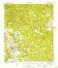
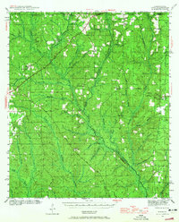
 1942 Ates Creek1942 Print · USGSNorthern Florida's training grounds and rural settlements come into focus during the early mobilization of the Second World War. Researchers can trace the military layout of Camp Blanding alongside the agricultural colony at Penney Farms and the springs of Gold Head Branch.
 - 1942 Map of Dyas, 1965 Print
 1942 Dyas1965 Print · USGSThe borderlands of Alabama and Florida are captured here during the early 1940s, highlighting a landscape shaped by timber and the Perdido River. Genealogists can locate family landmarks like Cain Cem, Nokomis Sch, and the St Stephens and St Louis RR.2 unique versions available
 - 1943 Map of Robertsdale
 1943 Robertsdale1943 Print · USGSCentral Baldwin County is shown here in the early 1940s, when timber work and rail lines defined the landscape. You can trace family roots at Rock Creek Cem, locate the Turpentine Camp, and find old schools like Blackwater Sch.3 unique versions available
 - 1943 Map of Arran
 1943 Arran1943 Print · USGSWakulla County's coastal lowlands and timber forests are captured here just before the mid-century, centered on CRAWFORDVILLE and the Seaboard Air Line. Genealogists can trace family footprints at Roddenberry Cem, Pilgrims Rest Ch, and the rural Mt Pleasant Sch.2 unique versions available
 - 1943 Map of St Joseph Spit
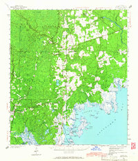
 1943 St Joseph Spit1943 Print · USGSThe Florida Panhandle coastline appears in its wild, mid-century state as the War Department surveys this strategic peninsula. Researchers can trace the shifting Sand Dunes and tidal inlets like Pig Bayou along the length of St Joseph Spit.4 unique versions available
 - 1943 Map of Beacon Beach
 1943 Beacon Beach1943 Print · USGSCoastal Florida in the early nineteen-forties reveals a landscape of isolated bayous and quiet shorelines before the postwar boom. Genealogists and local historians can trace the early layout of Beacon Beach and locate the Marywood Cem near Pearl Bayou.3 unique versions available
 - 1943 Map of Muscogee
 1943 Muscogee1943 Print · USGSThe Florida-Alabama borderlands come alive in the early 1940s as the river-and-rail economy pulses through Muscogee and Cantonment. Genealogists can trace family footprints at Mission Cem, Sunnyhill Sch, and rural stops along the Louisville and Nashville RR.2 unique versions available
 - 1943 Map of Bay Keys
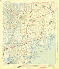
 1943 Bay Keys1943 Print · USGSThe shallow waters north of Key West are captured in the 1940s as a series of navigational channels and mangroves. Maritime researchers can trace early survey markers like Tidal Bm 2 and passages through Bay Keys and Bluefish Channel.
 - 1943 Map of Saddlebunch Keys
 1943 Saddlebunch Keys1943 Print · USGSMonroe County’s island chain is captured during the war years as the modern overseas route was still taking shape. Maritime researchers can trace essential coastal markers like American Shoal Lighthouse and the early layout of Sugaloa Beach.2 unique versions available
 - 1943 Map of Boca Chica
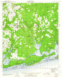
 1943 Boca Chica1943 Print · USGSThe Lower Keys are captured here during the Second World War as modern infrastructure begins to reshape the archipelago. Researchers can trace the development of Boca Chica Airport and early roads connecting Stock Island, Big Coppitt Key, and the Sugar Loaf Club.
Showing maps 1-25
Top cities of Florida
- Jacksonville historical maps
- Miami historical maps
- Tampa historical maps
- Orlando historical maps
- Saint Petersburg historical maps
- Hialeah historical maps
See more
Top counties of Florida
- Miami-Dade County historical maps
- Broward County historical maps
- Palm Beach County historical maps
- Hillsborough County historical maps
- Orange County historical maps
- Pinellas County historical maps
See more
Frequently asked questions
- What are the different types of historical maps available for Florida?
- What is the oldest map of Florida?
- Where can I purchase historical maps of Florida for my home or office?
- Where can I download high-res historical maps of Florida?
- Are there historical topographic maps available for Florida?
- Is there historical aerial imagery available for Florida?
- Where are historical maps of Florida sourced from?