1990s Maps of Florida
Explore 253 historic maps of Florida from the 1990s. These maps offer a rare glimpse into what life looked like during the 1990s — showing old roads, neighborhoods, homes, and landmarks that have changed or disappeared over time.
Whether you're researching your family's past, planning a metal detecting trip, or studying how Florida's landscape evolved across the 1990s, these high-resolution maps are a powerful tool for exploring the history of this region.
- Focus on a specific era: All maps on this page are from the 1990s, giving you a focused view of this time period.
- See what’s changed: Compare century-old streets, trails, and buildings to today's modern landscape using overlays and satellite layers.
- Research with precision: Use these maps for genealogy, historical research, land use analysis, or educational projects.
- View, download, or print: Maps are fully viewable online in high resolution, and can be downloaded or printed for your own records.
Start exploring Florida's history through authentic maps from the 1990s. This is your window into the past.
Florida maps
- 1990 Map of Woods
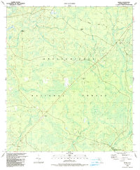
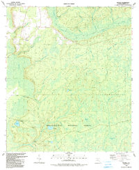 1990 Woods1990 Print · USGSLiberty County's pine flatwoods and cypress bays are meticulously mapped here during the late twentieth century. Genealogists and local historians can locate the community of Woods, trace the path to Smokehouse Crossing, or find the remote Fawn Ford along the New River.
 - 1990 Map of Bristol
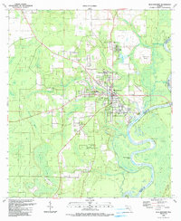
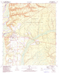 1990 Bristol1990 Print · USGSThe town of Bristol and its surrounding Liberty County wetlands are captured here at the start of the 1990s. Researchers can trace local landmarks like Mitchum Cem and Bristol Ch or locate the historic Forbes Indefinite Purchase Boundary.
 - 1990 Map of Smith Creek
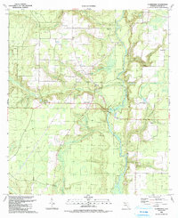
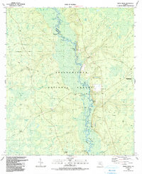 1990 Smith Creek1990 Print · USGSLiberty and Wakulla Counties are defined here by the winding Ochlockonee River during the late twentieth century. Researchers can trace historic river access at Blazed Pine Landing and Upper Langston Landing or locate the Mt Zion Ch community.
 - 1990 Map of Hosford
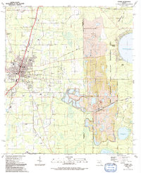
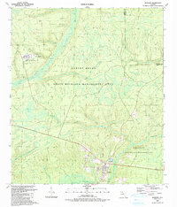 1990 Hosford1990 Print · USGSThe Florida Panhandle near the Gadsden and Liberty County line is documented here in the early nineties, centered on the community of Hosford. Researchers can trace old family sites near Kent Cem or locate the rural settlement of Lowry amidst Telogia Creek and its many branches.
 - 1990 Map of Bradwell Bay
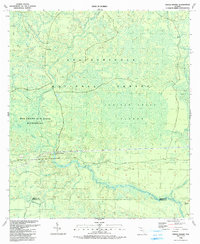
 1990 Bradwell Bay1990 Print · USGSWakulla County's interior wetlands and timberlands are meticulously detailed in this late twentieth-century study of the Florida panhandle. Researchers can trace the path of the Florida National Scenic Trail as it skirts the Bradwell Bay swamp and the banks of the Sopchoppy River.
 - 1990 Map of Orange
 1990 Orange1990 Print · USGSThe riverfront landings and deep swamps of the Panhandle are preserved here as they appeared in the early nineties. Researchers can locate family landmarks like Orange Cem and Humility Cem or trace the river traffic through Porter Ldg and Larkin Fish Camp.
 - 1990 Map of Frink
 1990 Frink1990 Print · USGSCalhoun County in the early nineties remains a landscape of river-bottom swamps and quiet crossroads. Genealogists and historians can trace family roots through the McClellan Cem or locate community hubs like Scotts Ferry and Kinard Ch.
 - 1990 Map of Wewahitchka
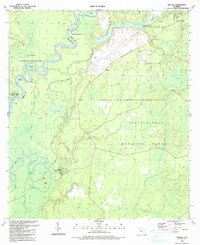
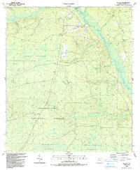
 1990 Wewahitchka1990 Print · USGSGulf County at the close of the twentieth century shows a landscape defined by the winding Apalachicola River and its many sloughs. Genealogists and local historians can locate Williamsburg Cem, trace the community at Dalkeith, and identify old river landings like Cochran Landing.
 - 1990 Map of Queens Bay
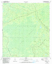
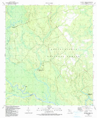
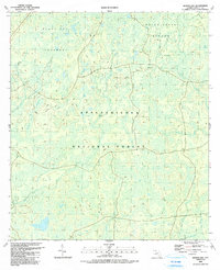 1990 Queens Bay1990 Print · USGSThe Florida Panhandle's interior wetlands are captured here during the 1980s, centered on the dense reaches of the Apalachicola National Forest. Researchers can trace the winding paths of Spring Head Creek or locate landmarks like the Black Cat Islands and Queens Bay.
 - 1990 Map of Owens Bridge
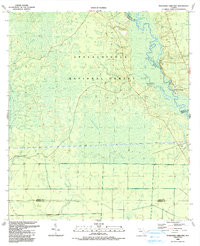
 1990 Owens Bridge1990 Print · USGSLiberty County and the surrounding forest lands are shown here in the 1990s as the wilderness was being preserved and documented. Genealogists and historians can locate the river crossing at Owens Bridge and traces of early settlements at Nero and Morgan Place.
 - 1990 Map of Telogia
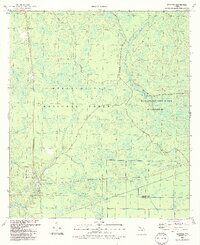
 1990 Telogia1990 Print · USGSLiberty County's rural character is on full display in the 1990s, defined by the wetlands of the Apalachicola National Forest. Researchers can locate several family burial grounds like Old Burnoff Cem and McNair Cem or trace the early paths at Conners Ford.
 - 1990 Map of Estiffanulga
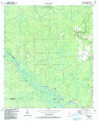
 1990 Estiffanulga1990 Print · USGSThe Florida Panhandle river country is captured here in the 1990s as the Apalachicola River flows between Calhoun and Liberty Counties. Researchers can trace the Forbes Purchase Boundary or locate rural sites like Shiloh Cem and Humility Ch.
 - 1990 Map of Dead Lakes
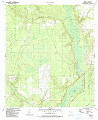
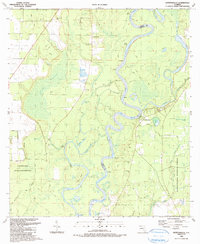
 1990 Dead Lakes1990 Print · USGSThe Florida Panhandle's riverine landscape comes to life in this map centered on Wewahitchka and the sprawling Dead Lakes system. Researchers can trace historical property lines at the Forbes Purchase Boundary or locate family sites near Jehu Cem and Chipola Park.
 - 1990 Map of Kennedy Creek
 1990 Kennedy Creek1990 Print · USGSLiberty County's riverfront and forest lands are captured here in the late twentieth century, showing a landscape defined by the Apalachicola and Chipola rivers. Researchers can trace historic river access at White Oak Landing, locate the Kennedy Creek Fish Camp, and explore the wetlands of Hathcock Bay.
 - 1990 Map of Sumatra
 1990 Sumatra1990 Print · USGSSumatra and the surrounding wetlands of the Florida Panhandle are captured here in the late twentieth century. Researchers can locate the Sumatra Cem, the settlement of Bon Ami, and remote landmarks like the Boatwright Lakes and Boggy Jordan.2 unique versions available
 - 1990 Map of Thousand Yard Bay
 1990 Thousand Yard Bay1990 Print · USGSThe Florida Panhandle river country is documented here during the late twentieth century, showing a wilderness of interconnected basins and riverbanks. Researchers can locate family landmarks like Vause Cem or trace the winding course of the Ochlockonee River past Roberts Landing.
 - 1990 Map of Sanborn
 1990 Sanborn1990 Print · USGSThe Sopchoppy and Ochlockonee rivers converge in the Florida panhandle during the late twentieth century. Genealogists can trace family names at Revell Cemetery and McKenzie-Sanborn Cemetery or locate the settlements of Sopchoppy and Curtis Mill.
 - 1990 Map of Wilma
 1990 Wilma1990 Print · USGSLiberty County in the early nineties is shown here as a dense landscape of national forest and wilderness. Genealogists and historians can trace old family-named landmarks and small settlements like Wilma, Jensen Place, and Vilas among the many swamps and creeks.
 - 1990 Map of Blountstown
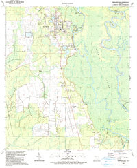
 1990 Blountstown1990 Print · USGSThe Apalachicola riverfront at Blountstown and the surrounding Calhoun County swamplands are shown here at the start of the nineties. Genealogists and historians can locate community anchors like Bethel Ch, Neal Landing, and the ancient Indian Mound.
 - 1990 Map of Clarksville
 1990 Clarksville1990 Print · USGSCalhoun County in the late twentieth century was a landscape of river-fed lowlands and tight-knit rural communities. Researchers can trace family ties through numerous local landmarks like Rollins Corner, Abe Springs Ch, and the Ayers Cems.
 - 1991 Map of Starke
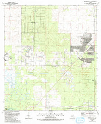
 1991 Starke1991 Print · USGSStarke and its surrounding Bradford County rural districts are shown in the early nineties, revealing a mix of municipal growth and heavy industrial extraction. Researchers can locate several community landmarks including the Bethlehem Mem Cem, New Hope Ch, and the extensive Strip Mines near Kingsley Village.
 - 1991 Map of Ocala West
 1991 Ocala West1991 Print · USGSOcala's western corridor was rapidly evolving into a regional hub of education and aviation during the early nineties. Researchers can trace the development of Central Florida Jr College and local landmarks like Vanguard High Sch and the Old Railroad Grade.
 - 1991 Map of Riverdale
 1991 Riverdale1991 Print · USGSThe St. Johns River corridor comes alive in the early nineties, documenting the riverside landings and crossings that shaped this region. Researchers can trace family sites near Riverdale, Federal Point, and St Johns Ch, or follow the Old Railroad Grade.
 - 1991 Map of Cotton Plant
 1991 Cotton Plant1991 Print · USGSMarion County in the early nineties reveals a transition from traditional rural life to a noted equestrian and residential landscape. Researchers can trace historic church sites and cemeteries like Wesley Chapel Cem and Siloam Ch Cem alongside the Classic Mile Racetrack.
 - 1991 Map of Dunnellon SE
 1991 Dunnellon SE1991 Print · USGSMarion County enters a decade of rapid transformation in the early nineties as residential communities expand across the landscape. Genealogists and historians can trace the growth of Oak Run and Marion Oaks alongside rural landmarks like Cedar Grove Ch.
Showing maps 1-25
Top cities of Florida
- Jacksonville historical maps
- Miami historical maps
- Tampa historical maps
- Orlando historical maps
- Saint Petersburg historical maps
- Hialeah historical maps
See more
Top counties of Florida
- Miami-Dade County historical maps
- Broward County historical maps
- Palm Beach County historical maps
- Hillsborough County historical maps
- Orange County historical maps
- Pinellas County historical maps
See more
Frequently asked questions
- What are the different types of historical maps available for Florida?
- What is the oldest map of Florida?
- Where can I purchase historical maps of Florida for my home or office?
- Where can I download high-res historical maps of Florida?
- Are there historical topographic maps available for Florida?
- Is there historical aerial imagery available for Florida?
- Where are historical maps of Florida sourced from?