1980s Maps of Florida
Explore 237 historic maps of Florida from the 1980s. These maps offer a rare glimpse into what life looked like during the 1980s — showing old roads, neighborhoods, homes, and landmarks that have changed or disappeared over time.
Whether you're researching your family's past, planning a metal detecting trip, or studying how Florida's landscape evolved across the 1980s, these high-resolution maps are a powerful tool for exploring the history of this region.
- Focus on a specific era: All maps on this page are from the 1980s, giving you a focused view of this time period.
- See what’s changed: Compare century-old streets, trails, and buildings to today's modern landscape using overlays and satellite layers.
- Research with precision: Use these maps for genealogy, historical research, land use analysis, or educational projects.
- View, download, or print: Maps are fully viewable online in high resolution, and can be downloaded or printed for your own records.
Start exploring Florida's history through authentic maps from the 1980s. This is your window into the past.
Florida maps
- 1980 Map of Orange Beach
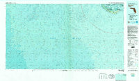
 1980 Orange Beach1980 Print · USGSCoastal Alabama was entering a new era of development in the late seventies, centered on the waterways of Baldwin County. Local historians can trace the early layouts of Orange Beach, the residential expansion on Ono Island, and landmarks like Lay Cem or the U S Naval Res Wolf Field.2 unique versions available
 - 1980 Map of Kingsland
 1980 Kingsland1980 Print · USGSCoastal Camden County is captured in the early 1970s through this detailed orthophotomap, showing the Georgia shoreline’s dense wetlands and timberlands. Researchers can locate small settlements like Seals and Kinlaw among the winding coastal marshes and creek beds.
 - 1980 Map of Okefenokee Swamp, 1981 Print
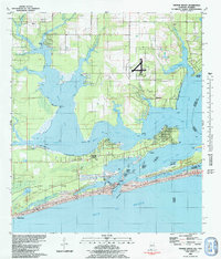
 1980 Okefenokee Swamp1981 Print · USGSThe Georgia-Florida borderlands come to life in the early 1980s, centered on the immense wilderness of the Okefenokee Swamp. Genealogists and historians can trace rail-stop settlements like Fargo and Fruitland or explore the interior geography of Billys Island and Trail Ridge.
 - 1980 Map of Jacksonville, 1984 Print
 1980 Jacksonville1984 Print · USGSThe Jacksonville metropolitan area and the Atlantic coast are captured here during a period of significant late-century growth. Researchers can trace the massive military footprints of Cecil Field and Mayport Naval Station alongside historic communities like Mandarin and Switzerland.
 - 1981 Map of Fernandina Beach
 1981 Fernandina Beach1981 Print · USGSCoastal Florida and Georgia meet at this maritime crossroads in the early eighties, where river and ocean currents converge. Trace the historic fortifications of Fort Clinch and the layout of Old Fernandina alongside the Amelia Island Lighthouse.4 unique versions available
 - 1981 Map of Lake City
 1981 Lake City1981 Print · USGSNorth Florida and South Georgia are mapped in the early eighties as the region balanced forestry with growing infrastructure. Genealogists can trace family names and locations from Live Oak to Macclenny, or find cultural landmarks like the Stephen Foster State Folk Culture Center.2 unique versions available
 - 1981 Map of Valdosta
 1981 Valdosta1981 Print · USGSCrossing the Georgia and Florida border in the early eighties, this survey captures the agricultural and military landscape of the coastal plain. Genealogists and historians can trace the rail-linked growth of Valdosta and Quitman or find rural landmarks like New Hope Church and Lake Miccosukee.
 - 1981 Map of Fort Myers
 1981 Fort Myers1981 Print · USGSSouthwest Florida experienced a transformative era of growth during the early eighties as coastal cities pushed inland toward the Everglades. Trace the expansion of Lehigh Acres and Cape Coral or locate rural landmarks like Palmdale and the Brighton Indian Reservation.
 - 1981 Map of Cody
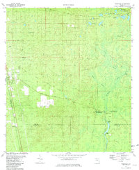
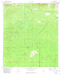 1981 Cody1981 Print · USGSJefferson and Leon Counties are captured here in the early eighties, showcasing a landscape of river swamps and small rural outposts. Local historians can trace the Old Railroad Grade and locate old landmarks like Cody, Fanlew, and Hardy Sink.
 - 1981 Map of Panama City
 1981 Panama City1981 Print · USGSPanama City and the Florida Panhandle coast are captured here in the early eighties, showing the region's balance of military installations and maritime industry. Researchers can trace the Atlanta and St Andrews Bay RR or locate coastal sites like Tyndall Air Force Base and Dead Lake.2 unique versions available
 - 1981 Map of Bay Minette
 1981 Bay Minette1981 Print · USGSThe Alabama-Florida borderlands come to life in the early 1980s as the river delta meets the growing coastal communities. Researchers can trace the Louisville and Nashville rail lines or locate historical points like Twenty-two Mile Bluff and the Blackwater River State Forest.2 unique versions available
 - 1981 Map of Vero Beach, 1982 Print
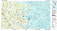
 1981 Vero Beach1982 Print · USGSThe Florida Atlantic coast and the upper St. Johns River basin are shown here in the early 1980s during a period of steady coastal growth. Researchers can trace the development of Vero Beach and Palm Bay or locate inland landmarks like Blue Cypress Lake and the Valkaria Missile Tracking Station.
 - 1981 Map of Tates Hell Swamp, 1982 Print
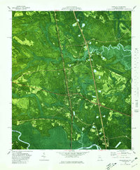
 1981 Tates Hell Swamp1982 Print · USGSFranklin County's dense wetlands are visible in this early 1980s aerial orthophotomap of the Florida Panhandle. Researchers can trace the path of the Old Railroad Grade, locate the small settlement at Five Points, and follow Whiskey George Creek through the swamp.
 - 1981 Map of Fernandina Beach, 1982 Print
 1981 Fernandina Beach1982 Print · USGSThe coastal borderlands of Georgia and Florida are captured here in the early eighties, from the barrier islands to the rail towns of the interior. Genealogists and historians can trace family-named bluffs and sites like Franklintown, Dungeness Wharf, and St Marys Historical Park.3 unique versions available
 - 1981 Map of Dothan, 1982 Print
 1981 Dothan1982 Print · USGSSoutheast Alabama and the tri-state border region are shown here in the early 1980s as the area thrived on military and rail connectivity. Researchers can trace historic transit lines like the Hartford and Slocomb railroad or locate family roots in Ozark, Headland, and Geneva.
 - 1981 Map of Carrabelle, 1982 Print
 1981 Carrabelle1982 Print · USGSCoastal Franklin County in the early eighties shows the intersection of deep-swamp timberlands and a working Gulf waterfront. Genealogists and historians can trace the town’s layout from Carrabelle High Sch to the Crooked River Lighthouse and the remote Yent Place.4 unique versions available
 - 1981 Map of Sanibel, 1982 Print
 1981 Sanibel1982 Print · USGSThe Florida Gulf Coast appears as a patchwork of conservation and coastal life in the early eighties. Researchers can trace the protected boundaries of the J. N. "Ding" Darling National Wildlife Refuge or locate the historic Lighthouse at the tip of Sanibel Island.2 unique versions available
 - 1981 Map of West Palm Beach, 1982 Print
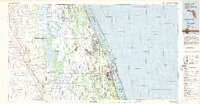
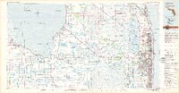 1981 West Palm Beach1982 Print · USGSPalm Beach County and the eastern shores of Lake Okeechobee are shown here just after the start of the 1980s. Genealogists and local historians can trace the development of inland towns like Belle Glade and Harlem alongside coastal communities like Lantana and Riviera Beach.
 - 1981 Map of Miami, 1982 Print
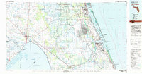
 1981 Miami1982 Print · USGSThe Miami metropolitan corridor and the vast marshlands of the interior are seen here in the early 1980s. Trace the reach of Florida's Turnpike and the Florida East Coast Railway past Opa-locka, Coral Gables, and the Miami International Airport.
 - 1981 Map of Sugar Hill, 1982 Print
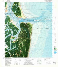
 1981 Sugar Hill1982 Print · USGSSt George Island and its coastal waters are captured in this 1980s orthophotomap, showing the delicate barrier island before modern development. Maritime researchers can trace the submerged shoals of the Gulf of Mexico and the boundaries of St George Island State Park.
 - 1981 Map of Cape Sable, 1982 Print
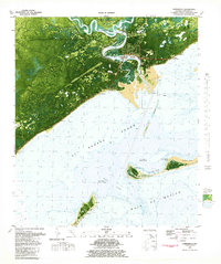
 1981 Cape Sable1982 Print · USGSThe tip of the Florida peninsula and the coastal Everglades appear here in the early eighties, showcasing a complex wilderness of mangrove channels and tidal bays. Researchers can trace the water systems of Lake Ingraham and Whitewater Bay or locate landmarks like Lonesome Mound.
 - 1981 Map of Saint Augustine, 1982 Print
 1981 Saint Augustine1982 Print · USGSNortheast Florida in the early eighties shows a landscape of deep river commerce and coastal growth. Genealogists and historians can trace the inland rail network of the Seaboard Coast Line through rural Hastings or explore the military footprint of Camp Blanding.2 unique versions available
 - 1981 Map of Fort Pierce, 1982 Print
 1981 Fort Pierce1982 Print · USGSFlorida's Treasure Coast and the northern rim of the Everglades are caught in a period of significant growth during the early eighties. Genealogists and historians can trace the rail-side development of White City and Eden or the water-management history of the St Lucie Canal.
 - 1981 Map of Goose Island, 1982 Print
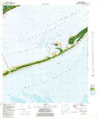 1981 Goose Island1982 Print · USGSCoastal Franklin County in the early eighties shows the vital link between the mainland and the barrier islands. Trace the path of the BRYANT PATTON BRIDGE to St George Island State Park and explore landmarks like Goose Island.2 unique versions available
 - 1981 Map of Woodville, 1982 Print
 1981 Woodville1982 Print · USGSThe Leon and Wakulla county borderlands are shown here in the early eighties, centered on the historic site of the Natural Bridge Battlefield. Trace the path of the Seaboard Coast Line or locate family markers at Rhodes Cem and Godwin Cem.2 unique versions available
Showing maps 1-25
Top cities of Florida
- Jacksonville historical maps
- Miami historical maps
- Tampa historical maps
- Orlando historical maps
- Saint Petersburg historical maps
- Hialeah historical maps
See more
Top counties of Florida
- Miami-Dade County historical maps
- Broward County historical maps
- Palm Beach County historical maps
- Hillsborough County historical maps
- Orange County historical maps
- Pinellas County historical maps
See more
Frequently asked questions
- What are the different types of historical maps available for Florida?
- What is the oldest map of Florida?
- Where can I purchase historical maps of Florida for my home or office?
- Where can I download high-res historical maps of Florida?
- Are there historical topographic maps available for Florida?
- Is there historical aerial imagery available for Florida?
- Where are historical maps of Florida sourced from?