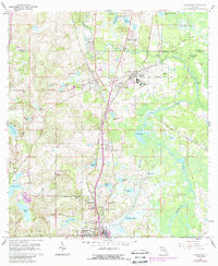
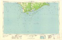
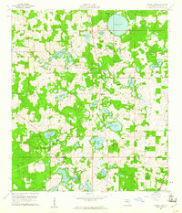
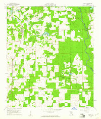
1960s Maps of Florida
Explore 555 historic maps of Florida from the 1960s. These maps offer a rare glimpse into what life looked like during the 1960s — showing old roads, neighborhoods, homes, and landmarks that have changed or disappeared over time.
Whether you're researching your family's past, planning a metal detecting trip, or studying how Florida's landscape evolved across the 1960s, these high-resolution maps are a powerful tool for exploring the history of this region.
- Focus on a specific era: All maps on this page are from the 1960s, giving you a focused view of this time period.
- See what’s changed: Compare century-old streets, trails, and buildings to today's modern landscape using overlays and satellite layers.
- Research with precision: Use these maps for genealogy, historical research, land use analysis, or educational projects.
- View, download, or print: Maps are fully viewable online in high resolution, and can be downloaded or printed for your own records.
Start exploring Florida's history through authentic maps from the 1960s. This is your window into the past.
Florida maps
- 1960 Map of Pensacola
 1960 Pensacola1960 Print · USGSThe Florida Panhandle and Alabama's eastern shore are shown during a period of rapid military and coastal growth. Genealogists and historians can trace the mid-century footprints of Warrington, the Pensacola NAS (Chevalier), and the Blackwater River timber lands.
 - 1960 Map of Jacksonville
 1960 Jacksonville1960 Print · USGSCoastal Florida and Georgia meet in this mid-century portrait of a region shaped by naval power and the winding St Johns River. Researchers can trace the development of military sites like Cecil Field or locate historic rural landmarks such as Jerusalem Ch and Kings Ferry.
 - 1960 Map of Lacoochee
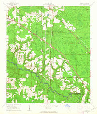
 1960 Lacoochee1960 Print · USGSPasco and Hernando counties centered on the rail-junction towns of the 1960s, where the Withlacoochee River meets a network of citrus-growing ridges. Genealogists can trace family roots at Trilby Cem, Moss Town, and the Old Henley Place.2 unique versions available
 - 1960 Map of Apalachicola
 1960 Apalachicola1960 Print · USGSFlorida's Forgotten Coast was a realm of maritime industry and vast wetlands in the late fifties. Genealogists and historians can trace the rail lines of the Apalachicola Northern or locate sites like Port St Joe, the Cape St George Lighthouse, and Carrabelle.
 - 1960 Map of Tallahassee
 1960 Tallahassee1960 Print · USGSThe Florida Panhandle and southern Georgia are captured here in the mid-twentieth century, showing a region defined by its rivers and military installations. Genealogists and historians can trace the growth of Tallahassee or locate coastal landmarks like the St Marks Lighthouse and Tyndall Air Force Base.
 - 1960 Map of Tampa
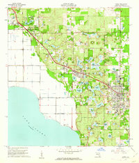
 1960 Tampa1960 Print · USGSThe Florida Gulf Coast was undergoing a major transformation at the start of the sixties, with new bridges linking burgeoning cities across the bays. Researchers can trace the mid-century footprints of St Petersburg and Tampa, or locate coastal landmarks like Mac Dill AFB and the Sunshine Skyway.2 unique versions available
 - 1960 Map of Cherry Lake, 1961 Print
 1960 Cherry Lake1961 Print · USGSNorthern Florida's lake country is captured here in the early sixties as rural life centered around the water and the rail. Genealogists and historians can locate family-named landmarks and community hubs like Cherry Lake 4-H Camp, Jestlamb Sch, and New Hopeful Ch.3 unique versions available
 - 1960 Map of Pinetta, 1961 Print
 1960 Pinetta1961 Print · USGSMadison County, Florida, is captured at the dawn of the 1960s, showing a landscape defined by small hamlets and the Withlacoochee River. Researchers can trace old rail lines like the Valdosta Southern or locate family-named landmarks like Leland and Smiths Pond.4 unique versions available
 - 1960 Map of Branchborough, 1962 Print
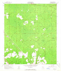
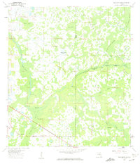 1960 Branchborough1962 Print · USGSThe swampy interior of Florida at the tri-county border shows a landscape of riverine hammocks and early forest industry in the 1960s. Genealogists and historians can trace the foundations of Branchborough and locate Withlacoochee Cemetery and Port Lonesome.4 unique versions available
 - 1960 Map of Sorrento, 1962 Print
 1960 Sorrento1962 Print · USGSLake and Orange Counties are captured here in the early 1960s, showing a landscape defined by citrus groves and spring-fed waters. Genealogists can locate family landmarks like Tangerine Cem and Lake Ola Chapel near the Atlantic Coast Line railroad.4 unique versions available
 - 1960 Map of Dade City, 1962 Print
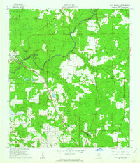
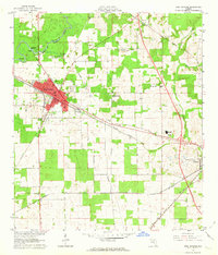
 1960 Dade City1962 Print · USGSPasco County's interior comes into focus during the early 1960s, showing the intersection of Florida's citrus economy and rail history. Trace the old lines of the Atlantic Coast Line to junctions at Vitis or find family history at Mount Zion Cemetery and Tommytown.4 unique versions available
 - 1960 Map of Bay Lake, 1962 Print
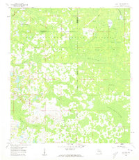
 1960 Bay Lake1962 Print · USGSFlorida's interior wetlands and timberlands are captured here in the early sixties, centered on the Sumter and Lake County border. Genealogists and historians can trace local landmarks like Bay Lake Ch or follow the path of the Seaboard Air Line through the cypress hammocks.3 unique versions available
 - 1960 Map of Rock Ridge, 1962 Print
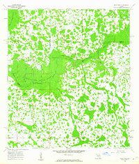 1960 Rock Ridge1962 Print · USGSThe Florida swamp country at the edge of Polk and Sumter Counties comes into focus during the early sixties. Genealogists and historians can trace the foundations of the Rock Ridge community, including Little Flock Ch and numerous segments of an Old Railroad Grade.4 unique versions available
 - 1960 Map of Clay Sink, 1962 Print
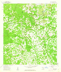
 1960 Clay Sink1962 Print · USGSFlorida's swampy interior at the Hernando and Pasco county line reveals a wilderness of forestry grades and isolated settlements in the early sixties. Researchers can trace the Atlantic Coast Line and locate sites like Bevels Place, Richloam, and Sturkey.2 unique versions available
 - 1960 Map of Apopka, 1962 Print
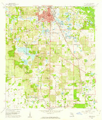
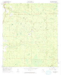
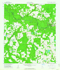
 1960 Apopka1962 Print · USGSOrange County's citrus and farming heartland thrives in the early sixties along the Seaboard Air Line. Genealogists and researchers can trace local roots through Zellwood Cem, Memorial High Sch, and the Hampden DuBose Academy.4 unique versions available
 - 1961 Map of Deep Creek, 1962 Print
 1961 Deep Creek1962 Print · USGSThe Osceola National Forest in the early sixties was a landscape of timber-driven transport and swampy flatwoods. You can trace the network of an old railroad grade and locate remote sites like Greenfield, a cemetery, and the central Lookout Tower.2 unique versions available
 - 1961 Map of Live Oak East, 1962 Print
 1961 Live Oak East1962 Print · USGSSuwannee County was a major rail and industrial crossroads in the early sixties, centered on the hub of Live Oak. Local historians can trace the intersecting lines of the Southern Railway and find landmarks like the Suwannee Mine and Douglas High Sch.2 unique versions available
 - 1961 Map of Hillcoat, 1963 Print
 1961 Hillcoat1963 Print · USGSNorth Florida's river country is captured here in the early sixties, showing the intersection of heavy rail and rural settlement along the river. Genealogists can locate family landmarks like Nunn Cem and Mt Pleasant Ch near the historic Suwannee Springs.2 unique versions available
 - 1961 Map of White Springs East, 1963 Print
 1961 White Springs East1963 Print · USGSAlong the Suwannee River in the early sixties, this area shows a rural landscape defined by deep swamps and timber-rich bayous. Genealogists can trace family footprints at Riverside Cem, the settlement of Winfield, and country landmarks like Falling Creek Ch.3 unique versions available
 - 1961 Map of White Springs West, 1963 Print
 1961 White Springs West1963 Print · USGSThe Suwannee River country in the early sixties was a landscape of river-bend memorials and rural church communities. Genealogists can trace family footprints at Springville Ch or Swift Creek Cem, and locate landmarks like the Sailor Hotel and Bullock Lookout Tower.3 unique versions available
 - 1962 Map of Key West
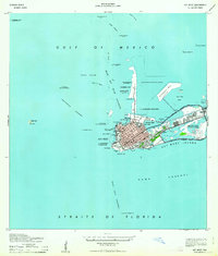 1962 Key West1962 Print · USGSKey West at the start of the sixties reveals a unique landscape where military readiness and island life converged. Genealogists and historians can trace the evolution of Key West Island through landmarks like Fort Taylor, Meacham Field, and Stock I.
 - 1962 Map of Orlando
 1962 Orlando1962 Print · USGSCentral Florida was transformed by aerospace and citrus at the start of the sixties. Genealogists and historians can trace old community footprints from Eau Gallie to Leesburg, alongside landmarks like McCoy AFB and the winding Econlockhatchee River.
 - 1962 Map of Genoa, 1963 Print
 1962 Genoa1963 Print · USGSHamilton County was a landscape of timber camps and rural parishes in the early sixties. Genealogists can trace family roots at Spring Branch Cem or Barton Cem, while industrial researchers can locate old rail-side works like Blacks Still and Camps Still.3 unique versions available
 - 1962 Map of Pine Lakes, 1963 Print
 1962 Pine Lakes1963 Print · USGSThe rural landscape near Cassia and the St. Johns River basin is captured here in the early sixties, showing a region defined by pine woods and citrus groves. Genealogists and local historians can trace the Old Railroad Grade and locate family sites near Cassia Cem or the remote Otter Mound.4 unique versions available
 - 1962 Map of High Springs, 1963 Print
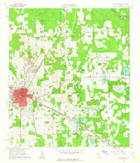
 1962 High Springs1963 Print · USGSHigh Springs and its surrounding rail corridors are captured here in the early sixties, as the region's transportation and agricultural networks were fully matured. Genealogists and local historians can trace rural family landmarks like Traxier Ch, Asberry Cem, and the springs along the Santa Fe River.5 unique versions available
Showing maps 1-25
Top cities of Florida
- Jacksonville historical maps
- Miami historical maps
- Tampa historical maps
- Orlando historical maps
- Saint Petersburg historical maps
- Hialeah historical maps
See more
Top counties of Florida
- Miami-Dade County historical maps
- Broward County historical maps
- Palm Beach County historical maps
- Hillsborough County historical maps
- Orange County historical maps
- Pinellas County historical maps
See more
Frequently asked questions
- What are the different types of historical maps available for Florida?
- What is the oldest map of Florida?
- Where can I purchase historical maps of Florida for my home or office?
- Where can I download high-res historical maps of Florida?
- Are there historical topographic maps available for Florida?
- Is there historical aerial imagery available for Florida?
- Where are historical maps of Florida sourced from?