1950s Maps of Florida
Explore 1,751 historic maps of Florida from the 1950s. These maps offer a rare glimpse into what life looked like during the 1950s — showing old roads, neighborhoods, homes, and landmarks that have changed or disappeared over time.
Whether you're researching your family's past, planning a metal detecting trip, or studying how Florida's landscape evolved across the 1950s, these high-resolution maps are a powerful tool for exploring the history of this region.
- Focus on a specific era: All maps on this page are from the 1950s, giving you a focused view of this time period.
- See what’s changed: Compare century-old streets, trails, and buildings to today's modern landscape using overlays and satellite layers.
- Research with precision: Use these maps for genealogy, historical research, land use analysis, or educational projects.
- View, download, or print: Maps are fully viewable online in high resolution, and can be downloaded or printed for your own records.
Start exploring Florida's history through authentic maps from the 1950s. This is your window into the past.
Florida maps
- 1950 Map of Hialeah
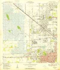 1950 Hialeah1950 Print · USGSMid-century Miami-Dade County is shown here during a period of rapid suburban and industrial expansion. Researchers can trace the early layout of Hialeah, the grounds of Hialeah Park, and numerous family burial sites like Mt Nebo Cem.
 - 1950 Map of Arlington
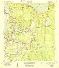 1950 Arlington1950 Print · USGSCoastal Duval County comes alive in the early fifties as the St. Johns River communities begin to expand eastward into the pine lands. Local researchers can trace family roots through several rural burial grounds like Gilmore Cem and Parsons Cem, or locate historic landmarks such as Craig Field and the ancient Indian Mound.2 unique versions available
 - 1950 Map of Riomar
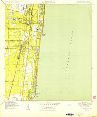
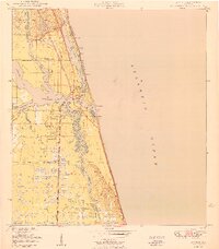
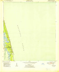 1950 Riomar1950 Print · USGSThe Florida barrier island around Vero Beach is captured here at mid-century, before the era of intensive high-rise development. Trace the early layout of the Riomar Country Club Golf Course and coastal landmarks like the Vero Beach Bridge and Bethel Creek.
 - 1950 Map of St. Lucie Inlet
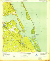 1950 St. Lucie Inlet1950 Print · USGSMid-century coastal Florida comes alive in this survey of the St. Lucie area as it appeared just after the war. Local historians can trace the foundations of Stuart and Port Sewall, the grounds of Witham Field, and the expanse of the Hanson Grant.
 - 1950 Map of Homestead
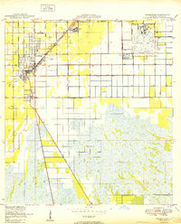 1950 Homestead1950 Print · USGSSouth Florida's agricultural heartland is documented here just after the war, showing the expansion of Homestead and Florida City. Genealogists and historians can trace the early road network of Avocado Drive and the vital Florida East Coast railway.
 - 1950 Map of Ankona
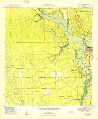
 1950 Ankona1950 Print · USGSThe Florida coast near White City is shown here just after the war, when rail and river dominated the landscape. Genealogists and historians can trace the early layout of Ankona and Walton along the Indian River and the Florida East Coast railway.
 - 1950 Map of Mayport
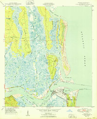 1950 Mayport1950 Print · USGSCoastal Duval County comes to life at the midpoint of the century, showing the intricate wetlands between the St. Johns River and Nassau Sound. Researchers can locate the Anderson Cem, the Ribault Monument, and the Abandoned Lighthouse near East Mayport.
 - 1950 Map of Fort Pierce
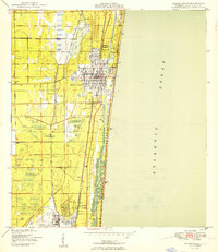
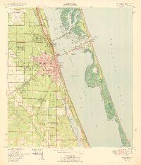 1950 Fort Pierce1950 Print · USGSFort Pierce and the surrounding St. Lucie County coast come alive in this mid-century survey. Genealogists and local historians can trace the development of White City, locate the White City Cem, and explore the rail corridor of the Florida East Coast.
 - 1950 Map of Palm City
 1950 Palm City1950 Print · USGSMid-century coastal Florida comes alive in this survey of the river forks and early development near the Atlantic coast. Genealogists and local historians can trace the foundations of Stuart and Palm City, locating landmarks like Union Ch and the Fern Hill Cem.
 - 1950 Map of Glades
 1950 Glades1950 Print · USGSThe Florida coast at mid-century reveals a landscape defined by the intersection of marsh and sea. Researchers can trace the path of the Old Dixie Highway and locate coastal landmarks like Narrow Point and Manatee Bay.
 - 1950 Map of Trout River
 1950 Trout River1950 Print · USGSNorth of Jacksonville in the early postwar era, the riverfront is a landscape of growing suburbs and civic institutions. Genealogists and local historians can locate family burial sites at Restlawn Memorial Park or trace the early days of the Jacksonville Municipal Airport.
 - 1950 Map of Boca Raton
 1950 Boca Raton1950 Print · USGSSoutheast Florida’s coastline shows its mid-century character before the peak of modern development, centered on the growing resorts and transit hubs. Genealogists and historians can trace the early footprints of Boca Raton and Deerfield Beach, locating landmarks like the Lighthouse and the original Florida East Coast rail line.
 - 1950 Map of Miami
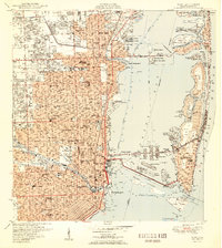 1950 Miami1950 Print · USGSGreater Miami at the midpoint of the century reveals a landscape of dredging and development across Biscayne Bay. Genealogists and researchers can trace neighborhood growth through dozens of named sites like Liberty Square, Bethel Ch, and the Burdine Stadium.2 unique versions available
 - 1950 Map of Delray Beach
 1950 Delray Beach1950 Print · USGSThe Florida coast near Delray Beach and Boca Raton is captured here during its post-war transition. You can trace the competing paths of the Florida East Coast and Seaboard Air Line railroads or locate local landmarks like Christ Ch and the Rifle Range.2 unique versions available
 - 1950 Map of Mulberry
 1950 Mulberry1950 Print · USGSThe phosphate mining district around Mulberry is captured here at mid-century, showing a landscape defined by industry and rail. Genealogists and historians can trace old settlements like Tancrede and locate rural landmarks such as Medulla Ch and Prairie Cem.
 - 1950 Map of Bartow
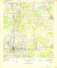
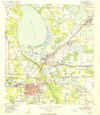 1950 Bartow1950 Print · USGSMid-century Bartow and the central Florida phosphate district are seen here during a period of industrial expansion. Genealogists and researchers can locate old schools like Union Academy, rural churches like Macedonia Ch, and the sprawling Strip Mine Area that reshaped the local terrain.
 - 1950 Map of Goose Island
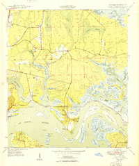
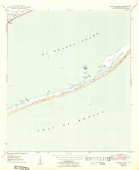 1950 Goose Island1950 Print · USGSThe Franklin County coast comes alive in the mid-century, showing the quiet settlement of Eastpoint and the long, sandy stretches of St George Island. Genealogists and maritime historians can trace coastal landmarks like Eastpoint Cem, Old Landing, and Goose Island.4 unique versions available
 - 1950 Map of Fort Pierce NW
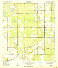 1950 Fort Pierce NW1950 Print · USGSSt. Lucie County was a landscape of citrus groves and emerging aviation hubs just after the war. Researchers can trace early infrastructure along Kings Highway, the St Lucie County Airport, and the winding Tenmile Creek.2 unique versions available
 - 1950 Map of Hobbs Cross Roads
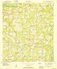 1950 Hobbs Cross Roads1950 Print · USGSThe Florida-Alabama state line at mid-century was a region of river landings and remote crossroad communities. Genealogists can trace family footprints through sites like McDuffie Cem, Beulah Anna Ch, and the old river access at Old Warehouse Landing.2 unique versions available
 - 1950 Map of Prosperity
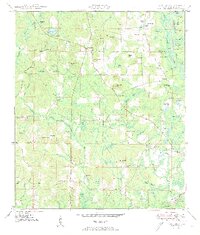 1950 Prosperity1950 Print · USGSHolmes County in the early post-war years remained a landscape of timbered bays and scattered family settlements connected by the Old Spanish Trail. Researchers can trace the footprints of Arrant Settlement, Prosperity, and historic churches like Corinth Ch.3 unique versions available
 - 1950 Map of Millers Ferry
 1950 Millers Ferry1950 Print · USGSThe riverine corridor of the Florida Panhandle comes alive in the mid-century before major highway changes altered the local landscape. Genealogists can trace family connections at Miller Cem and locate vanished river crossings like Millers Ferry and Shell Landing Ferry.
 - 1950 Map of Jupiter
 1950 Jupiter1950 Print · USGSCoastal Florida is mapped in the early postwar years as the town of Jupiter begins to expand around its famous lighthouse. Genealogists and local historians can trace landmarks like the Jupiter Cem, the US Navy Marine Base, and the old Jupiter Sch.
 - 1950 Map of Eastport
 1950 Eastport1950 Print · USGSCoastal Duval County comes alive in this mid-century survey of the riverbanks and tidal marshes north of the city. Genealogists can trace family footprints through community anchors like New Berlin, the Dunn Creek Cem, and churches such as Oak Grove Ch.
 - 1950 Map of Laurel Hill
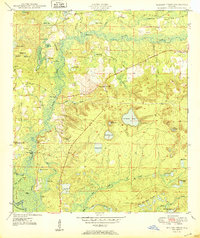
 1950 Laurel Hill1950 Print · USGSThe Florida-Alabama border region is captured here at mid-century, showcasing the timberlands and rail-centered settlements between Laurel Hill and Florala. Researchers can trace old transportation routes like the Old Spanish Trail and find family sites like Mt Zion Cem or Dorcas Ch.2 unique versions available
 - 1950 Map of North Miami
 1950 North Miami1950 Print · USGSMid-century Miami-Dade County comes to life as coastal settlements like Bal Harbour and Surfside begin to take shape. Genealogists and historians can trace the foundations of Opa-locka and the sprawling U S Naval Air Station during this era of rapid growth.
Showing maps 1-25
Top cities of Florida
- Jacksonville historical maps
- Miami historical maps
- Tampa historical maps
- Orlando historical maps
- Saint Petersburg historical maps
- Hialeah historical maps
See more
Top counties of Florida
- Miami-Dade County historical maps
- Broward County historical maps
- Palm Beach County historical maps
- Hillsborough County historical maps
- Orange County historical maps
- Pinellas County historical maps
See more
Frequently asked questions
- What are the different types of historical maps available for Florida?
- What is the oldest map of Florida?
- Where can I purchase historical maps of Florida for my home or office?
- Where can I download high-res historical maps of Florida?
- Are there historical topographic maps available for Florida?
- Is there historical aerial imagery available for Florida?
- Where are historical maps of Florida sourced from?