1980s Maps of New Mexico
Explore 606 historic maps of New Mexico from the 1980s. These maps offer a rare glimpse into what life looked like during the 1980s — showing old roads, neighborhoods, homes, and landmarks that have changed or disappeared over time.
Whether you're researching your family's past, planning a metal detecting trip, or studying how New Mexico's landscape evolved across the 1980s, these high-resolution maps are a powerful tool for exploring the history of this region.
- Focus on a specific era: All maps on this page are from the 1980s, giving you a focused view of this time period.
- See what’s changed: Compare century-old streets, trails, and buildings to today's modern landscape using overlays and satellite layers.
- Research with precision: Use these maps for genealogy, historical research, land use analysis, or educational projects.
- View, download, or print: Maps are fully viewable online in high resolution, and can be downloaded or printed for your own records.
Start exploring New Mexico's history through authentic maps from the 1980s. This is your window into the past.
New Mexico maps
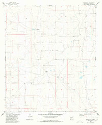
(606)- 1980 Map of Owl Tank Canyon West
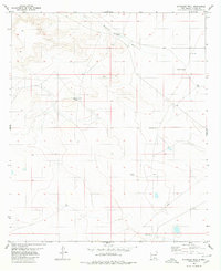
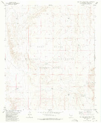 1980 Owl Tank Canyon West1980 Print · USGSThe high desert of Otero County is captured here in the 1970s, showcasing the intersection of military training grounds and ranching history. Researchers can trace vital desert water sources like Foster Ranch Tanks, Childs Tank, and the winding Owl Tank Canyon.
 - 1980 Map of Bassett Lake
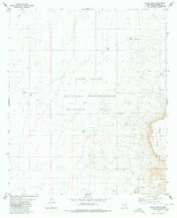
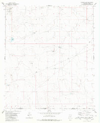 1980 Bassett Lake1980 Print · USGSThe high desert borderlands of Otero County are captured here in the early eighties. Researchers can trace water management and military boundaries across the landscape, from Bassett Lake and Escondida Tank to the vast Fort Bliss Military Reservation.
 - 1980 Map of El Paso Draw
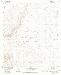
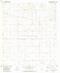 1980 El Paso Draw1980 Print · USGSOtero County in the early eighties was defined by the intersection of military activity and the high desert. Researchers can trace land use through naming conventions at Mc Gregor Range and locate water sources like Ruthford Tanks and Wildcat Draw.
 - 1980 Map of Sixteen Canyon
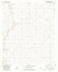
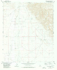 1980 Sixteen Canyon1980 Print · USGSOtero County is captured here in the early 1980s as military and ranching lands meet in a landscape of deep canyons and seasonal rivers. Researchers can locate the Prather Ranch and a lone Grave, or trace water sources like Trammel Well and Shipment Tank.2 unique versions available
 - 1980 Map of Stockard Well
 1980 Stockard Well1980 Print · USGSOtero County ranching lands are captured here in the mid-1970s, showcasing the vital water infrastructure of the high desert. Researchers can trace the legacy of local livestock operations through sites like Stockard Well, Horse Camp Tanks, and Rawhide Tank.
 - 1980 Map of Wilde Tank
 1980 Wilde Tank1980 Print · USGSThe McGregor Range in southern New Mexico is captured here in the early 1980s, showcasing a landscape of military corridors and ranching remnants. Researchers can trace the water history of the region through catchments like Wilde Tank and the Old Wright Place.
 - 1980 Map of Otero Mesa North
 1980 Otero Mesa North1980 Print · USGSOtero County in the early eighties is shown as a dedicated military and ranching landscape. Researchers can trace the water infrastructure of McGregor Range through sites like Double Tanks, Godfrey Tank, and the high-desert Landing Strip.
 - 1980 Map of Owl Tank Canyon East
 1980 Owl Tank Canyon East1980 Print · USGSOtero County is shown here as a landscape of military range lands and desert water infrastructure in the early 1980s. Researchers can trace the layout of the Mc Gregor Range and locate water sources like Johno Well and the Aqueduct.
 - 1980 Map of Stone Well
 1980 Stone Well1980 Print · USGSThe high desert of Otero County is shown during the early eighties as part of a massive military training expanse. Researchers can trace the essential water network of the area through landmarks like Stone Well, Antelope Well, and Cockleburr Tank.
 - 1980 Map of Mountain Tank
 1980 Mountain Tank1980 Print · USGSThe high desert borderlands of New Mexico and Texas come into focus here during the late twentieth century. Genealogists and researchers can trace the limits of the Fort Bliss Military Reservation (Mcgregor Range) and find local landmarks like Hat Ranch and Hale Tank.
 - 1980 Map of Farmington, 1981 Print
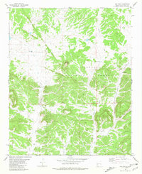
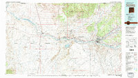 1980 Farmington1981 Print · USGSIn the San Juan Basin during the early 1980s, the energy economy was rapidly transforming the landscape around Farmington and Shiprock. Genealogists and historians can trace the growth of river towns like Kirtland or locate specific sites like the Navajo Mine and Aztec Ruins.2 unique versions available
 - 1980 Map of Navajo Reservoir, 1981 Print
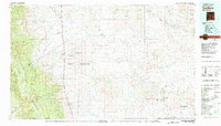
 1980 Navajo Reservoir1981 Print · USGSThe high desert and river valleys of Rio Arriba and San Juan counties are captured here in the early eighties. Genealogists and local historians can trace the development of Aztec and Bloomfield or locate family sites along Gubernador Canyon and the Animas River.
 - 1980 Map of Corona, 1981 Print
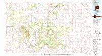 1980 Corona1981 Print · USGSThe high-desert ranching and rail country of Lincoln County is documented here during the early eighties. Genealogists and local historians can trace the Southern Pacific line through Corona, locate the Old Railroad Grade, and find remote outposts like Claunch and Gallinas.
 - 1980 Map of Toadlena, 1981 Print
 1980 Toadlena1981 Print · USGSSan Juan County and the Navajo Nation are shown in the 1980s as a landscape of high mesas and desert washes. Trace the routes between Toadlena, the Tsaya Trading Post, and the ancient grounds of Chaco Canyon National Monument.3 unique versions available
 - 1981 Map of Cox Peak
 1981 Cox Peak1981 Print · USGSCatron County, New Mexico, is shown here in the early 1980s as a landscape of forest management and high-country ranching. Researchers can trace vital water sources and family-named infrastructure such as Mc Clusky Well, Raino Windmill, and the namesake Cox Peak.
 - 1981 Map of Gallo Spring Canyon
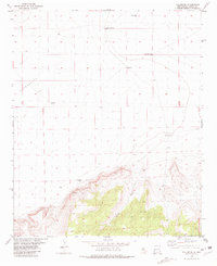
 1981 Gallo Spring Canyon1981 Print · USGSLincoln County rangeland and desert canyons are meticulously detailed in this early 1980s survey. Genealogists and researchers can trace land features like Gallo Spring, Rattlesnake Hill, and the remote Jeep Trail across this arid terrain.
 - 1981 Map of Loco Draw
 1981 Loco Draw1981 Print · USGSLincoln County ranch lands are captured here in the early 1980s, showing a landscape defined by water management and open range. Researchers can trace the layout of the Mile High Ranch and locate remote livestock features like Barvel Lake and Twin Windmills.
 - 1981 Map of Cowboy Mesa NE
 1981 Cowboy Mesa NE1981 Print · USGSLincoln County ranching life in the late twentieth century was defined by isolated outposts and high-desert water management. Researchers can trace family-named landmarks and essential infrastructure like Kuykendall Well, the local Cem, and Ditch Lake.
 - 1981 Map of Gilmore Draw
 1981 Gilmore Draw1981 Print · USGSThe high desert of Doña Ana County in the early eighties reveals a landscape of cattle ranching and military research. Genealogists and historians can trace the water infrastructure of Hills Ranch and the isolated House Pasture Windmill near the White Sands Missile Range.
 - 1981 Map of Rough Mountain
 1981 Rough Mountain1981 Print · USGSLincoln County mining and ranching are documented here during the early eighties, centered on the high ridges of the Cibola National Forest. Researchers can trace railroad history along the Southern Pacific and locate family sites near Gallinas, the Cem, or the Corona Queen Mine.
 - 1981 Map of Fullerton
 1981 Fullerton1981 Print · USGSHigh desert ranching and remote settlement in Catron County appear during the early 1980s. Trace old water sources like Birmingham Well and Sanchez Well near the settlement of Fullerton or explore the terrain around Bat Cave.
 - 1981 Map of Mangas Mountain
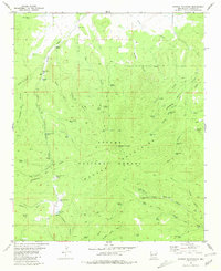 1981 Mangas Mountain1981 Print · USGSIn the high country of Catron County during the early eighties, the Continental Divide crosses a landscape shaped by the Apache National Forest. Researchers can trace old routes and water sources like the Mangas Work Center, Valle Tio Vinces Spring, and Sawmill Pond.
 - 1981 Map of Big Gyp Mountain
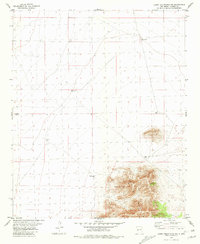
 1981 Big Gyp Mountain1981 Print · USGSSierra County's high desert landscape was firmly established as a military testing ground by the early eighties. Researchers can trace historic water sources like Gyp Spring and Smith Springs alongside the geography of Big Gyp Mountain and the Gyp Hills.
 - 1981 Map of Fleck Draw
 1981 Fleck Draw1981 Print · USGSThe northern Chihuahuan Desert in the early eighties shows a unique overlap of military and agricultural research lands. Researchers can trace remote desert outposts and water infrastructure like Fleck Ranch, Britton Camp, and Cedar Well.
 - 1981 Map of Luera Mountains NW
 1981 Luera Mountains NW1981 Print · USGSCatron County ranch land in the early eighties is defined by the high elevations of the Luera Mountains and essential water infrastructure. Genealogists and land historians can trace the distribution of range resources like Navajo Well, Chamiza Well, and First Well.
Showing maps 1-25 of 606
Top cities of New Mexico
- Albuquerque historical maps
- Las Cruces historical maps
- Rio Rancho historical maps
- Santa Fe historical maps
- Roswell historical maps
- Farmington historical maps
See more
Top counties of New Mexico
- Bernalillo County historical maps
- Doña Ana County historical maps
- Santa Fe County historical maps
- Sandoval County historical maps
- San Juan County historical maps
- McKinley County historical maps
See more
Frequently asked questions
- What are the different types of historical maps available for New Mexico?
- What is the oldest map of New Mexico?
- Where can I purchase historical maps of New Mexico for my home or office?
- Where can I download high-res historical maps of New Mexico?
- Are there historical topographic maps available for New Mexico?
- Is there historical aerial imagery available for New Mexico?
- Where are historical maps of New Mexico sourced from?