1990s Maps of New Mexico
Explore 539 historic maps of New Mexico from the 1990s. These maps offer a rare glimpse into what life looked like during the 1990s — showing old roads, neighborhoods, homes, and landmarks that have changed or disappeared over time.
Whether you're researching your family's past, planning a metal detecting trip, or studying how New Mexico's landscape evolved across the 1990s, these high-resolution maps are a powerful tool for exploring the history of this region.
- Focus on a specific era: All maps on this page are from the 1990s, giving you a focused view of this time period.
- See what’s changed: Compare century-old streets, trails, and buildings to today's modern landscape using overlays and satellite layers.
- Research with precision: Use these maps for genealogy, historical research, land use analysis, or educational projects.
- View, download, or print: Maps are fully viewable online in high resolution, and can be downloaded or printed for your own records.
Start exploring New Mexico's history through authentic maps from the 1990s. This is your window into the past.
New Mexico maps
(539)- 1990 Map of Picture Rock
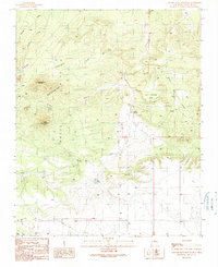
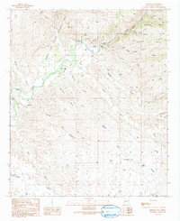
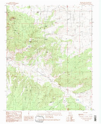 1990 Picture Rock1990 Print · USGSNew Mexico's high desert reveals its complex mining and indigenous history in the final decades of the twentieth century. Genealogists and historians can trace old prospects near Mount Chalchihuitl, the historic Cerrillos settlement, and the site of the San Marcos Pueblo.
 - 1990 Map of Longhorn Reservoir
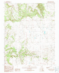
 1990 Longhorn Reservoir1990 Print · USGSThe border of Santa Fe and Torrance counties is captured here in the final decade of the century, showing a landscape shaped by water management and ranching. Researchers can locate the Longhorn Ranch, trace the winding Armijo Draw, and find local landmarks like Stinking Spring and a solitary Grave.
 - 1990 Map of White Lakes
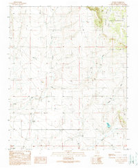
 1990 White Lakes1990 Print · USGSSanta Fe County ranching and utility infrastructure are documented in the late twentieth century. Genealogists and researchers can trace local landmarks like Bozier Well, family-named features such as Armijo Draw, and the seasonal basins of the White Lakes.
 - 1990 Map of Madrid
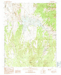 1990 Madrid1990 Print · USGSAt the close of the twentieth century, this Santa Fe County landscape shows a region shaped by mining and rail. Genealogists and historians can trace the Madrid Cem and old transportation routes like the Old Railroad Grade near Cerrillos.
 - 1990 Map of El Cuervo Butte
 1990 El Cuervo Butte1990 Print · USGSHigh desert ranching and water management define the landscape along the Santa Fe and Torrance County line in the late twentieth century. Genealogists and local historians can trace the settlement of Osita and natural features like El Cuervo Butte or Dinosaur Tank.
 - 1990 Map of Lobo Hill
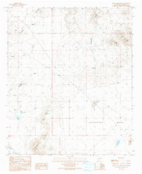
 1990 Lobo Hill1990 Print · USGSThe high plains of Torrance County are revealed in the early nineties, showing a landscape shaped by water rights and energy infrastructure. Trace the routes of the PIPELINE across the Cañada de la Puerta and locate rural landmarks like Cottonwood Well and Lobo Hill.
 - 1990 Map of Lobo Hill SE
 1990 Lobo Hill SE1990 Print · USGSTorrance County ranching and water infrastructure are documented here during the late twentieth century as the region balanced traditional land use with modern utilities. Researchers can trace family-named sites and industrial markers including Dean Ranch, Allan Well, and local Gravel Pits.
 - 1990 Map of Stanley
 1990 Stanley1990 Print · USGSStanley and the surrounding Santa Fe County high desert are captured here as they appeared in the 1990s. Genealogists and local historians can trace the foundations of this ranching community through landmarks like Stanley Cemetery and Landon Windmill.
 - 1990 Map of Lobo Hill NE
 1990 Lobo Hill NE1990 Print · USGSTorrance County ranching and rugged terrain are captured in this late twentieth-century survey of the New Mexico landscape. Researchers can trace the infrastructure of rural life through family-named landmarks like Red Canyon Ranch, Antelope Well, and Chavez Draw.
 - 1990 Map of Lobo Hill SW
 1990 Lobo Hill SW1990 Print · USGSTorrance County ranching and water management are at the forefront of this late-century survey of the New Mexico basin. Researchers can trace land use through named landmarks like Sprule Windmill, Childress Well, and the shores of Laguna del Perro.
 - 1990 Map of Captain Davis Mountain
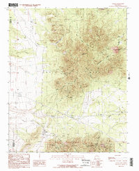
 1990 Captain Davis Mountain1990 Print · USGSThe Ortiz Mountains and surrounding high mesas come into focus during the late twentieth century, showing a landscape shaped by mining and cattle ranching. Researchers can trace the layout of the Dolores Mine, the remote Bullmill Camp, and landmarks like Captain Davis Mountain.
 - 1990 Map of Golden
 1990 Golden1990 Print · USGSSanta Fe County mining history is preserved on this 1990 map of the Ortiz and San Pedro Mountains. Genealogists and historians can trace the foundations of Golden, locate the Old Ortiz Mine, and find the remote Boxcar Camp and Cem.2 unique versions available
 - 1990 Map of Cliff, 1991 Print
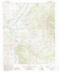 1990 Cliff1991 Print · USGSGrant County ranching and river life are captured here in the early nineties, centered on the fertile valley between the high mesas. Genealogists and local historians can trace family locations through Farm labels, the Clark Cem, and landmarks like the Rodeo Ground.
 - 1990 Map of Willow Draw, 1991 Print
 1990 Willow Draw1991 Print · USGSHidalgo and Grant Counties meet in this arid basin during the late twentieth century, where water management shaped the desert landscape. Trace the network of cattle tanks and seasonal washes like Willow Draw, Harper Tank, and the rugged Knight Canyon.
 - 1990 Map of Crookson Peak, 1991 Print
 1990 Crookson Peak1991 Print · USGSHigh desert peaks and canyons in Grant County were centers of mining and ranching during the late twentieth century. Genealogists and historians can trace industrial remains at the Billali Mine and early settlement markers like the Grave and Old Ranch.
 - 1990 Map of Eagle Eye Peak, 1991 Print
 1990 Eagle Eye Peak1991 Print · USGSThe high ridges of the Gila National Forest come to life in this 1990 survey of the Grant and Hidalgo county line. Researchers can trace the legacy of southwestern mining and ranching through landmarks like the Malone Mines, the Open Pit Mine, and family-named features like Thompson Canyon.
 - 1990 Map of Bullard Peak, 1991 Print
 1990 Bullard Peak1991 Print · USGSThe Big Burro Mountains in the late twentieth century reveal a landscape deeply shaped by mining and wilderness. Researchers can trace historic extraction sites like the Black Hawk Mines, German Mine, and the remote Hummingbird Mine.
 - 1990 Map of Antelope Ridge, 1991 Print
 1990 Antelope Ridge1991 Print · USGSGrant County’s high desert landscape appears here during the late twentieth century, showing a territory of ranching and exploration. Researchers can find old prospect sites and remote landmarks like Horse Lake and the Cem near Howard Cieriega.
 - 1990 Map of Walker Canyon, 1991 Print
 1990 Walker Canyon1991 Print · USGSThe high desert borderlands of Grant and Hidalgo Counties appear in the early 1990s as a landscape of isolated canyons and mesas. Geologists and local historians can trace mining activity at the Open Pit Mine or locate vital water sources like Walker Tank and Mud Springs Draw.
 - 1990 Map of Steeple Rock, 1991 Print
 1990 Steeple Rock1991 Print · USGSNear the Hidalgo county line in the early 1990s, this area of the Summit Mountains was a center of intensive mineral exploration. Genealogists and historians can trace the legacy of the mining era through the Carlisle Mine, the Graves cemetery, and family-named sites like the Hext Place.
 - 1990 Map of Nichols Canyon, 1991 Print
 1990 Nichols Canyon1991 Print · USGSThe Gila River basin in southwestern New Mexico was home to scattered mining operations and ranching outposts during the late twentieth century. Genealogists and historians can trace local industry and infrastructure through features like the Black Bob Mine, Anderson Windmill, and a small Cem.
 - 1990 Map of Applegate Mountain, 1991 Print
 1990 Applegate Mountain1991 Print · USGSThe high desert ranching country of Grant County is captured here in the 1990s. Researchers can trace land use through family-named sites like Willis Dickerson Tank and Foster Draw or locate remote outposts such as Summer Resort and Sycamore Camp.
 - 1990 Map of Rock Tank Draw, 1991 Print
 1990 Rock Tank Draw1991 Print · USGSHidalgo County's arid high-desert landscape is captured here in the late twentieth century as ranching and infrastructure intersected. Researchers can trace land use through local landmarks like Cottonwood Windmill, Rock Tank, and the Summit Hills.
 - 1990 Map of Mangas Springs, 1991 Print
 1990 Mangas Springs1991 Print · USGSThe Gila River and Big Burro Mountains define this Grant County landscape as it appeared in the late eighties. Genealogists and researchers can trace old mining claims like the Aetna Mine and Blackmoor Mine or locate early settlements at Mangas Springs.
 - 1990 Map of Redrock, 1991 Print
 1990 Redrock1991 Print · USGSThe Gila River corridor in the 1990s reveals a landscape shaped by ancient settlement and desert ranching. Researchers can trace the Old Indian Village (Site), the Grey Eagle Mine, and numerous stock tanks like the CCC Tank.
Showing maps 1-25 of 539
Top cities of New Mexico
- Albuquerque historical maps
- Las Cruces historical maps
- Rio Rancho historical maps
- Santa Fe historical maps
- Roswell historical maps
- Farmington historical maps
See more
Top counties of New Mexico
- Bernalillo County historical maps
- Doña Ana County historical maps
- Santa Fe County historical maps
- Sandoval County historical maps
- San Juan County historical maps
- McKinley County historical maps
See more
Frequently asked questions
- What are the different types of historical maps available for New Mexico?
- What is the oldest map of New Mexico?
- Where can I purchase historical maps of New Mexico for my home or office?
- Where can I download high-res historical maps of New Mexico?
- Are there historical topographic maps available for New Mexico?
- Is there historical aerial imagery available for New Mexico?
- Where are historical maps of New Mexico sourced from?