1960s Maps of New Mexico
Explore 841 historic maps of New Mexico from the 1960s. These maps offer a rare glimpse into what life looked like during the 1960s — showing old roads, neighborhoods, homes, and landmarks that have changed or disappeared over time.
Whether you're researching your family's past, planning a metal detecting trip, or studying how New Mexico's landscape evolved across the 1960s, these high-resolution maps are a powerful tool for exploring the history of this region.
- Focus on a specific era: All maps on this page are from the 1960s, giving you a focused view of this time period.
- See what’s changed: Compare century-old streets, trails, and buildings to today's modern landscape using overlays and satellite layers.
- Research with precision: Use these maps for genealogy, historical research, land use analysis, or educational projects.
- View, download, or print: Maps are fully viewable online in high resolution, and can be downloaded or printed for your own records.
Start exploring New Mexico's history through authentic maps from the 1960s. This is your window into the past.
New Mexico maps
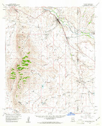
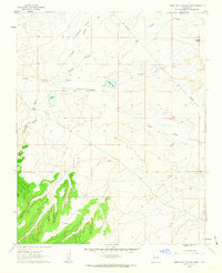
(841)- 1960 Map of Los Griegos
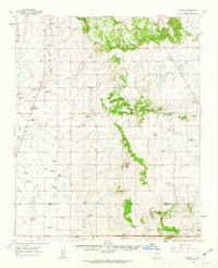
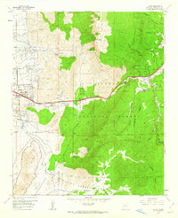
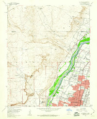 1960 Los Griegos1960 Print · USGSThe Rio Grande valley north of Albuquerque is captured here during a period of suburban growth into traditional grant lands. Researchers can trace the extensive irrigation network and find sites like St Joseph College, Los Poblanos Ranch, and the A T & S F RR.3 unique versions available
 - 1960 Map of Alameda
 1960 Alameda1960 Print · USGSThe Rio Grande valley north of Albuquerque shows a landscape of intensive irrigation and early suburban growth during the 1960s. Researchers can trace the historic Camino Real, locate family landmarks like San Ysidro Ch, or study the grounds of the Sandia View Academy.3 unique versions available
 - 1960 Map of Albuquerque West
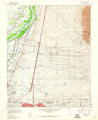
 1960 Albuquerque West1960 Print · USGSAlbuquerque's West Side and Rio Grande valley are seen here in the early sixties as historic land grants began to yield to postwar expansion. Genealogists can trace family roots through numerous parish sites and cemeteries like San Felipe Ch and the US Indian Cem.5 unique versions available
 - 1960 Map of Albuquerque East
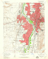
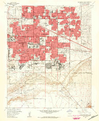 1960 Albuquerque East1960 Print · USGSAlbuquerque's eastern neighborhoods and the foothills of the Sandia Mountains are captured here during a decade of rapid growth. Researchers can locate mid-century schools and churches like Pius X High Sch and Queen of Heaven Ch, or trace the boundaries of the Sandia Military Reservation.3 unique versions available
 - 1960 Map of Duncan, 1961 Print
 1960 Duncan1961 Print · USGSThe Gila River valley along the Arizona-New Mexico border is captured here in the early 1960s as a thriving corridor of rail and irrigation. Researchers can trace the Southern Pacific line through Duncan and Franklin, or locate family sites like Cox Ranch and Rainville Ranch.4 unique versions available
 - 1960 Map of Villanueva, 1962 Print
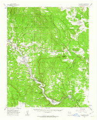 1960 Villanueva1962 Print · USGSThe Pecos River valley in the early sixties maintains its traditional network of villages and acequia irrigation ditches. Genealogists and historians can trace family locations across the San Miguel Del Bado Tract and find settlements like Sena, El Cerrito, and San Miguel.
 - 1960 Map of Apache Springs, 1962 Print
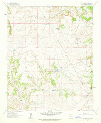
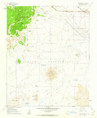
 1960 Apache Springs1962 Print · USGSSan Miguel County ranching and mesa country are captured here in the early sixties, showing a landscape shaped by canyons and cattle. Trace old family sites and rural infrastructure at San Augustin, Los Montoyas, and the Armstrong Ranch Hdqrs.
 - 1960 Map of Sky Village NW, 1963 Print
 1960 Sky Village NW1963 Print · USGSSandoval County ranching and water management are documented in detail in this early 1960s survey of the high desert terrain. Researchers can locate remote family-named landmarks and essential livestock infrastructure like Armijo Lake, Griego Tanks, and the Red Gate Dam.2 unique versions available
 - 1960 Map of South Butte, 1963 Print
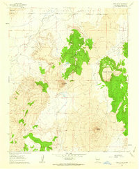
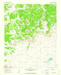 1960 South Butte1963 Print · USGSLaguna Pueblo lands in the early 1960s reveal a high-desert landscape shaped by traditional landmarks and vital water sources. Researchers can trace the cattle and water infrastructure of the era, from the Katama settlement to the Casp-Druma Dam and Kemp Santiago Spring.2 unique versions available
 - 1960 Map of Pueblo Alto Trading Post, 1963 Print
 1960 Pueblo Alto Trading Post1963 Print · USGSMcKinley and Sandoval counties appear here in the early sixties as a high-desert landscape of trading posts and remote airfields. Researchers can trace the proximity of the Pueblo Alto Trading Post to ancient Ruins and the Tanner Landing Strip.2 unique versions available
 - 1960 Map of Lobo Hill, 1963 Print
 1960 Lobo Hill1963 Print · USGSTorrance County ranching life in the early 1960s is captured here through a network of family homesteads and desert water draws. Researchers can locate specific legacy sites like the Lamb Homestead, Kincheloe Homestead, and Price Ranch.
 - 1960 Map of Sky Village NE, 1963 Print
 1960 Sky Village NE1963 Print · USGSHigh desert ranching and tribal lands in New Mexico come to life in this early 1960s survey. Researchers can trace the drainage of Arroyo Ojito and locate historic points like Tenorio Ranch and the waters of Laguna de Baca.2 unique versions available
 - 1960 Map of Taos Junction, 1963 Print
 1960 Taos Junction1963 Print · USGSHigh-altitude New Mexico terrain at the dawn of the sixties shows a landscape defined by ranching life and mountain transit. Researchers can trace the Old Railroad Grade and locate long-standing landmarks like Taos Junction and Cerro Azul.3 unique versions available
 - 1960 Map of Bloomfield, 1963 Print
 1960 Bloomfield1963 Print · USGSSan Juan County in the early sixties was a landscape of rapid industrial growth meeting traditional river valley life. Genealogists and researchers can trace the community footprints of Bloomfield and Blanco, finding local landmarks like St Marys Ch and the Hammond Cem.3 unique versions available
 - 1960 Map of Stanley, 1963 Print
 1960 Stanley1963 Print · USGSRanching life in Santa Fe County during the early 1960s is defined here by isolated homesteads and high-altitude water holes. Genealogists can trace family legacies through sites like Mitchell Ranch, Montaño Ranch, and the Stanley Cem.3 unique versions available
 - 1960 Map of Dough Mountain, 1963 Print
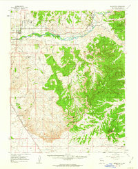
 1960 Dough Mountain1963 Print · USGSThe high desert of the Laguna Indian Reservation is captured here during the transition to the interstate era. Researchers can trace the path of the Atchison Topeka and Santa Fe past Mesitá Blanca and the South Laguna Mines.2 unique versions available
 - 1960 Map of Cerro Verde, 1963 Print
 1960 Cerro Verde1963 Print · USGSThe northern Laguna Indian Reservation meets a stark volcanic landscape in the early sixties. Researchers can trace the ranching infrastructure of this arid terrain, from the Homestead Windmill and Rock Tank Windmill to the peaks of Cerro Verde and Black Mesa.2 unique versions available
 - 1960 Map of Teel Ranch, 1964 Print
 1960 Teel Ranch1964 Print · USGSThe Chaves and Eddy county borderlands in the early sixties reveal a landscape of resilient family ranching and vital water infrastructure. Genealogists and historians can trace holdings like Teel Ranch, Harris Ranch, and the Schauer Landing Strip along the winding Rio Peñasco.
 - 1961 Map of Douglas
 1961 Douglas1961 Print · USGSThe Arizona-Mexico borderlands come into focus at mid-century, detailing the vital mining and ranching hubs of Cochise County and southwest New Mexico. Genealogists and historians can trace the Southern Pacific Railroad through Bisbee and Douglas, or locate early sites like the Old Hachita Mine and Rucker School.
 - 1961 Map of Durango
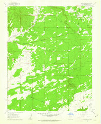
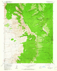
 1961 Durango1961 Print · USGSThe high San Juan country in the early sixties is shown here as a network of historic mining towns and early reservoir projects. Genealogists and researchers can trace the Denver & Rio Grande Western RR as it connects Durango, Silverton, and Arboles.
 - 1961 Map of Sandia Crest, 1962 Print
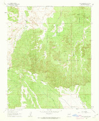
 1961 Sandia Crest1962 Print · USGSThe Sandia Mountains stand at a crossroads of recreational expansion and historic land grants in the early sixties. Researchers can find old backcountry outposts like Juan Tabo Cabin, the Cañoncito Cemetery, and the high-altitude La Luz Mine.5 unique versions available
 - 1961 Map of Tijeras, 1962 Print
 1961 Tijeras1962 Print · USGSThe mountain passes east of Albuquerque come to life in the early sixties as Route 66 winds through the Canon De Carnue. Genealogists and local historians can trace family roots at Santo Nino Cem and explore the remote reaches of the Sandia Military Reservation.5 unique versions available
 - 1961 Map of Santa Fe, 1962 Print
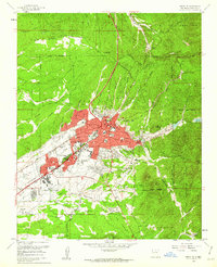 1961 Santa Fe1962 Print · USGSSanta Fe's mid-century landscape is captured here just as the city began its modern expansion beyond its traditional colonial footprint. Researchers can trace historic landmarks like The Plaza, the US Indian School, and the path of the Old Santa Fe Trail.6 unique versions available
 - 1961 Map of Priest Tank, 1963 Print
 1961 Priest Tank1963 Print · USGSSierra County ranch lands and irrigation networks are captured here in the early sixties, centered on the community of Placitas. Researchers can trace communal water systems like the Monticello Community Ditch or locate family landmarks such as Lopez Windmill and Samora Tank.2 unique versions available
 - 1961 Map of Marquez, 1963 Print
 1961 Marquez1963 Print · USGSCibola County’s high mesas and deep canyons are documented here in the early sixties, centered on the settlement of Marquez. Genealogists and historians can trace family-named landmarks like Gallegos Bridge, the Cem, and the intricate Las Cuevas de Marquez.2 unique versions available
Showing maps 1-25 of 841
Top cities of New Mexico
- Albuquerque historical maps
- Las Cruces historical maps
- Rio Rancho historical maps
- Santa Fe historical maps
- Roswell historical maps
- Farmington historical maps
See more
Top counties of New Mexico
- Bernalillo County historical maps
- Doña Ana County historical maps
- Santa Fe County historical maps
- Sandoval County historical maps
- San Juan County historical maps
- McKinley County historical maps
See more
Frequently asked questions
- What are the different types of historical maps available for New Mexico?
- What is the oldest map of New Mexico?
- Where can I purchase historical maps of New Mexico for my home or office?
- Where can I download high-res historical maps of New Mexico?
- Are there historical topographic maps available for New Mexico?
- Is there historical aerial imagery available for New Mexico?
- Where are historical maps of New Mexico sourced from?