1910s Maps of New Mexico
Explore 59 historic maps of New Mexico from the 1910s. These maps offer a rare glimpse into what life looked like during the 1910s — showing old roads, neighborhoods, homes, and landmarks that have changed or disappeared over time.
Whether you're researching your family's past, planning a metal detecting trip, or studying how New Mexico's landscape evolved across the 1910s, these high-resolution maps are a powerful tool for exploring the history of this region.
- Focus on a specific era: All maps on this page are from the 1910s, giving you a focused view of this time period.
- See what’s changed: Compare century-old streets, trails, and buildings to today's modern landscape using overlays and satellite layers.
- Research with precision: Use these maps for genealogy, historical research, land use analysis, or educational projects.
- View, download, or print: Maps are fully viewable online in high resolution, and can be downloaded or printed for your own records.
Start exploring New Mexico's history through authentic maps from the 1910s. This is your window into the past.
New Mexico maps
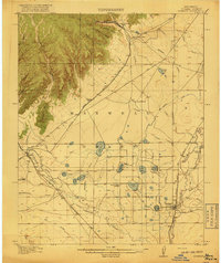
(59)- 1910 Map of Mogollon, 1959 Print
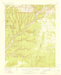
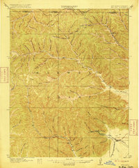
 1910 Mogollon1959 Print · USGSThe high mining camps and river settlements of Catron County come alive in this survey from the early 1900s. Genealogists and historians can trace old homesteads and industrial sites like the Meader Stage Sta, Box N Ranch, and the Power Plant near Graham.2 unique versions available
 - 1911 Map of Alum Mountain, 1959 Print
 1911 Alum Mountain1959 Print · USGSThe upper Gila River wilderness is documented here just after the turn of the century, showing a landscape of remote cattle ranches and early mining claims. Genealogists and researchers can trace family-named sites like TJ Ranch and the Meerschaum Mine, or locate the Gila Cliff-Dwellings National Monument.
 - 1912 Map of Soda Canyon
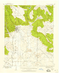
 1912 Soda Canyon1912 Print · USGSMontezuma County at the dawn of modern archaeology reveals a landscape dotted with ancestral dwellings. Researchers can trace the early documentation of Cliff Palace, Sprucetree House, and Balcony House alongside the winding course of the Mancos River.7 unique versions available
 - 1912 Map of Mogollon
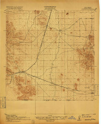
 1912 Mogollon1912 Print · USGSNew Mexico's high timber and mining country come to life in this survey from the years just before statehood. Researchers can trace the early industrial footprint of Cooney and Mogollon or locate remote outposts like Meadows Stage Sta and N Bar Ranch.2 unique versions available
 - 1912 Map of Raton, 1958 Print
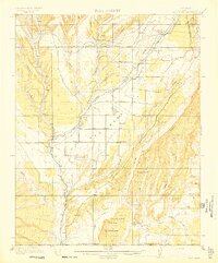
 1912 Raton1958 Print · USGSRaton and the high mesas of the Colorado-New Mexico border are captured here just as the railroad era reached its peak. Researchers can trace the early industrial landscape of coal towns like Gardiner and Blossburg or locate the historic Clifton House and Raton Tunnel.2 unique versions available
 - 1913 Map of Alum Mountain
 1913 Alum Mountain1913 Print · USGSNew Mexico's high wilderness is captured here just after statehood, documenting the remote ranching outposts and ancient sites along the Gila River. Researchers can locate early twentieth-century landmarks like Gila Cliff Dwellings National Monument, the Meerschaum Mine, and the XSX Ranch.3 unique versions available
 - 1913 Map of Red Mesa
 1913 Red Mesa1913 Print · USGSLa Plata County's high mesa country is captured here shortly after the turn of the century, showing a landscape of early homesteads and irrigation ditches. Researchers can locate the Mormon Church, several early schools like Rockville School, and the tracks of the Rio Grande Southern RR.4 unique versions available
 - 1913 Map of Morenci, 1954 Print
 1913 Morenci1954 Print · USGSArizona's copper country and high timberlands meet in this pre-war survey of the Morenci district and Apache National Forest. Researchers can trace the early industrial footprint of Morenci and Clifton or find family landmarks like Miller Cabin and Cooks Ranch.2 unique versions available
 - 1913 Map of Summitville, 1962 Print
 1913 Summitville1962 Print · USGSThe high San Juan Mountains at the turn of the century are captured here, from the gold-mining district at Summitville to the ranchlands of the Navajo River valley. Genealogists and historians can trace early school sites like Blanco School and working mines including the Asiatic Mine and Forest King Mine.
 - 1914 Map of Raton
 1914 Raton1914 Print · USGSRaton served as a vital mountain gateway during the early twentieth century as railroads and early highways crested the Colorado border. Researchers can trace the industrial spurs of the Wagon Mine or locate vanished stops like Blossburg, Gardiner, and Clifton House.5 unique versions available
 - 1915 Map of Summitville
 1915 Summitville1915 Print · USGSSouthern Colorado mining and timber operations are captured here during the early twentieth century. Researchers can trace remote mining claims like the Asiatic Mine, mountain schools such as Blanco School, and the path of the Logging RR.4 unique versions available
 - 1915 Map of Brilliant
 1915 Brilliant1915 Print · USGSColfax County, New Mexico, was a hub of coal and rail activity in the years before the Great War. Researchers can trace the spur lines of the Atchison Topeka and Santa Fe into mining camps like Brilliant and Van Houten.3 unique versions available
 - 1915 Map of Morenci
 1915 Morenci1915 Print · USGSGreenlee County during the early 1900s shows a landscape defined by industrial copper mining and isolated high-desert ranching. Genealogists and historians can trace family locations from the Eagle Creek School to historic homesteads like Dudley Ranch and the settlement of Oroville.3 unique versions available
 - 1915 Map of Deming
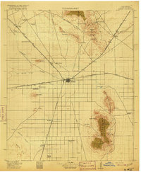 1915 Deming1915 Print · USGSDeming and the surrounding high desert of Luna County were a critical crossroads of Southwestern rail and wagon traffic at the start of the twentieth century. Genealogists can locate family holdings like the 76 Ranch and early social hubs including Midway Iola P O and Tunis School.4 unique versions available
 - 1915 Map of Soda Canyon
 1915 Soda Canyon1915 Print · USGSSouthwestern Colorado at the onset of the Great War reveals a landscape defined by deep canyons and ancient ruins. Archaeologists and historians can trace the early locations of Cliff Palace, the Double Walled Tower, and Waters Ranch.7 unique versions available
 - 1915 Map of Reserve, 1960 Print
 1915 Reserve1960 Print · USGSSocorro County and the Gila National Forest wilderness are documented here in the early twentieth century during the height of the ranger station era. Genealogists and researchers can trace the early plazas at San Francisco Plaza or locate Steven's Sawmill and the Tularosa School.
 - 1915 Map of Koehler, 1966 Print
 1915 Koehler1966 Print · USGSColfax County at the height of its rail and ranching era reveals a landscape of massive land grants and early irrigation systems. Genealogists can trace family connections to ranching outposts like Crow Creek Ranch or early schools such as Red River School and Grand Valley School.
 - 1916 Map of La Joya
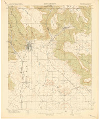
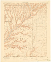
 1916 La Joya1916 Print · USGSThe Rio Grande valley at the time of the Belen Cut Off's construction reveals a landscape of massive Spanish land grants and new rail towns. Trace early settlements like La Joya and Becker or geological landmarks like Pyramid Crater.
 - 1916 Map of Tonuco
 1916 Tonuco1916 Print · USGSDona Ana and Socorro counties are shown during the mid-1910s, capturing a landscape of isolated desert ranches and railroad stops. Genealogists can trace family outposts and water sources such as Flat Lake Ranch, Baird's Ranch, and Red Lake well.
 - 1916 Map of Salinas Peak
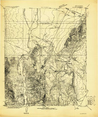
 1916 Salinas Peak1916 Print · USGSSouthern New Mexico was a land of expansive ranches and rail stops in the years before the Great War. You can trace early twentieth-century desert survival through water landmarks like Anaya Spring and rail-side settlements including Engle and Cutter.
 - 1916 Map of Tularosa
 1916 Tularosa1916 Print · USGSNew Mexico ranching and railroading define this pre-war survey of the valley during its early years of statehood. Genealogists and historians can trace family landholdings at Jackson Ranch and Chosa Ranch or follow the path of the El Paso and Southwestern railroad.2 unique versions available
 - 1916 Map of Point Of Sands
 1916 Point Of Sands1916 Print · USGSThe Tularosa Basin in the years before the Great War was a world of remote cattle ranches and alkali plains. Researchers can trace the heritage of the Tularosa frontier through family landmarks like Pelman Ranch, Bairds Wells, and the Eddy Soda Prospect.2 unique versions available
 - 1917 Map of Koehler
 1917 Koehler1917 Print · USGSColfax County at the time of the Great War shows a transition from high desert canyons to a landscape transformed by large-scale ranching and irrigation. Genealogists and historians can trace the foundations of Maxwell, the cattle operations of C S Ranch, and early rural education at Red River School.2 unique versions available
 - 1917 Map of Hermanas
 1917 Hermanas1917 Print · USGSSouthern New Mexico was a critical frontier at the time of the Great War, defined by cattle ranching and international border security. Researchers can trace the path of the El Paso and Southwestern Road and locate remote outposts like Dogtown Ranch, Mahoney, and Hermanas.
 - 1917 Map of Estancia
 1917 Estancia1917 Print · USGSThe Estancia Valley and Manzano foothills come alive in this Great War-era survey, showing a landscape defined by massive land grants and new rail lines. Trace family roots and vanished ranch sites across the Manzano Grant or locate early buildings in Mountainair, Willard, and Chilili.
Showing maps 1-25 of 59
Top cities of New Mexico
- Albuquerque historical maps
- Las Cruces historical maps
- Rio Rancho historical maps
- Santa Fe historical maps
- Roswell historical maps
- Farmington historical maps
See more
Top counties of New Mexico
- Bernalillo County historical maps
- Doña Ana County historical maps
- Santa Fe County historical maps
- Sandoval County historical maps
- San Juan County historical maps
- McKinley County historical maps
See more
Frequently asked questions
- What are the different types of historical maps available for New Mexico?
- What is the oldest map of New Mexico?
- Where can I purchase historical maps of New Mexico for my home or office?
- Where can I download high-res historical maps of New Mexico?
- Are there historical topographic maps available for New Mexico?
- Is there historical aerial imagery available for New Mexico?
- Where are historical maps of New Mexico sourced from?