1930s Maps of New Mexico
Explore 28 historic maps of New Mexico from the 1930s. These maps offer a rare glimpse into what life looked like during the 1930s — showing old roads, neighborhoods, homes, and landmarks that have changed or disappeared over time.
Whether you're researching your family's past, planning a metal detecting trip, or studying how New Mexico's landscape evolved across the 1930s, these high-resolution maps are a powerful tool for exploring the history of this region.
- Focus on a specific era: All maps on this page are from the 1930s, giving you a focused view of this time period.
- See what’s changed: Compare century-old streets, trails, and buildings to today's modern landscape using overlays and satellite layers.
- Research with precision: Use these maps for genealogy, historical research, land use analysis, or educational projects.
- View, download, or print: Maps are fully viewable online in high resolution, and can be downloaded or printed for your own records.
Start exploring New Mexico's history through authentic maps from the 1930s. This is your window into the past.
New Mexico maps
(28)- 1930 Map of Tucumcari
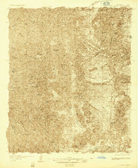
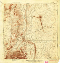
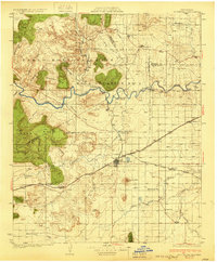 1930 Tucumcari1930 Print · USGSTucumcari and the surrounding ranch lands of eastern New Mexico are captured here during the peak of the steam rail era. Genealogists and historians can trace family-named sites like the Elliott Ranch, remote schools such as Bryantine Sch, and the winding Canadian River corridor.2 unique versions available
 - 1932 Map of Tonuco
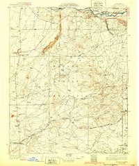
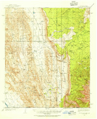
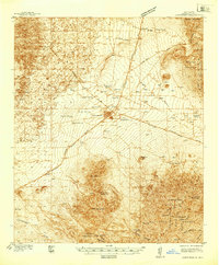
 1932 Tonuco1932 Print · USGSThe high desert of southern New Mexico appears here as a land of isolated ranches and railroad sidings in the early 1930s. Genealogists and historians can trace family-named outposts like Detroit Ranch and Ritch Ranch or follow the A. T. & S. F. line past Aleman.
 - 1932 Map of Kirtland
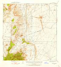
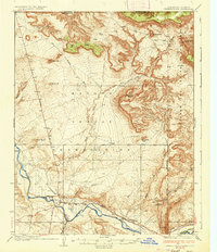
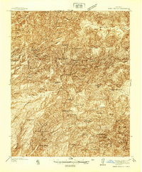
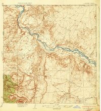
 1932 Kirtland1932 Print · USGSThe Navajo Nation's high desert landscape and the San Juan River valley are documented here in the early thirties. Genealogists and historians can trace essential early hubs like the Wheeler Trading Post, the Oil Pumping Sta near Barber Peak, and the community at Fruitland.
 - 1934 Map of Alameda
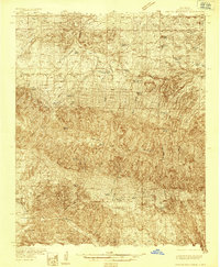
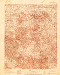
 1934 Alameda1934 Print · USGSThe Rio Grande valley in the mid-1930s reveals a landscape of deep-rooted land grants and modernizing infrastructure. Genealogists and historians can trace the irrigation ditches around Alameda and find landmarks like the Nazareth Sanatorium and KOB Radio Transmitter.
 - 1934 Map of West Albuquerque
 1934 West Albuquerque1934 Print · USGSThe Rio Grande Valley near Albuquerque was a complex landscape of irrigation and industry during the mid-thirties. Genealogists and historians can trace family-named schools and early city infrastructure, from the US Indian School to the Old Town Bridge and Hubble Lake.
 - 1934 Map of Capitan
 1934 Capitan1934 Print · USGSLincoln County’s high-mountain ranching and mining country is captured in the mid-1930s, showing the early infrastructure of the Sacramento Mountains. Researchers can trace the layout of White Oaks, locate the Encinoso Cem, and find landmarks like Hudner Airport.3 unique versions available
 - 1934 Map of Griegos
 1934 Griegos1934 Print · USGSThe Rio Grande valley north of Albuquerque is shown here in the mid-thirties as a landscape of historic land grants and complex irrigation. Genealogists and historians can trace the early rail-and-road network near Hahn Station and the Alameda Bridge.
 - 1934 Map of East Albuquerque
 1934 East Albuquerque1934 Print · USGSAlbuquerque's eastern reaches are captured in the mid-1930s just as federal and institutional growth began defining the city. Local historians can trace the early University of New Mexico campus and the original Albuquerque Landing Field.
 - 1934 Map of Ship Rock, 1955 Print
 1934 Ship Rock1955 Print · USGSThe high desert of San Juan County during the mid-1930s is revealed through this detailed topographic survey of the Navajo Nation. Geologists and local historians can trace the paths of the Red Rock Highway or locate water sources like Sheep Spring and Mud Spring.4 unique versions available
 - 1934 Map of Chimney Rock, 1967 Print
 1934 Chimney Rock1967 Print · USGSThe Navajo and Southern Ute borders met along the San Juan River in the mid-1930s, creating a crossroads of tribal administration and desert agriculture. Genealogists and historians can locate the Shiprock Indian Agency, the Agency Coal Mine, and the path of the Old Mormon Trail.
 - 1934 Map of Rattlesnake, 1971 Print
 1934 Rattlesnake1971 Print · USGSThe San Juan River basin and the Four Corners intersection are captured here in the mid-1930s. Researchers can trace the early road networks and small settlements of the Navajo Indian Reservation, including Rattlesnake, Cudai, and Bitlabito.
 - 1935 Map of Capitan Mountains
 1935 Capitan Mountains1935 Print · USGSLincoln County ranching and public health history are preserved here in the mid-1930s, dominated by the massif of the Capitan Mountains. Researchers can trace early family homesteads like Merchant Ranch and the localized community centers of Richardson School and the U S Marine Hospital Reservation.2 unique versions available
 - 1935 Map of Hillsboro
 1935 Hillsboro1935 Print · USGSHillsboro and Kingston are documented here in the mid-1930s, surrounded by the busy mining and ranching country of the Black Range. Genealogists and historians can locate family landmarks like the J P Nunn Ranch and Wilson Ranch or trace the footprint of the Silver Tail Mine.2 unique versions available
 - 1935 Map of El Paso Gap, 1954 Print
 1935 El Paso Gap1954 Print · USGSThe Guadalupe Mountains of the mid-thirties are captured here as a landscape of isolated ranching outposts and vital water tanks. Genealogists and historians can trace family homesteads like Thayer Ranch and Carpenter Ranch, or locate the rural schoolhouses at Queen Sch and Dog Canyon Sch.2 unique versions available
 - 1936 Map of Chimney Rock
 1936 Chimney Rock1936 Print · USGSThe Navajo and Southern Ute borders met along the San Juan River in the mid-1930s, showing a landscape defined by both geologic wonders and early industry. Trace the path of the Old Mormon Trail or locate early coal operations at the Agency Coal Mine.2 unique versions available
 - 1936 Map of El Paso Gap
 1936 El Paso Gap1936 Print · USGSThe high desert ranching frontier along the New Mexico-Texas border is captured here during the mid-1930s. Researchers can locate remote schools and outposts like Queen Sch, the El Paso Gap PO, and family-named landmarks including Thayer Ranch.
 - 1936 Map of Arabela
 1936 Arabela1936 Print · USGSRanching and rural education define this mid-1930s survey of the Arabela region near the Capitan Mountains. Genealogists and historians can locate family holdings like Purcella Ranch and several local institutions including Plainview School and Escondido Spring School.4 unique versions available
 - 1937 Map of Santa Rita
 1937 Santa Rita1937 Print · USGSThe mining landscape of New Mexico comes into focus in the 1930s, documenting the busy rail corridors and copper districts around Santa Rita. Genealogists and historians can trace old community hubs like Fierro, Hanover, and the Vanadium Post Office.
 - 1937 Map of Ship Rock
 1937 Ship Rock1937 Print · USGSThe Navajo Nation territory comes into focus in the mid-1930s, centered on the towering geological monadnock and the high-plateau borderlands. Trace early travel routes like the Red Rock Highway past isolated landmarks including Mitten Rock and Mud Spring.4 unique versions available
 - 1937 Map of Jemez Springs
 1937 Jemez Springs1937 Print · USGSThe Jemez Mountains in the late thirties were a landscape of geothermal activity and sprawling land grants. Researchers can trace historic family outposts like Boyd Ranch and Ruiz Ranch or locate New Deal-era sites such as the CCC Camp.
 - 1937 Map of Rattlesnake
 1937 Rattlesnake1937 Print · USGSThe high desert borderlands where New Mexico meets Colorado and Arizona are captured here in the mid-1930s. Researchers can trace early reservation life near the San Juan River and locate historic points like Bitlabito, Cudai, and Rattlesnake.3 unique versions available
 - 1937 Map of Capitan
 1937 Capitan1937 Print · USGSLincoln County in the mid-thirties is a landscape of high-altitude ranching and specialized federal outposts. Genealogists and historians can trace family landholdings and community sites such as Le Baron Ranch, Mesa Sch, and the Enginoso Cem.3 unique versions available
 - 1938 Map of Carrizozo
 1938 Carrizozo1938 Print · USGSLincoln County in the late 1930s centers on the rail hub of Carrizozo as it transitions from a mining-era landscape to a modern ranching community. Genealogists and local historians can locate early family holdings like Spencer Ranch and remote sites such as Degners Mine.
 - 1938 Map of Albuquerque
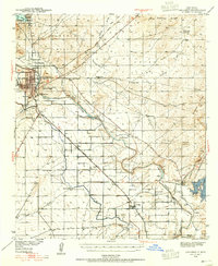
 1938 Albuquerque1938 Print · USGSAlbuquerque and the Rio Grande Valley are shown in the late 1930s, when irrigation ditches still defined the rural landscape between the river and the mountains. Researchers can trace ancestral lands through the Town of Atrisco Grant or locate landmarks like the U S Indian School and Old Albuquerque.
 - 1939 Map of Carlsbad, 1955 Print
 1939 Carlsbad1955 Print · USGSEddy County’s river-and-rail economy is captured here in the late 1930s, centered on the growing hub of Carlsbad. Researchers can trace the early footprint of the potash industry at the U S Potash Co Refinery and find local landmarks like the Harroun Sch and Forehand Ranch.2 unique versions available
Showing maps 1-25 of 28
Top cities of New Mexico
- Albuquerque historical maps
- Las Cruces historical maps
- Rio Rancho historical maps
- Santa Fe historical maps
- Roswell historical maps
- Farmington historical maps
See more
Top counties of New Mexico
- Bernalillo County historical maps
- Doña Ana County historical maps
- Santa Fe County historical maps
- Sandoval County historical maps
- San Juan County historical maps
- McKinley County historical maps
See more
Frequently asked questions
- What are the different types of historical maps available for New Mexico?
- What is the oldest map of New Mexico?
- Where can I purchase historical maps of New Mexico for my home or office?
- Where can I download high-res historical maps of New Mexico?
- Are there historical topographic maps available for New Mexico?
- Is there historical aerial imagery available for New Mexico?
- Where are historical maps of New Mexico sourced from?