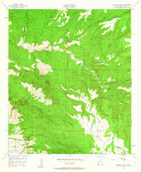
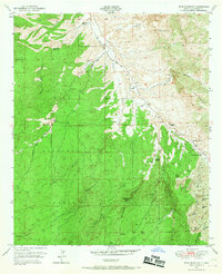
1950s Maps of New Mexico
Explore 388 historic maps of New Mexico from the 1950s. These maps offer a rare glimpse into what life looked like during the 1950s — showing old roads, neighborhoods, homes, and landmarks that have changed or disappeared over time.
Whether you're researching your family's past, planning a metal detecting trip, or studying how New Mexico's landscape evolved across the 1950s, these high-resolution maps are a powerful tool for exploring the history of this region.
- Focus on a specific era: All maps on this page are from the 1950s, giving you a focused view of this time period.
- See what’s changed: Compare century-old streets, trails, and buildings to today's modern landscape using overlays and satellite layers.
- Research with precision: Use these maps for genealogy, historical research, land use analysis, or educational projects.
- View, download, or print: Maps are fully viewable online in high resolution, and can be downloaded or printed for your own records.
Start exploring New Mexico's history through authentic maps from the 1950s. This is your window into the past.
New Mexico maps
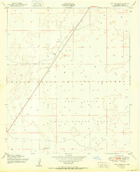
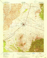
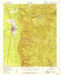
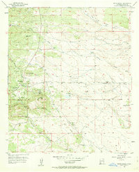
(388)- 1950 Map of Dexter West
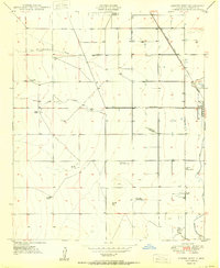 1950 Dexter West1950 Print · USGSChaves County's agricultural and ranching heartland is captured here at mid-century, just as the regional economy was being shaped by irrigation and aviation. Genealogists and historians can trace family holdings like Lowe Ranch or locate industrial sites like Bogies Cotton Gin and the Twin Wells Stock Pens.4 unique versions available
 - 1950 Map of Corn Ranch
 1950 Corn Ranch1950 Print · USGSChaves County ranching lands are captured here at mid-century, showing the critical infrastructure of water and travel in the high desert. Researchers can trace remote homesteads and wells like Corn Ranch, Rosenberg Well, and the path of the Roswell-Pine Lodge Road.
 - 1950 Map of San Simon
 1950 San Simon1950 Print · USGSThe high desert borderlands of Arizona and New Mexico are captured here at mid-century, following the line of the Southern Pacific railroad. Researchers can locate remote cattle operations and early landmarks like the Braidfoot Ranch, the Old Stage Station (Ruins), and the lonely Giddings Grave.2 unique versions available
 - 1950 Map of Lake Lucero
 1950 Lake Lucero1950 Print · USGSThe Tularosa Basin meets the high ridges of the San Andres Mountains at mid-century, where military testing grounds and wildlife refuges overlap. Researchers can find the site of Lucero Ranch, the expanse of Lake Lucero, and remote landmarks like Ash Canyon.
 - 1950 Map of Comanche Spring
 1950 Comanche Spring1950 Print · USGSChaves County ranching lands and the western edge of the Pecos River valley are captured in the early fifties. Researchers can trace the essential water network of the era, from the namesake Comanche Spring to dozens of scattered Windmills.3 unique versions available
 - 1950 Map of Bottomless Lakes
 1950 Bottomless Lakes1950 Print · USGSThe high plains of Chaves County meet the Pecos River valley at mid-century, where unique sinkhole geology created a legendary desert oasis. Researchers can trace historic property boundaries like Atkinson Ranch and find early recreational landmarks including Lea Lake and the Fin and Feather Club.4 unique versions available
 - 1950 Map of Lake Lucero SW
 1950 Lake Lucero SW1950 Print · USGSThe San Andres Mountains meet the military frontier of New Mexico in the early Cold War years. Genealogists and historians can trace isolated desert outposts like Saunders Ranch, Lathermans Well, and the SK White Ranch.
 - 1950 Map of Lake Lucero SE
 1950 Lake Lucero SE1950 Print · USGSOtero County was a critical military landscape in the years following World War II, dedicated to testing and tactical ranges. Historians and researchers can locate specific desert water sources like Windmill Water and Burch Tank amidst the White Sands Proving Grounds.
 - 1950 Map of Three Rivers
 1950 Three Rivers1950 Print · USGSMid-century Otero County is captured here at the intersection of traditional ranching and the expanding White Sands Proving Grounds. Researchers can trace the Southern Pacific rail line and locate Three Rivers, Falls Ranch, and Aguilar Spring.
 - 1950 Map of South Spring
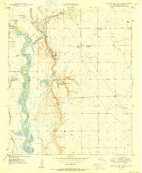
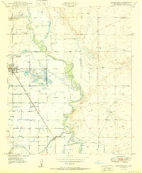
 1950 South Spring1950 Print · USGSThe Pecos River valley in the early 1950s shows a landscape transformed by the Hagerman Canal and the railroad. Genealogists can trace the rural communities of Orchard Park and Oasis, including the local Oasis Sch.
 - 1950 Map of Bitter Lake
 1950 Bitter Lake1950 Print · USGSMid-century Chaves County comes to life in this survey of the Pecos River valley and its surrounding high plains. Researchers can locate the St Marys Cem, trace the Atchison Topeka and Santa Fe rail line, or explore the early grounds of the Roswell Country Club.
 - 1950 Map of Lake Lucero NE
 1950 Lake Lucero NE1950 Print · USGSThe Tularosa Basin desert during the early Cold War era is captured here, showing the intersection of ranching and military land. Trace local family holdings like Bairds Ranch or find water sources like Antelope Tank and various Windmills.
 - 1950 Map of Oscura
 1950 Oscura1950 Print · USGSMid-century Lincoln County is shown here as a landscape of remote rail sidings and military expansion. You can trace the Southern Pacific line through Oscura and locate high-desert water sources like Malagro Springs and Norton Well.
 - 1950 Map of Dexter East
 1950 Dexter East1950 Print · USGSThe Pecos River valley comes alive in this mid-century survey of Chaves County agriculture and irrigation. Genealogists and local historians can trace the rail-side growth of Dexter and Greenfield or locate the Dexter Federal Fish Hatchery and Calumet Ranch.3 unique versions available
 - 1950 Map of Carrizozo, 1954 Print
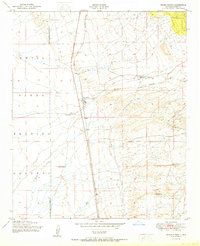
 1950 Carrizozo1954 Print · USGSCarrizozo and the surrounding high desert of Lincoln County are captured here at mid-century, centered on the Southern Pacific rail junction. Researchers can trace local history through Evergreen Cemetery, the Junction Mine, and old sidings like Robsart.4 unique versions available
 - 1950 Map of Escondido Canyon, 1954 Print
 1950 Escondido Canyon1954 Print · USGSOtero County's high desert and mountain slopes are captured here in the mid-century, featuring the transition from the rail-centered basin to the Lincoln National Forest. Genealogists and historians can trace the site of Sacramento City (Abandoned) and ranching landmarks like McCracken Ranch.2 unique versions available
 - 1950 Map of Little Black Peak, 1954 Print
 1950 Little Black Peak1954 Print · USGSLincoln County and Socorro County meet at the edge of the high desert in this mid-century survey. Trace the route of the Southern Pacific railroad past Little Black Peak and through the volcanic expanse of The Malpais.3 unique versions available
 - 1950 Map of Tyrone, 1955 Print
 1950 Tyrone1955 Print · USGSMining operations in the Burro Mountains reached deep into the Grant County earth during the mid-century. Genealogists and historians can trace the industrial footprint of Tyrone and Oak Grove through numerous mines including the Klondike Tunnel and Rocket Shaft.
 - 1950 Map of Alamogordo, 1955 Print
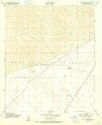
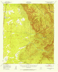
 1950 Alamogordo1955 Print · USGSMid-century Alamogordo and the Sacramento Mountains are captured here during a period of steady growth and high-altitude development. Researchers can trace the Southern Pacific rail line, locate the State Sch For Blind, or find mountain sites like High Rolls and the Warnock Mine.3 unique versions available
 - 1950 Map of Sierra Blanca Peak, 1955 Print
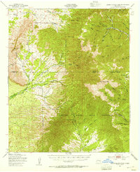 1950 Sierra Blanca Peak1955 Print · USGSThe high Sacramento Mountains are documented at mid-century as this area was managed by federal and tribal authorities. Researchers can trace remote canyons and water sources like Cienegita Spring, Three Rivers, and the slopes of Sierra Blanca Peak.2 unique versions available
 - 1950 Map of Mescalero, 1955 Print
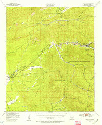 1950 Mescalero1955 Print · USGSThe Mescalero Apache Indian Reservation and the Sacramento Mountains are mapped here at the start of the 1950s. Researchers can trace tribal and forest lands, local schools like Bent Public Sch, and landmarks including St Josephs Mission and Blazers Mill.2 unique versions available
 - 1950 Map of Vanar, 1958 Print
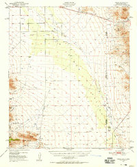 1950 Vanar1958 Print · USGSThe high desert borderlands near the Arizona and New Mexico line come to life in this mid-century survey of the San Simon Valley. Genealogists and historians can trace the remote Southern Pacific rail stops, old mining sites like Mineral Mtn Mine, and ranching landmarks such as Cienega Ranch.3 unique versions available
 - 1950 Map of White Signal, 1963 Print
 1950 White Signal1963 Print · USGSGrant County ranching and mining history come into focus in this mid-century survey of the New Mexico high country. Genealogists and researchers can locate the White Signal School and 7XV Ranch, or trace the paths to inactive sites like Gold Lake Mine.3 unique versions available
 - 1950 Map of Dorsey Ranch, 1963 Print
 1950 Dorsey Ranch1963 Print · USGSGrant County's high mesa country comes to life in the mid-century, showing the isolated homesteads and vital water sources that sustained life here. Trace the old routes of the Reading Canyon Trail and locate remote outposts like Burris H W Ranch and Avery Ranch.2 unique versions available
 - 1950 Map of Wind Mountain, 1967 Print
 1950 Wind Mountain1967 Print · USGSGrant County ranching and mining operations are captured here at mid-century as they sprawl across the Continental Divide. Researchers can locate family landmarks like Fleming Ranch or trace the many claims of the Little Burro Mountains, including the Burro Chief Mine and Indian Burial Ground.3 unique versions available
Showing maps 1-25 of 388
Top cities of New Mexico
- Albuquerque historical maps
- Las Cruces historical maps
- Rio Rancho historical maps
- Santa Fe historical maps
- Roswell historical maps
- Farmington historical maps
See more
Top counties of New Mexico
- Bernalillo County historical maps
- Doña Ana County historical maps
- Santa Fe County historical maps
- Sandoval County historical maps
- San Juan County historical maps
- McKinley County historical maps
See more
Frequently asked questions
- What are the different types of historical maps available for New Mexico?
- What is the oldest map of New Mexico?
- Where can I purchase historical maps of New Mexico for my home or office?
- Where can I download high-res historical maps of New Mexico?
- Are there historical topographic maps available for New Mexico?
- Is there historical aerial imagery available for New Mexico?
- Where are historical maps of New Mexico sourced from?