1980s Maps of Beaver County, Utah
Explore 31 historic maps of Beaver County from the 1980s. These maps offer a rare glimpse into what life looked like during the 1980s — showing old roads, neighborhoods, homes, and landmarks that have changed or disappeared over time.
Whether you're researching your family's past, planning a metal detecting trip, or studying how Beaver County's landscape evolved across the 1980s, these high-resolution maps are a powerful tool for exploring the history of this region.
- Focus on a specific era: All maps on this page are from the 1980s, giving you a focused view of this time period.
- See what’s changed: Compare century-old streets, trails, and buildings to today's modern landscape using overlays and satellite layers.
- Research with precision: Use these maps for genealogy, historical research, land use analysis, or educational projects.
- View, download, or print: Maps are fully viewable online in high resolution, and can be downloaded or printed for your own records.
Start exploring Beaver County's history through authentic maps from the 1980s. This is your window into the past.
Beaver County, UT maps
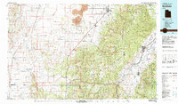
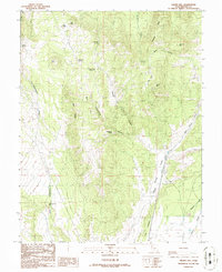
(31)- 1980 Map of Beaver, 1981 Print
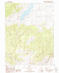
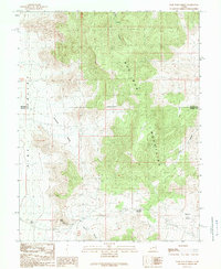
 1980 Beaver1981 Print · USGSSouthern Utah at the start of the 1980s reveals a rugged landscape of high mountain plateaus and essential desert irrigation networks. Researchers can trace the path of the Denver and Rio Grande Western through Marysvale or locate local landmarks like the Deer Trail Mine and Puffer Lake.2 unique versions available
 - 1980 Map of Mount Belknap, 1981 Print
 1980 Mount Belknap1981 Print · USGSThe Tushar Mountains of Piute and Beaver Counties are shown in the early 1980s during a period of high-altitude resource management. Researchers can trace historic mining locations like Lower Kimberly and the Grasshopper Mine near Mount Belknap.
 - 1980 Map of Mount Brigham, 1981 Print
 1980 Mount Brigham1981 Print · USGSThe Tushar Mountains of central Utah are captured in the early 1980s, documenting a high-country landscape of mining claims and rugged peaks. Researchers can locate specific operations like the Silver King Mine, trace the D & R G W railroad, or find landmarks like Bullion Falls.2 unique versions available
 - 1980 Map of Wah Wah Mts. South, 1984 Print
 1980 Wah Wah Mts. South1984 Print · USGSWestern Utah’s high desert and mineral-rich ranges are captured here in the late twentieth century, showing a landscape shaped by mining and the railroad. Researchers can locate remote shafts like the Wild Bill Mine, trace the Union Pacific Railroad through Lund, or explore the geography of the Wah Wah Mountains.2 unique versions available
 - 1980 Map of Wah Wah Mts. North, 1984 Print
 1980 Wah Wah Mts. North1984 Print · USGSSouthwestern Utah's high desert was a landscape of remote mining claims and railroad outposts during the late twentieth century. Researchers can trace historic operations like the Carbonate Mine and Magnolia Mine, or locate early valley settlements such as Lund and Milford.2 unique versions available
 - 1980 Map of Richfield, 1987 Print
 1980 Richfield1987 Print · USGSCentral Utah in the early eighties shows a landscape of volcanic fields and high mountain forests. Genealogists can trace family roots through the Sevier River valley in Richfield, Fillmore, and Monroe, or follow the Union Pacific rail lines.2 unique versions available
 - 1981 Map of Delano Peak
 1981 Delano Peak1981 Print · USGSThe high Tushar Mountains of Piute and Beaver counties are shown in detail during the early eighties. Researchers can trace alpine mining history near Alunite Ridge, locate remote water features like Blainies Dam, and follow the old Pack Trails around Delano Peak.2 unique versions available
 - 1981 Map of Shelly Baldy Peak
 1981 Shelly Baldy Peak1981 Print · USGSThe Tushar Mountains in the early eighties were a hub of water engineering and recreation. Genealogists and historians can trace the Fort Cameron Military Reservation Boundary or locate landmarks like Robbers Roost and Mount Holly Ski Area.2 unique versions available
 - 1982 Map of Wilson Creek Range
 1982 Wilson Creek Range1982 Print · USGSLincoln County mining districts and high-desert basins are captured here in the early eighties as the region balanced mineral production with early conservation. Researchers can trace historic industrial sites like the Atlanta Mine and Bristol Silver Mine or locate remote landmarks such as The Hermitage.
 - 1986 Map of Minersville Reservoir
 1986 Minersville Reservoir1986 Print · USGSBeaver County and Iron County meet in the 1980s at the intersection of the Mineral Mountains and the Black Mountains. Researchers can trace water management and recreation history through the Minersville Reservoir, the Aberdare Canal, and the State Recreation Area.
 - 1986 Map of Cove Fort
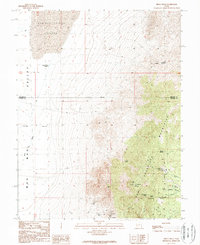
 1986 Cove Fort1986 Print · USGSBeaver County is captured in the mid-eighties at the historic junction of pioneer defenses and mining industry. Researchers can locate the iconic Old Cove Fort, trace mineral Prospect sites near Sulphurdale, and find remote water sources like Dead Cow Spring.
 - 1986 Map of Cinder Crater
 1986 Cinder Crater1986 Print · USGSThe volcanic landscape of the Beaver and Millard county line is captured here in the mid-1980s, showcasing a remote high-desert region. Geologists and local historians can trace small-scale mining and ranching markers like the Cinder Pits, Danish Reservoir, and Cinder Crater.
 - 1986 Map of Bearskin Mountain
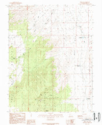
 1986 Bearskin Mountain1986 Print · USGSThe Mineral Mountains of Beaver County were a hub of geological activity in the mid-1980s, marked by peaks and geothermal exploration. Researchers can pinpoint early energy infrastructure like geothermal wells alongside natural landmarks like Milford Needle and Old Indian Spring.
 - 1986 Map of Gillies Hill
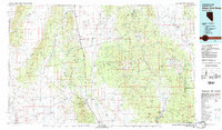
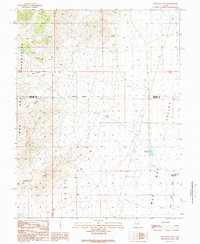
 1986 Gillies Hill1986 Print · USGSBeaver County, Utah, is mapped during the mid-eighties, showing a landscape shaped by volcanic knolls and essential desert springs. Researchers can locate remote resource sites like Prospects and a Gravel Pit or trace water sources from Carlyle Spring to Fields Creek.
 - 1986 Map of Beaver
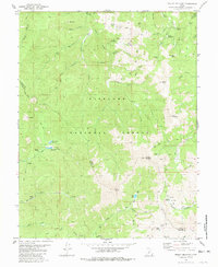
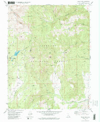
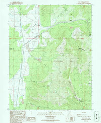
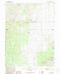
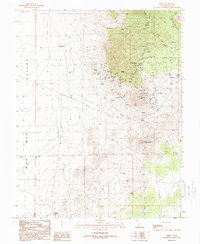
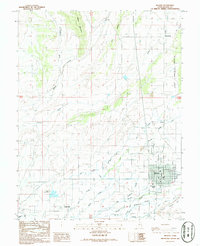 1986 Beaver1986 Print · USGSBeaver County is captured in the mid-1980s as a thriving agricultural hub centered on the river valley. Genealogists and local historians can trace the irrigation networks of Carter Ditch and locate family landmarks from Manderfield to Greenville.
 - 1986 Map of Adamsville
 1986 Adamsville1986 Print · USGSIn the mid-1980s, this area of Beaver County shows the intersection of the high Mineral Mountains and the irrigated valley floor. Genealogists and researchers can locate the Adamsville settlement and its nearby Cem, or trace water sources from Rock Corral Spring to the Minersville Reservoir.
 - 1987 Map of Black Ridge
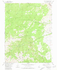
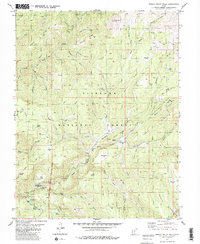
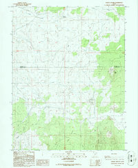
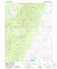
 1987 Black Ridge1987 Print · USGSBeaver, Utah, is documented here in the late eighties, showing the critical intersection of mountain water and valley agriculture. Genealogists and local historians can trace irrigation networks like the South Field DITCH and explore landmarks from Rattlesnake Peak to Ponderosa Park.
 - 1987 Map of Pole Mountain
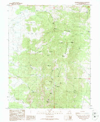
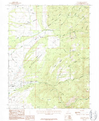
 1987 Pole Mountain1987 Print · USGSThe Tushar Mountains in the late eighties reveal a landscape shaped by mineral extraction and high-country irrigation. Researchers can trace the footprint of mining at the Bob Roy Mine and follow water management through the Manderfield Old Levee.
 - 1989 Map of High Rock
 1989 High Rock1989 Print · USGSThe arid border of Millard and Beaver Counties in the late 1980s reveals a terrain defined by mineral exploration and high desert springs. Trace the history of regional mining through the Black Rock Mine, Three Kilns Spring, and scattered Prospects.
 - 1989 Map of Frisco Peak
 1989 Frisco Peak1989 Print · USGSThe high-desert mining country of Beaver County is captured here in the late eighties, where the mountains meet the Wah Wah Valley. Trace local history through the Golden Reef Mine, the old Kilns, and the Indian Queen Reservoir.
 - 1989 Map of Frisco SW
 1989 Frisco SW1989 Print · USGSThe Wah Wah Valley and its surrounding peaks are captured here in the late 1980s, reflecting a landscape shaped by mining and desert ranching. Researchers can locate specific industrial footprints like the Open Pit Mines and water features such as Brimstone Reservoir and Willow Spring.
 - 1989 Map of Wah Wah Cove
 1989 Wah Wah Cove1989 Print · USGSBeaver County and Millard County meet in the high desert of the late eighties, where water management shaped the landscape. Trace early ranching footprints and mining history at Kelleys Place, Wild Horse Corral, and the Prospects on the slopes.
 - 1989 Map of Wah Wah Summit
 1989 Wah Wah Summit1989 Print · USGSWestern Utah in the late eighties remained a landscape of isolated outposts and high-altitude crossings like Wah Wah Summit. Researchers can trace old livestock operations and early mining efforts through features like Kelleys Place, a remote Ranch, and scattered Prospects.
 - 1989 Map of Pine Valley Hardpan South
 1989 Pine Valley Hardpan South1989 Print · USGSSouthwestern Utah's high basin floor is captured here in the late eighties, documenting a period of federal land research and arid-land ranching. Trace the water management systems essential to the region, including Desert Ranch Reservoir and the facilities at Range Headquarters.
 - 1989 Map of Frisco
 1989 Frisco1989 Print · USGSBeaver County mining history is preserved on this late twentieth-century survey of the San Francisco Mountains. Genealogists and researchers can trace the Horn Silver Mine, the settlement of Frisco, and the Cem that served the area's miners.
Showing maps 1-25 of 31
Top cities of Beaver County
Frequently asked questions
- What are the different types of historical maps available for Beaver County?
- What is the oldest map of Beaver County?
- Where can I purchase historical maps of Beaver County for my home or office?
- Where can I download high-res historical maps of Beaver County?
- Are there historical topographic maps available for Beaver County?
- Is there historical aerial imagery available for Beaver County?
- Where are historical maps of Beaver County sourced from?