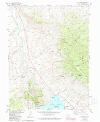
1980 Map of King Creek
USGS Topo · Published 1988About this map
The Blue River flows through this high-altitude landscape, feeding into the northern reaches of the Green Mountain Reservoir. Along its shores, the settlement of Heeney serves as a focal point for the region's recreational and industrial character, marked by the presence of the Green Mountain Camp and Willows Campground. The engineering of the reservoir is documented through features like the Gaging Sta, Power Plant, and the prominent Spillway near the dam.
Find a feature on this map
44 named features on this map. Tap any name to fly to it.
Don’t see what you’re looking for? This feature index may not catch every label — zoom into the map to look around manually.
Map Details
Editions of this 1980 King Creek Map
3 editions found
Other maps of this area

1933 · Mt. Powell
USGS Topo · 1:48,000

1933 · Ute Peak
USGS Topo · 1:62,500

1937 · Ute Peak
USGS Topo · 1:62,500

1940 · Mount Powell
USGS Topo · 1:62,500

1954 · Craig
USGS Topo · 1:250,000

1956 · Kremmling
USGS Topo · 1:62,500

1957 · Craig
USGS Topo · 1:250,000

1957 · Hot Sulphur Springs
USGS Topo · 1:62,500

1957 · Leadville
USGS Topo · 1:250,000

1958 · Craig
USGS Topo · 1:250,000