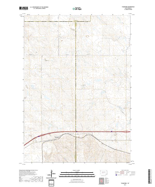
2021 Map of Stamford
USGS Topo · Published 2021About this map
Stamford sits at the southern edge of this West River landscape where the local road network bridges the rural divide between Jackson and Jones counties. The terrain is defined by the dendritic drainage patterns of Ash Cr and Dry Cr, which carve through the high plains. Local transit and property boundaries are marked by named corridors such as Church Rd and Stamford Rd, reflecting the grid-based settlement pattern of the region. This 2021 survey illustrates the modern configuration of the area, where the vast open country is segmented by historical township lines like t1s r25e and t1s r26e. The map highlights the sparse distribution of infrastructure, with primary access routes like Bork Rd and Co Rd Ch 1 serving the ranching and agricultural interests that persist in this part of South Dakota.
Find a feature on this map
17 named features on this map. Tap any name to fly to it.
Don’t see what you’re looking for? This feature index may not catch every label — zoom into the map to look around manually.
Map Details
Editions of this 2021 Stamford Map
This is the sole edition of this map. No revisions or reprints were ever made.
Other maps of this area

1951 · Stamford SW
USGS Topo · 1:24,000

1951 · Capa
USGS Topo · 1:24,000

1951 · Stamford SE
USGS Topo · 1:24,000

1951 · Okaton SW
USGS Topo · 1:24,000

1954 · Midland
USGS Topo · 1:24,000

1954 · Midland SE
USGS Topo · 1:24,000

1954 · Pierre
USGS Topo · 1:250,000

1955 · Martin
USGS Topo · 1:250,000

1958 · Pierre
USGS Topo · 1:250,000

1958 · Martin
USGS Topo · 1:250,000