1970s Maps of Louisiana
Explore 210 historic maps of Louisiana from the 1970s. These maps offer a rare glimpse into what life looked like during the 1970s — showing old roads, neighborhoods, homes, and landmarks that have changed or disappeared over time.
Whether you're researching your family's past, planning a metal detecting trip, or studying how Louisiana's landscape evolved across the 1970s, these high-resolution maps are a powerful tool for exploring the history of this region.
- Focus on a specific era: All maps on this page are from the 1970s, giving you a focused view of this time period.
- See what’s changed: Compare century-old streets, trails, and buildings to today's modern landscape using overlays and satellite layers.
- Research with precision: Use these maps for genealogy, historical research, land use analysis, or educational projects.
- View, download, or print: Maps are fully viewable online in high resolution, and can be downloaded or printed for your own records.
Start exploring Louisiana's history through authentic maps from the 1970s. This is your window into the past.
Louisiana maps
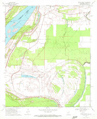
(210)- 1970 Map of Ellerslie, 1971 Print
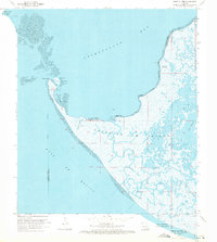
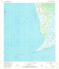
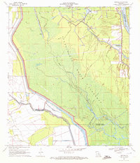
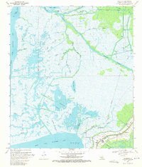 1970 Ellerslie1971 Print · USGSThe Louisiana coast in the early 1970s reveals a landscape where industrial energy extraction meets the tide-washed wetlands of St. Mary Parish. Genealogists and historians can trace local life around Ellerslie and South Bend, or locate historic drill holes and pumping stations throughout the expansive Oil and Gas Field.4 unique versions available
 - 1970 Map of Point Au Fer NE, 1971 Print
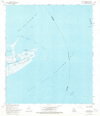
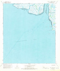 1970 Point Au Fer NE1971 Print · USGSThe Louisiana coast at the mouth of the Atchafalaya was a frontier of energy exploration and maritime transit during the early seventies. Researchers can trace the shifting parish lines and locate offshore infrastructure like Drill Holes near Shell Island and Plumb Island Point.3 unique versions available
 - 1970 Map of Centerville NW, 1971 Print
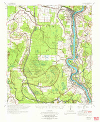
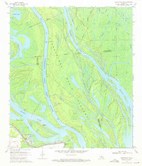 1970 Centerville NW1971 Print · USGSThe Atchafalaya swamplands and the community of Charenton are shown here in the early 1970s as the basin's floodway system was actively managed. Researchers can locate the Myette Point Ch, trace the massive LEVEE system, and find specific Drill Holes scattered near Grand Lake.3 unique versions available
 - 1970 Map of Marone Point, 1971 Print
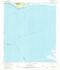 1970 Marone Point1971 Print · USGSThe Louisiana coastline at the start of the 1970s reveals a landscape of industrial energy production and marshy geography. Researchers can trace the development of the Cote Blanche Island Oil and Gas Field and find coastal landmarks like Cote Blanche Landing and Marone Point.2 unique versions available
 - 1970 Map of Point Au Fer, 1971 Print
 1970 Point Au Fer1971 Print · USGSCoastal Terrebonne Parish in the early seventies reveals a landscape of industrial expansion amidst the marshes. Trace the development of the Locust Bayou Oil Field and locate remote coastal landmarks like Eugene Island and Dead Alligator Point.3 unique versions available
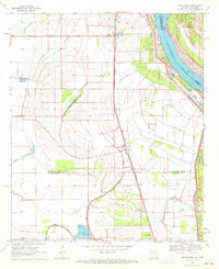
 - 1970 Map of Carencro, 1972 Print
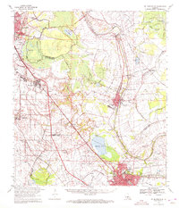
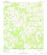
 1970 Carencro1972 Print · USGSCajun country at the start of the seventies reveals a landscape where deep-rooted parish settlements like Grand Coteau exist alongside a booming energy industry. Trace family roots and local landmarks from Mt Pleasant Ch Cem to the Vatican Oil Field.
 - 1970 Map of Lake Point, 1972 Print
 1970 Lake Point1972 Print · USGSThe Louisiana coastline in the early 1970s is defined by its industrial energy and protected marshlands. Trace the offshore infrastructure of the Lake Sand Gas Field or the bounds of the Marsh Island State Wildlife Refuge.2 unique versions available
 - 1970 Map of Lake Providence, 1972 Print
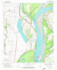
 1970 Lake Providence1972 Print · USGSThe Louisiana-Mississippi borderlands around the 1970s show a river economy in transition, where the great oxbow of Lake Providence shelters the parish seat. Local historians can trace family roots through numerous landmarks like China Grove Ch Cem, Briarfield Academy, and Stack Island.
 - 1970 Map of Point Chevreuil, 1972 Print
 1970 Point Chevreuil1972 Print · USGSThe Louisiana coast in the early 1970s reveals a world where the oil industry and the bayou economy meet. Genealogists and researchers can trace local landmarks like South Bend Cem and the small communities of Gordy and Luke Landing along the edge of Bayou Sale.3 unique versions available
 - 1970 Map of Tylertown SE, 1972 Print
 1970 Tylertown SE1972 Print · USGSThe Mississippi-Louisiana border comes into focus in the early seventies, capturing a rural landscape of creek-side settlements and family cemeteries. Genealogists can trace local roots through landmarks like Ard Cem, New Zion Ch, and the small community of Flowers.2 unique versions available
 - 1970 Map of Millikin, 1972 Print
 1970 Millikin1972 Print · USGSThe Louisiana-Mississippi borderlands come into focus during the early 1970s, as the river carves through the alluvial plains of East Carroll Parish. Genealogists and local historians can trace the foundations of Millikin and find rural landmarks like Jerusalem Cem and Rose Hill Ch.2 unique versions available
 - 1970 Map of Cecilia, 1972 Print
 1970 Cecilia1972 Print · USGSSt. Martin Parish in the early seventies shows a landscape where the Atchafalaya swamplands meet the historic Bayou Teche settlements. Genealogists and historians can locate family landmarks like Our Lady of Mercy Cem or trace the early days of Crawfish Farms and Bordelon Airpark.
 - 1970 Map of Odenburg, 1972 Print
 1970 Odenburg1972 Print · USGSThe Atchafalaya Basin in the early seventies shows a landscape defined by massive flood control projects and traditional bayou settlements. Genealogists can locate family-named landmarks and rural congregations like Dunbar High Sch, St Matthew Ch, and Taterville.
 - 1970 Map of St. Martinville, 1972 Print
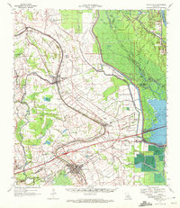
 1970 St. Martinville1972 Print · USGSThe heart of Acadiana comes to life in the early 1970s as industrial growth meets the historic Bayou Teche. Genealogists and local historians can trace family-named sites and landmarks like Holy Name Institute, the Keystone Lock and Dam, and the old community at Duchamp.2 unique versions available
 - 1970 Map of Fordoche, 1972 Print
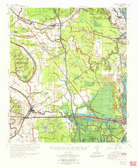
 1970 Fordoche1972 Print · USGSPointe Coupee Parish in the early seventies reveals a landscape defined by massive flood control projects and a growing oil economy. Genealogists and historians can trace family locations near Stonewall Plantation, the Valverda Sch, or the Indian Mound Valley Cem.
 - 1970 Map of Palmetto, 1972 Print
 1970 Palmetto1972 Print · USGSSt. Landry and Pointe Coupee Parishes are shown in the early seventies as a landscape of deep bayous and massive flood control works. Genealogists and historians can trace family locations near Rideau Settlement, Palmetto Cem, and Sacred Heart Ch.
 - 1970 Map of Whiting Bayou, 1972 Print
 1970 Whiting Bayou1972 Print · USGSThe Mississippi Delta bottomlands come alive in this early 1970s survey of Issaquena County. Researchers can trace the levee-side community of Tallula, the path of an Old Railroad Grade, and several historic black churches including Mt Sinai Ch and Christian Home Ch.
 - 1970 Map of Sondheimer, 1972 Print
 1970 Sondheimer1972 Print · USGSThe Mississippi River delta in the early 1970s shows a landscape of rail-side settlements and parish-line farming. Researchers can locate local landmarks like Henderson Sch, Seventh Star Ch, and the Fish Farm near Omega.
 - 1970 Map of Transylvania, 1972 Print
 1970 Transylvania1972 Print · USGSThe Mississippi Delta's rich agricultural and rail-dependent landscape is captured here in the early seventies. Genealogists and local historians can trace family ties at Cold Tar Cem, visit the Indian Mounds, or locate historic railroad stops at Hollybrook and Transylvania.2 unique versions available
 - 1970 Map of Readland, 1972 Print
 1970 Readland1972 Print · USGSThe tri-state river country of the Arkansas-Louisiana-Mississippi border comes into focus in this early 1970s survey. Researchers can trace the Missouri Pacific tracks past the Rising Sun Ch or locate family roots in the settlements of Readland and Arkla.
 - 1970 Map of Portage, 1972 Print
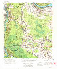
 1970 Portage1972 Print · USGSThe Atchafalaya bottomlands near the St. Landry and St. Martin parish line are captured here in the early 1970s. Researchers can trace the hydraulic engineering of the era through the Levee system, the Krotz Springs Oil and Gas Field, and the settlement at Portage.2 unique versions available
 - 1970 Map of Dexter, 1972 Print
 1970 Dexter1972 Print · USGSWalthall County, Mississippi, and Washington Parish, Louisiana, meet in this early 1970s survey of a landscape shaped by petroleum and timber. Genealogists and researchers can locate family sites like Fortenberry Cem and old rural churches such as Centerville Ch and Mt Olive Ch.
 - 1970 Map of Arnaudville, 1972 Print
 1970 Arnaudville1972 Print · USGSThe heart of Acadiana is captured here in the early seventies as Cajun communities grew along the winding Bayou Teche. Genealogists and historians can trace family roots through sites like Ridge Zion Cem, Leonville Sch, and the Missouri Pacific Railroad corridor.2 unique versions available
 - 1970 Map of St. Tammany, 1972 Print
 1970 St. Tammany1972 Print · USGSSt. Tammany Parish at the end of the sixties shows a landscape of creek-fed bottomlands and emerging utility infrastructure. Genealogists and local historians can locate Crow Cem and trace the paths of Lacombe Bayou and English Branch through the pine woods.3 unique versions available
 - 1970 Map of Opelousas, 1972 Print
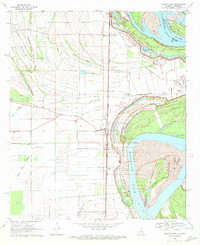
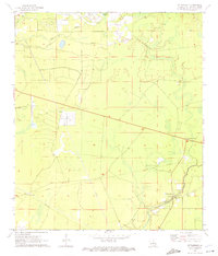
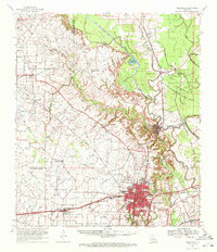 1970 Opelousas1972 Print · USGSSt. Landry Parish in the early 1970s reveals a landscape defined by its bayous and a significant rail-to-river economy centered on Opelousas. Genealogists can trace family landmarks like Sacred Heart Chapel & Cem and Bertrand Cem across this detailed 1970 survey.2 unique versions available
Showing maps 1-25 of 210
Top cities of Louisiana
- New Orleans historical maps
- Baton Rouge historical maps
- Shreveport historical maps
- Metairie historical maps
- Lafayette historical maps
- Saint George historical maps
See more
Top parishes of Louisiana
- Jefferson Parish historical maps
- Orleans Parish historical maps
- Caddo Parish historical maps
- St. Tammany Parish historical maps
- Lafayette Parish historical maps
- Calcasieu Parish historical maps
See more
Frequently asked questions
- What are the different types of historical maps available for Louisiana?
- What is the oldest map of Louisiana?
- Where can I purchase historical maps of Louisiana for my home or office?
- Where can I download high-res historical maps of Louisiana?
- Are there historical topographic maps available for Louisiana?
- Is there historical aerial imagery available for Louisiana?
- Where are historical maps of Louisiana sourced from?