1900s (20th Century) Maps of Louisiana
Explore 2,468 historic maps of Louisiana from the 1900s (20th Century). These maps offer a rare glimpse into what life looked like during the 1900s — showing old roads, neighborhoods, homes, and landmarks that have changed or disappeared over time.
Whether you're researching your family's past, planning a metal detecting trip, or studying how Louisiana's landscape evolved across the 1900s, these high-resolution maps are a powerful tool for exploring the history of this region.
- Focus on a specific era: All maps on this page are from the 1900s, giving you a focused view of this time period.
- See what’s changed: Compare century-old streets, trails, and buildings to today's modern landscape using overlays and satellite layers.
- Research with precision: Use these maps for genealogy, historical research, land use analysis, or educational projects.
- View, download, or print: Maps are fully viewable online in high resolution, and can be downloaded or printed for your own records.
Start exploring Louisiana's history through authentic maps from the 1900s. This is your window into the past.
Louisiana maps
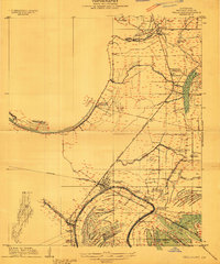
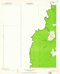
(2,468)- 1906 Map of Bayou Sara
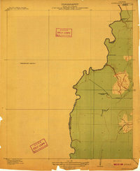
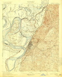
 1906 Bayou Sara1906 Print · USGSThe Feliciana parishes and the Mississippi River bottomlands come to life in this early twentieth-century survey. Genealogists can trace family footprints through river-town settlements like St Francisville or find early rail stops such as Gayden Sta (Gurley P.O.) and Slaughter.3 unique versions available
 - 1907 Map of Atlanta, 1954 Print
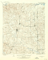 1907 Atlanta1954 Print · USGSNorthwest Louisiana and Northeast Texas meet in this early century survey of the rail-and-timber corridor surrounding Atlanta. Researchers can trace the heritage of rural communities through dozens of local landmarks like Laws Chapel, Pritchard's Gin, and the Cass Lumber Co Sawmill.2 unique versions available
 - 1908 Map of Baton Rouge, 1921 Print
 1908 Baton Rouge1921 Print · USGSBaton Rouge and the surrounding river parishes are captured here at the dawn of the twentieth century, as the railroad network began to rival the river. Genealogists can locate family landmarks like Harelsons Store, Morning Star Church, and the community of Benton's.2 unique versions available
 - 1909 Map of Delta Bridge
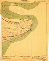
 1909 Delta Bridge1909 Print · USGSTensas Parish was a landscape of riverfront estates and early rail lines in the years before the Great War. Researchers can trace ancestral property lines and community centers like Oneonta Plantation, Rock of Ages Church, and the St Louis Iron Mountain and Southern Railroad.
 - 1909 Map of Sycamore Landing
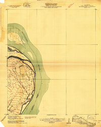
 1909 Sycamore Landing1909 Print · USGSThe riverfront of Concordia Parish comes alive in the early twentieth century as plantations and rail lines intersect along the Mississippi. Genealogists and historians can trace family roots at Lucerna Plantation or locate community centers like Rufus Baptist Church and Morville.
 - 1909 Map of Lake Bruen
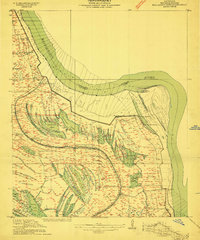
 1909 Lake Bruen1909 Print · USGSTensas Parish life in the early 1900s centered on the massive Mississippi oxbow and the fertile soils of the delta. Researchers can trace historic family holdings like Bellevue and Panola or locate local landmarks including Zion Baptist Church and the St Joseph Station.
 - 1909 Map of Baxter Bayou
 1909 Baxter Bayou1909 Print · USGSLouisiana's delta country at the end of the first decade of the twentieth century shows a landscape tied to its winding waterways. Researchers can locate early river crossings and oxbows like Lanes Ferry Bridge, Corbins Ferry (Abandoned), and Johnson Lake.
 - 1909 Map of Vidalia
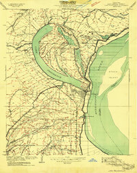
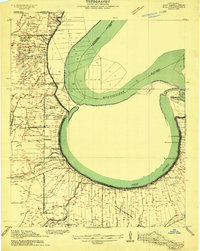
 1909 Vidalia1909 Print · USGSConcordia Parish sits at a tight bend of the Mississippi River in the early 1900s, where plantation life and rail commerce intersect. Genealogists and local historians can trace the foundations of Vidalia or locate family-named sites like Taconey Plantation and Minorca Church.
 - 1909 Map of Millikens Bend
 1909 Millikens Bend1909 Print · USGSMadison Parish and the Mississippi River front are captured during the peak of the plantation era. Researchers can trace historic family lands like Sparta and Huon Plantation, or locate rural landmarks such as Paradise Church and Hews Store.3 unique versions available
 - 1909 Map of Lake Providence
 1909 Lake Providence1909 Print · USGSEast Carroll Parish at the turn of the century shows a landscape of expansive plantations and river commerce centered on the great oxbow. Genealogists and historians can locate family estates like Way Way Plantation or trace community roots at Good Hope Church and Watersheta School.2 unique versions available
 - 1909 Map of Tallulah
 1909 Tallulah1909 Print · USGSMadison Parish at the turn of the century shows a landscape defined by its rail junctions and expansive estates. Genealogists can locate named family lands like Shelby Plantation and trace rural congregational history at Zion Flower Church.
 - 1909 Map of Wilsons Point
 1909 Wilsons Point1909 Print · USGSEast Carroll Parish at the height of the river trade era reveals a landscape of alluvial points and levee-protected settlements. Genealogists and researchers can trace land tracts near Wilsons Point, the Morning Star Church, and the riverfront at Cottonwood.2 unique versions available
 - 1909 Map of Millikin
 1909 Millikin1909 Print · USGSEast Carroll Parish at the turn of the century reveals a landscape of large riverside estates and early rail infrastructure. Researchers can trace family history through sites like Ashton Plantation, find old commercial hubs like the Bells of the Bend Store, or locate vanished landmarks like Millikin School.2 unique versions available
 - 1909 Map of Mound
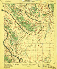 1909 Mound1909 Print · USGSMadison Parish plantations and bayous are meticulously detailed in this 1909 survey as they appeared at the dawn of the twentieth century. Researchers can trace the legacy of the Vicksburg Shreveport and Pacific Railroad and locate ancestral sites like Solomon Temple Church or Mound.2 unique versions available
 - 1909 Map of Ashton Bridge, 1961 Print
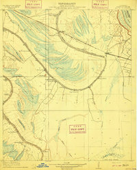
 1909 Ashton Bridge1961 Print · USGSThe Louisiana delta country at the turn of the century is documented here along the winding Bayou Macon. Researchers can trace early industry and transport through Cook and McLean's Sawmill, a Tram Road, and the original Ashton Bridge.
 - 1910 Map of Mound
 1910 Mound1910 Print · USGSMadison Parish in the early 1900s shows a landscape of productive riverbottom plantations and railroad commerce. Genealogists can trace family holdings and rural landmarks like California Plantation, Thomastown, and the Indian Mounds near the local rail siding.2 unique versions available
 - 1910 Map of Atlanta
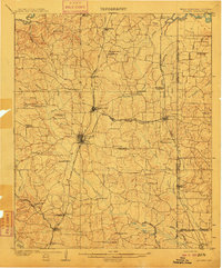 1910 Atlanta1910 Print · USGSNortheast Texas at the height of the timber boom is captured here, showing the intricate network of sawmills and rail lines crossing into Arkansas and Louisiana. Genealogists can locate family landmarks like Laws Chapel, Hosey's Store, and the Henderson Hill School among the many rural settlements.2 unique versions available
 - 1911 Map of Lake Providence
 1911 Lake Providence1911 Print · USGSLouisiana's Mississippi River delta region comes into sharp focus during the early 1910s, centered on the strategic oxbow lake at the parish seat. Genealogists and historians can trace family landholdings at Belle Mead Plantation or locate local landmarks like Winterfield School and Cane Ridge Church.2 unique versions available
 - 1911 Map of Baxter Bayou, 1961 Print
 1911 Baxter Bayou1961 Print · USGSLouisiana's Mississippi Delta region appears as a network of winding waterways and large agricultural estates just after the turn of the century. Trace the boundaries of Tompkins Plantation, find the Lickskillet School, or locate the abandoned Corbins Ferry along Macon Bayou.
 - 1912 Map of Ashton Bridge
 1912 Ashton Bridge1912 Print · USGSNortheast Louisiana timber and transit are captured here in the years before the Great War. Researchers can trace the industrial footprint of Cook and McLean's Sawmill and the early Tram Road crossing Bayou Macon.3 unique versions available
 - 1913 Map of Wilson Point
 1913 Wilson Point1913 Print · USGSEast Carroll Parish at the height of the levee-building era shows a landscape defined by the shifting banks of the Mississippi River. Researchers can trace the riverfront settlements at Wilson Point and Cottonwood, or locate the Morning Star Church near the water.
 - 1914 Map of Baxter Bayou
 1914 Baxter Bayou1914 Print · USGSEast Carroll Parish in the early twentieth century is a landscape of expansive plantations and winding delta waterways. Family historians can trace ancestral lands at Tompkins Plantation or Bowie Plantation, and locate rural landmarks like Lickskillet School.2 unique versions available
 - 1914 Map of Nicholson, 1957 Print
 1914 Nicholson1957 Print · USGSThe Pearl River swamp along the Louisiana-Mississippi border was a landscape of timber and tides during the early twentieth century. Genealogists can locate family-named settlements like Logtown and Gainsville or trace the early paths of the 3 Notch Road.2 unique versions available
 - 1918 Map of Vicksburg
 1918 Vicksburg1918 Print · USGSVicksburg and the Mississippi River bluffs are shown in great detail during the early twentieth century. Researchers can locate Civil War landmarks like Grants Canal and Vicksburg National Military Park or trace family roots near Blakeley and Cedars.4 unique versions available
 - 1921 Map of Natchez
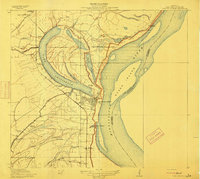
 1921 Natchez1921 Print · USGSThe Mississippi River bluffs and floodplain come alive in this early 1920s survey of the Natchez region and its Louisiana neighbors. Genealogists can trace family roots through numerous sites like Taconey Plantation, the Adams County Poor Farm, and Quitman School.
Showing maps 1-25 of 2,468
Top cities of Louisiana
- New Orleans historical maps
- Baton Rouge historical maps
- Shreveport historical maps
- Metairie historical maps
- Lafayette historical maps
- Saint George historical maps
See more
Top parishes of Louisiana
- Jefferson Parish historical maps
- Orleans Parish historical maps
- Caddo Parish historical maps
- St. Tammany Parish historical maps
- Lafayette Parish historical maps
- Calcasieu Parish historical maps
See more
Frequently asked questions
- What are the different types of historical maps available for Louisiana?
- What is the oldest map of Louisiana?
- Where can I purchase historical maps of Louisiana for my home or office?
- Where can I download high-res historical maps of Louisiana?
- Are there historical topographic maps available for Louisiana?
- Is there historical aerial imagery available for Louisiana?
- Where are historical maps of Louisiana sourced from?