1960s Maps of Louisiana
Explore 303 historic maps of Louisiana from the 1960s. These maps offer a rare glimpse into what life looked like during the 1960s — showing old roads, neighborhoods, homes, and landmarks that have changed or disappeared over time.
Whether you're researching your family's past, planning a metal detecting trip, or studying how Louisiana's landscape evolved across the 1960s, these high-resolution maps are a powerful tool for exploring the history of this region.
- Focus on a specific era: All maps on this page are from the 1960s, giving you a focused view of this time period.
- See what’s changed: Compare century-old streets, trails, and buildings to today's modern landscape using overlays and satellite layers.
- Research with precision: Use these maps for genealogy, historical research, land use analysis, or educational projects.
- View, download, or print: Maps are fully viewable online in high resolution, and can be downloaded or printed for your own records.
Start exploring Louisiana's history through authentic maps from the 1960s. This is your window into the past.
Louisiana maps
(303)- 1960 Map of El Dorado
 1960 El Dorado1960 Print · USGSSouth Central Arkansas in the late fifties was a hub of energy production and defense industry. Researchers can trace the extensive Oil and Gas Fields around El Dorado or locate family landmarks like Old Park Cem and New Hope Church.
 - 1960 Map of Mobile
 1960 Mobile1960 Print · USGSThe Gulf Coast at the dawn of the sixties shows a landscape of busy ports, military airbases, and barrier islands. Trace the rail lines of the Louisville & Nashville through BILOXI and Pascagoula or find family history in towns like Bayou La Batre and Poplarville.
 - 1960 Map of North Highlands
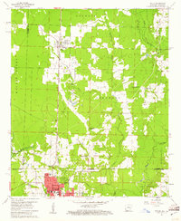
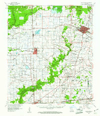
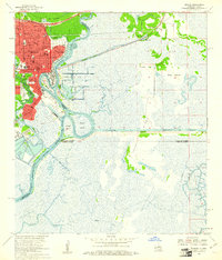
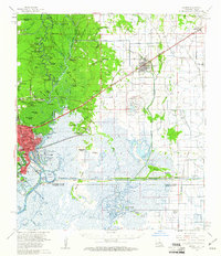
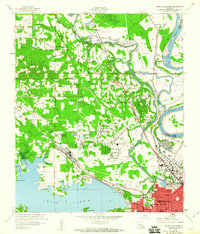 1960 North Highlands1960 Print · USGSShreveport and its northern suburbs reached toward the Red River in the early sixties as new infrastructure transformed the Caddo Parish landscape. Genealogists and local historians can trace the foundations of neighborhoods near Northside Sch, locate family plots at Walker Hill Cem, and follow the old rail lines of the Texas and Pacific.2 unique versions available
 - 1960 Map of Bossier City
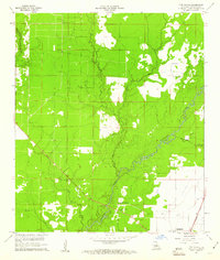
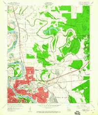 1960 Bossier City1960 Print · USGSBossier City and Shreveport are shown at a peak of post-war growth as the urban center expands toward the Red River. Researchers can trace mid-century neighborhoods near Plantation Park Sch or locate rural landmarks like Mt Zion Ch and Vanceville.2 unique versions available
 - 1960 Map of Forts, 1961 Print
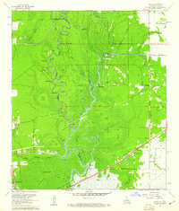
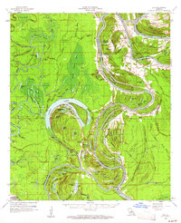
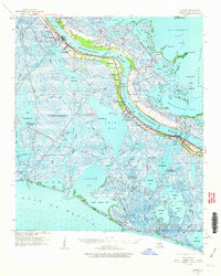
 1960 Forts1961 Print · USGSThe lower Mississippi River delta in the early sixties was a landscape defined by the intersection of river settlements and the emerging oil industry. Researchers can trace the riverfront communities of Boothville and Venice, or locate historic sites like Fort St Philip and the Boothville Cem.3 unique versions available
 - 1960 Map of Wilmot, 1961 Print
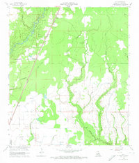
 1960 Wilmot1961 Print · USGSThe borderlands of southeast Arkansas and northeast Louisiana are defined by the winding oxbows of Bayou Bartholomew and the Missouri Pacific railroad. Genealogists can trace early rural life through landmarks like Chiller Chapel Cem, Savage High Sch, and the town of Wilmot.2 unique versions available
 - 1960 Map of Echo, 1961 Print
 1960 Echo1961 Print · USGSThe Sabine River bottomlands on the Texas-Louisiana border are captured here at the start of the 1960s. Researchers can trace the winding river at Niblett Bluff and locate family landmarks like Comier Cem and Crossroad Ch.4 unique versions available
 - 1960 Map of Guy, 1961 Print
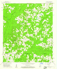
 1960 Guy1961 Print · USGSThe rural landscapes of Allen Parish come to life in the early sixties, centered on the MISSOURI PACIFIC rail corridor. Genealogists can trace family footprints through numerous small burial sites like Reed Cem and Deshotel Cem, alongside the early oil infrastructure at Foley.4 unique versions available
 - 1960 Map of Taylor, 1961 Print
 1960 Taylor1961 Print · USGSThe Arkansas-Louisiana state line comes alive in the early sixties, showing the industrial heart of the Springhill Oil Field and Taylor. Trace the family-named landmarks of the day, from the Kansas City Southern rail line to Salem Grace Ch and Browning Sch.2 unique versions available
 - 1960 Map of Vinton, 1961 Print
 1960 Vinton1961 Print · USGSCalcasieu Parish in the early sixties reveals a landscape shaped by oil production and heavy irrigation. Genealogists and industrial historians can trace the derrick-lined Vinton Oil Field and old settlements like Ged, Edgerly, and Hampton.4 unique versions available
 - 1960 Map of Ville Platte, 1961 Print
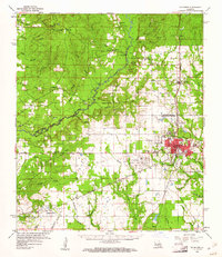
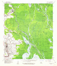
 1960 Ville Platte1961 Print · USGSEvangeline Parish at the start of the sixties shows a landscape of prairie rice farms, oil fields, and traditional Acadian settlements. Researchers can locate many family cemeteries and community landmarks like St Ann's Cem, Savoy Hosp, and the Mamou Oil Field.3 unique versions available
 - 1960 Map of Jonesville, 1961 Print
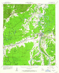 1960 Jonesville1961 Print · USGSThe river-junction town of Jonesville and the surrounding bayou country are captured here at the start of the 1960s. Researchers can trace old family burial grounds like Alexander Cem and rural centers including Lismore and Wallace Ridge.2 unique versions available
 - 1960 Map of Walkerville, 1961 Print
 1960 Walkerville1961 Print · USGSThe borderlands of southern Arkansas and northern Louisiana come into focus in the early 1960s, showing a landscape defined by timber and the oil industry. Trace rural family roots at Old Shongaloo Ch or Stewart-Walkerville Cem, and locate early infrastructure like the Horsehead Oil Field.3 unique versions available
 - 1960 Map of Wilmot, 1961 Print
 1960 Wilmot1961 Print · USGSThe Arkansas delta near the Louisiana border is captured here in the early sixties, centered on the river-and-rail corridor of the Missouri Pacific. Researchers can trace rural life through sites like Savage High Sch, Wilmot Cem, and the winding Bayou Bartholomew.3 unique versions available
 - 1960 Map of Orange, 1961 Print
 1960 Orange1961 Print · USGSOrange and the Sabine River borderlands at the start of the sixties reveal a thriving maritime and industrial hub. Genealogists and researchers can locate the U S Naval Station, historical schools like Stark High Sch, and Evergreen Cem.5 unique versions available
 - 1960 Map of Eva, 1961 Print
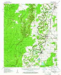
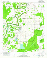
 1960 Eva1961 Print · USGSCatahoula and Concordia Parishes in the early sixties reveal a landscape defined by the winding Black River and the rural communities of Mayna and Acme. Genealogists and local historians can trace family-named landmarks, old cemeteries like Dewey Cem, and rural churches including Glade Ch.3 unique versions available
 - 1960 Map of De Ridder, 1961 Print
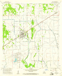
 1960 De Ridder1961 Print · USGSBeauregard Parish at the start of the 1960s shows a landscape shaped by timber, rail, and emerging oil interests. Genealogists can trace family roots through rural landmarks like Lillie Ch, Knight, and the settlements of Rosepine and Bon Ami.2 unique versions available
 - 1960 Map of Cameron Farms, 1961 Print
 1960 Cameron Farms1961 Print · USGSCoastal Louisiana marshes at the dawn of the 1960s reveal a landscape of oil extraction and maritime transit. Researchers can trace the development of the Gum Cove Oil and Gas Field and locate historic crossings like the Gum Cove Ferry.3 unique versions available
 - 1960 Map of Orange, 1961 Print
 1960 Orange1961 Print · USGSThe Texas-Louisiana borderlands come alive in the early sixties, showing the industrial waterfront of Orange alongside the rail-tied towns of Vinton and Edgerly. Genealogists and historians can locate rural landmarks like Granger Cem, Manley Sch, and the riverside Niblett Bluff.2 unique versions available
 - 1960 Map of Pine Chapel, 1961 Print
 1960 Pine Chapel1961 Print · USGSThe Louisiana piney woods of Allen Parish come to life in this mid-century survey of the Calcasieu River basin. Researchers can trace rural life and industry through landmarks like the Oakland Springs Cem, Pine Chapel, and the timber-watch Oberlin Lookout Tower.3 unique versions available
 - 1960 Map of Basile, 1961 Print
 1960 Basile1961 Print · USGSCoastal prairie life and petroleum exploration dominate this 1960s study of the area where Evangeline, Acadia, and Jefferson Davis parishes meet. Genealogists and historians can trace family roots through landmarks like St Ann Ch, China Cem, and the rural settlement of Panchoville.4 unique versions available
 - 1960 Map of Wilmot SW, 1961 Print
 1960 Wilmot SW1961 Print · USGSThe Arkansas-Louisiana borderlands come alive in the early sixties as a network of brakes and bayous. Researchers can locate remote family burial sites like Poley Bridge Cem and historic congregational centers such as St Matthew Ch near Bayou Bartholomew.2 unique versions available
 - 1960 Map of Empire, 1963 Print
 1960 Empire1963 Print · USGSThe lower Plaquemines Parish delta in the early sixties was a world defined by the river and the oil fields. Genealogists and historians can trace the foundations of communities like Empire and Port Sulphur, locating landmarks such as St Patrick Ch and Nairn PO.2 unique versions available
 - 1960 Map of Loreauville, 1963 Print
 1960 Loreauville1963 Print · USGSThe Bayou Teche corridor and Atchafalaya swamplands are captured here in the early sixties, showing the reach of the oil industry into the basin. Genealogists can locate family landmarks like Broussard Switch, Mt Zion Ch, and the Indian Mound Cem near Catahoula.2 unique versions available
 - 1960 Map of Cameron, 1976 Print
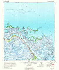
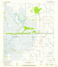
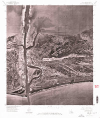 1960 Cameron1976 Print · USGSThe coastal settlement of Cameron is captured in the mid-1970s at the vital intersection of marsh and sea. Trace the docks and development along Calcasieu Pass and the southern shoreline of Calcasieu Lake at the edge of the Gulf.
Showing maps 1-25 of 303
Top cities of Louisiana
- New Orleans historical maps
- Baton Rouge historical maps
- Shreveport historical maps
- Metairie historical maps
- Lafayette historical maps
- Saint George historical maps
See more
Top parishes of Louisiana
- Jefferson Parish historical maps
- Orleans Parish historical maps
- Caddo Parish historical maps
- St. Tammany Parish historical maps
- Lafayette Parish historical maps
- Calcasieu Parish historical maps
See more
Frequently asked questions
- What are the different types of historical maps available for Louisiana?
- What is the oldest map of Louisiana?
- Where can I purchase historical maps of Louisiana for my home or office?
- Where can I download high-res historical maps of Louisiana?
- Are there historical topographic maps available for Louisiana?
- Is there historical aerial imagery available for Louisiana?
- Where are historical maps of Louisiana sourced from?