1990s Maps of Louisiana
Explore 392 historic maps of Louisiana from the 1990s. These maps offer a rare glimpse into what life looked like during the 1990s — showing old roads, neighborhoods, homes, and landmarks that have changed or disappeared over time.
Whether you're researching your family's past, planning a metal detecting trip, or studying how Louisiana's landscape evolved across the 1990s, these high-resolution maps are a powerful tool for exploring the history of this region.
- Focus on a specific era: All maps on this page are from the 1990s, giving you a focused view of this time period.
- See what’s changed: Compare century-old streets, trails, and buildings to today's modern landscape using overlays and satellite layers.
- Research with precision: Use these maps for genealogy, historical research, land use analysis, or educational projects.
- View, download, or print: Maps are fully viewable online in high resolution, and can be downloaded or printed for your own records.
Start exploring Louisiana's history through authentic maps from the 1990s. This is your window into the past.
Louisiana maps
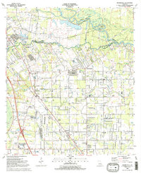
(392)- 1991 Map of Walker
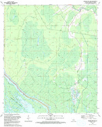
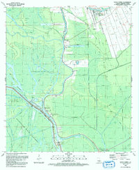
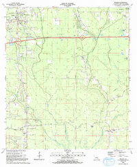 1991 Walker1991 Print · USGSLivingston Parish in the early nineties reveals a landscape of growing rural communities and deep family roots along the Colyell Creek forks. Genealogists and local historians can trace burial sites like Walker Cem and Blount Cem or find landmarks such as Revival Temple and the Doyle Sch.
 - 1991 Map of Gonzales
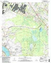
 1991 Gonzales1991 Print · USGSAscension Parish is captured here in the early nineties as residential growth expanded outward from the river. Genealogists and local historians can trace family sites near Hope Haven Cem, the community at Hillaryville, and landmarks like Sacred Heart of Mary Ch.2 unique versions available
 - 1991 Map of French Settlement
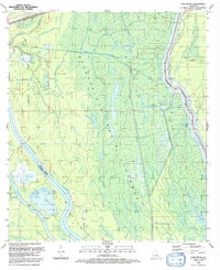
 1991 French Settlement1991 Print · USGSThe Amite River basin of the early nineties shows a landscape of bayous and riverside villages. Genealogists can trace family names at Watson Cem and locate community anchors like St Joseph Ch and French Settlement.2 unique versions available
 - 1991 Map of Denham Springs
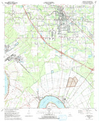
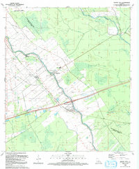
 1991 Denham Springs1991 Print · USGSLivingston Parish at the start of the 1990s shows the suburban expansion of Denham Springs and Walker alongside the vital Amite River corridor. Genealogists and local historians can trace family locations near O Neal Cem, Hebron Ch, and several historic schools.2 unique versions available
 - 1991 Map of Woodville
 1991 Woodville1991 Print · USGSWilkinson County and the Louisiana borderlands appear here in the early nineties, where the bluffs meet the Mississippi River floodplain. Trace the sites of old river landings and rural outposts like Fort Adams, Pinckneyville, and the remote Larto Lake community.
 - 1991 Map of Prairieville
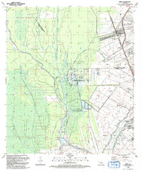
 1991 Prairieville1991 Print · USGSThe Ascension and East Baton Rouge Parish borderlands come alive in this early 1990s survey of the Bayou Manchac region. Trace family history through local landmarks like Prairieville Cem, St Amant, and Galvez Middle Sch.2 unique versions available
 - 1991 Map of Natchez, 1992 Print
 1991 Natchez1992 Print · USGSThe Mississippi River valley at the turn of the nineties reveals a landscape of oxbow lakes, river landings, and bustling bluff-top towns. Genealogists and historians can trace the rail corridors of the Illinois Central Gulf Railroad through Fayette or locate family roots in riverside settlements like Waterproof and St Joseph.
 - 1992 Map of Grosse Tete
 1992 Grosse Tete1992 Print · USGSThe bayou country of Iberville Parish in the early 1990s reveals a landscape shaped by petroleum extraction and traditional settlements. Genealogists and researchers can trace local family landmarks like St Joseph Cem, Nativity Ch, and the hamlet of Slacks along the Bayou Grosse Tete.
 - 1992 Map of Bertrandville
 1992 Bertrandville1992 Print · USGSCoastal Louisiana at the start of the nineties shows a landscape defined by the great river and maritime infrastructure. Trace the river road through Bertrandville and Oakville, or explore the sprawling Alvin Callender Field.2 unique versions available
 - 1992 Map of Grand River
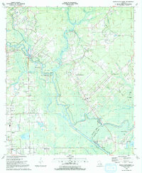
 1992 Grand River1992 Print · USGSIberville and St. Martin Parishes are captured in the early nineties as a landscape defined by industrial energy and wetland management. Researchers can trace the massive Atchafalaya Basin Floodway alongside the Bayou Blue Oil and Gas Field and the settlement at Grand River.
 - 1992 Map of Maringouin
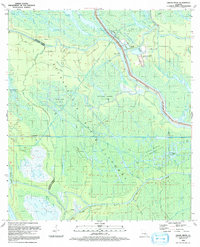
 1992 Maringouin1992 Print · USGSThe Atchafalaya Basin in the early nineties reveals a landscape split between the wild Atchafalaya National Wildlife Refuge and the industrial bayou towns. Researchers can trace family roots at New Zion Ch or explore the geography of the Maringouin Oil Field and the old Union Pacific line.
 - 1992 Map of Grosse Tete SW
 1992 Grosse Tete SW1992 Print · USGSIberville Parish in the early nineties is defined here by the vast wetlands of the Atchafalaya Basin Floodway. Researchers can trace the industrial layout of the Bayou Blue Oil Field and the engineering of the Maringouin Protection Levee.
 - 1992 Map of St. Gabriel
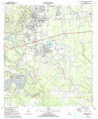
 1992 St. Gabriel1992 Print · USGSThe river parishes south of Baton Rouge were a landscape of heavy industry and institutional centers in the early nineties. Genealogists and local researchers can trace the connections between St Gabriel and its historic St Raphael Cem, or locate landmarks like Iberville (Bayou Paul Sta).
 - 1992 Map of Carville
 1992 Carville1992 Print · USGSThe Mississippi River bends around Iberville and Ascension Parishes in the early nineties, revealing a landscape shaped by river transport and industry. Genealogists and historians can locate legacy sites like Mulberry Grove Plantation, the Gillis W Long Hansens Disease Center, and the historic Carville-White Castle Ferry.
 - 1992 Map of Hahnville
 1992 Hahnville1992 Print · USGSSt. Charles Parish in the early nineties shows a landscape of heavy industry and riverfront communities along the Mississippi. Genealogists and historians can trace local landmarks like Holy Rosary Ch, Green Hill Cem, and the Triche Airfield.
 - 1992 Map of Bayou Sorrel
 1992 Bayou Sorrel1992 Print · USGSIberville Parish is captured in the early nineties as a landscape of intensive water management and energy production. You can trace the historic Indian Mound Cem, the operation of the Bayou Sorrel Locks, and numerous rural churches like Mt Airy Ch.
 - 1992 Map of Hanna
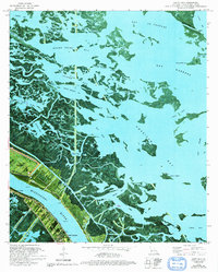 1992 Hanna1992 Print · USGSCoastal Plaquemines Parish reveals its intricate water network and riverfront settlements in the early nineties. Genealogists and historians can trace family locations in Happy Jack, Encalade, and Port Sulphur or locate the McBride School and Cem along the river road.
 - 1992 Map of Nacogdoches
 1992 Nacogdoches1992 Print · USGSEast Texas timberlands and river valleys are captured here in the early nineties, centered on the historic regional hub of Nacogdoches. Trace family roots and old rail lines through Cushing, San Augustine, and Logansport along the Southern Pacific RR.
 - 1992 Map of Luling
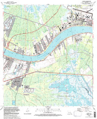 1992 Luling1992 Print · USGSSt. Charles Parish in the early nineties shows the dense riverfront settlements and industrial infrastructure lining the Mississippi. Researchers can locate the historic Davis Plantation, the site of the Davis Crevasse (1884), and St Charles Cem.
 - 1992 Map of Addis
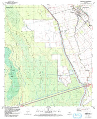
 1992 Addis1992 Print · USGSWest Baton Rouge and Iberville Parishes are shown in the early nineties as a landscape of industrial infrastructure and historic plantations. Trace local lineage and land use through St Delphine Plantation, Indian Village, and churches like Rock Zion Ch.
 - 1992 Map of Spanish Fort
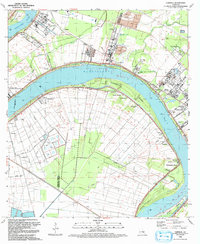
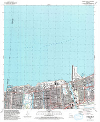 1992 Spanish Fort1992 Print · USGSThe northern lakefront of New Orleans is shown here in the early nineties, featuring a highly developed shoreline of harbors and universities. Researchers can trace local landmarks like Spanish Fort, City Park, and the Hebrew Rest Cem.2 unique versions available
 - 1992 Map of New Orleans West
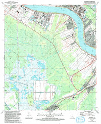
 1992 New Orleans West1992 Print · USGSGreater New Orleans is shown in high detail during the early nineties, centered on the river's sharp turns and industrial hubs. Genealogists and local historians can trace family roots through numerous parish schools and landmarks like Providence Memorial Park and the Huey P Long Bridge.2 unique versions available
 - 1992 Map of Baton Rouge West
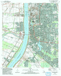 1992 Baton Rouge West1992 Print · USGSBaton Rouge and its West Bank neighbors are captured here in the early nineties as the region thrived as a river-and-rail hub. Genealogists can trace family landmarks like the Poplar Grove Plantation, Antioch Ch, and the Gilbert Memorial Cem.2 unique versions available
 - 1992 Map of Texarkana
 1992 Texarkana1992 Print · USGSThe Ark-La-Tex border region comes into focus in the early nineties, centered on the sprawling waters of Wright Patman Lake. Genealogists and historians can trace rail-town development and rural roots through Old Union Cem, the Red River Army Depot, and Dalby Springs Cem.
 - 1992 Map of Cow Bayou
 1992 Cow Bayou1992 Print · USGSThe Iberville and St. Martin Parish wetlands come alive in the early nineties, showing a landscape defined by the spillway and oil industry. Genealogists and historians can trace the intricate waterways of Billy Littles Lake, Cow Island, and the Henby Gas Field.
Showing maps 1-25 of 392
Top cities of Louisiana
- New Orleans historical maps
- Baton Rouge historical maps
- Shreveport historical maps
- Metairie historical maps
- Lafayette historical maps
- Saint George historical maps
See more
Top parishes of Louisiana
- Jefferson Parish historical maps
- Orleans Parish historical maps
- Caddo Parish historical maps
- St. Tammany Parish historical maps
- Lafayette Parish historical maps
- Calcasieu Parish historical maps
See more
Frequently asked questions
- What are the different types of historical maps available for Louisiana?
- What is the oldest map of Louisiana?
- Where can I purchase historical maps of Louisiana for my home or office?
- Where can I download high-res historical maps of Louisiana?
- Are there historical topographic maps available for Louisiana?
- Is there historical aerial imagery available for Louisiana?
- Where are historical maps of Louisiana sourced from?