1930s Maps of Louisiana
Explore 246 historic maps of Louisiana from the 1930s. These maps offer a rare glimpse into what life looked like during the 1930s — showing old roads, neighborhoods, homes, and landmarks that have changed or disappeared over time.
Whether you're researching your family's past, planning a metal detecting trip, or studying how Louisiana's landscape evolved across the 1930s, these high-resolution maps are a powerful tool for exploring the history of this region.
- Focus on a specific era: All maps on this page are from the 1930s, giving you a focused view of this time period.
- See what’s changed: Compare century-old streets, trails, and buildings to today's modern landscape using overlays and satellite layers.
- Research with precision: Use these maps for genealogy, historical research, land use analysis, or educational projects.
- View, download, or print: Maps are fully viewable online in high resolution, and can be downloaded or printed for your own records.
Start exploring Louisiana's history through authentic maps from the 1930s. This is your window into the past.
Louisiana maps
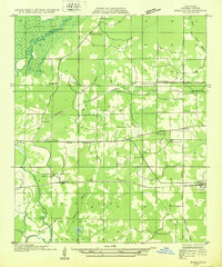
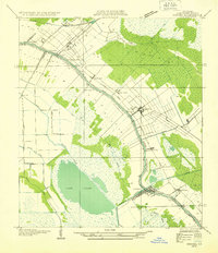
(246)- 1930 Map of El Dorado, 1949 Print
 1930 El Dorado1949 Print · USGSUnion County enters its oil boom era during the late twenties, with this survey capturing the burgeoning industry surrounding El Dorado. Genealogists and local historians can trace rural school districts like Shady Grove Sch and Fairview Sch, or locate family sites near Parnell Cemetery.
 - 1932 Map of Hosston NW
 1932 Hosston NW1932 Print · USGSCaddo Parish sits at the intersection of Louisiana, Texas, and Arkansas in the early 1930s, defined by its bayous and early industrial rail lines. Genealogists and researchers can trace family landmarks like Walnut Hill Cem, Pine Valley Sch, and the rail stops at Rodessa and Mira.
 - 1932 Map of New Orleans NE
 1932 New Orleans NE1932 Print · USGSNew Orleans and the West Bank riverfront are seen in the early thirties, showing the dense grid of the French Quarter and the sprawling medical and university districts. Researchers can find old landmarks like St Louis Cathedral, the Custom House, and Gretna High School.
 - 1932 Map of New Orleans NW
 1932 New Orleans NW1932 Print · USGSJefferson Parish is caught in a moment of rapid transformation in the early thirties as New Orleans expands westward. Researchers can trace the rise of early suburbs like Bonnabel Place, the construction of the Huey P Long Bridge, and the location of the historic Wedell Williams Airport.
 - 1932 Map of Lake Decade
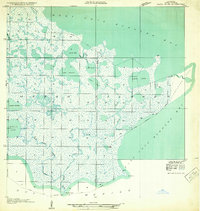
 1932 Lake Decade1932 Print · USGSCoastal Terrebonne Parish in the early thirties is a vast network of salt marshes and tidal bays just before the era of intensive coastal engineering. Genealogists and historians can trace isolated landmarks like Steinbergs Camp or navigate the intricate reaches of Rice Bayou and Lost Lake.
 - 1932 Map of Houma SE
 1932 Houma SE1932 Print · USGSCoastal Louisiana in the early thirties reveals a landscape defined by the intersection of marshland and new navigation projects. Genealogists and local historians can trace family locations near Aragon Plantation, Bisland Cem, and the village of Bourg.
 - 1932 Map of Abbeville SW
 1932 Abbeville SW1932 Print · USGSCoastal Vermilion Parish in the early thirties shows a delicate balance between new industrial channels and the traditional marsh economy. Researchers can locate remote landmarks like the Moutons Cove Sch, the Bayview Club House, and the isolated community of Esther.
 - 1932 Map of Bossier SE
 1932 Bossier SE1932 Print · USGSBossier Parish in the early 1930s is a landscape of growing military tracts and rural crossroads settlements. Genealogists can trace family footprints through numerous local landmarks, including Cedar Grove Sch, Rocky Mount Ch, and the Harper cemetery.
 - 1932 Map of Sabine Pass NE
 1932 Sabine Pass NE1932 Print · USGSThe maritime border between Louisiana and Texas is captured here in the early 1930s as a hub of coastal engineering and rail transport. Researchers can trace the industrial shoreline along the Southern Pacific railroad and the historical East Bdy Old Military Reservation.
 - 1932 Map of Constance Bayou NE
 1932 Constance Bayou NE1932 Print · USGSCoastal Louisiana marshes in the early thirties reveal a landscape of deep bayous and isolated ridges. Researchers can trace the sinuous path of Floating Turf Bayou or locate the historic elevation of Pecan Island and Long Island.2 unique versions available
 - 1932 Map of New Orleans SE
 1932 New Orleans SE1932 Print · USGSThe Mississippi River delta south of the city was a maze of bayous and new industrial canals in the early 1930s. Genealogists and historians can trace riverside settlements like Bertrandville and Oakville or locate the early Wedell-Williams Landing Field.
 - 1932 Map of Bayou Blanc
 1932 Bayou Blanc1932 Print · USGSLouisiana’s coastal wetlands are captured here in the early 1930s, showing the complex hydrology of the Iberia Parish shore. Researchers can trace the natural layout of Marsh Island and its many interior waters, including Lake Sand and Mound Point.
 - 1932 Map of Lac Des Allemands NW
 1932 Lac Des Allemands NW1932 Print · USGSSettlement and swamp meet at Vacherie during the early thirties as the region’s sugar and rail economy thrived between the river and the marsh. Family historians can trace local landmarks like Vacherie Sch, the Texas and Pacific rail line, and Coulee du Cimetiere.
 - 1932 Map of Lake Charles NE
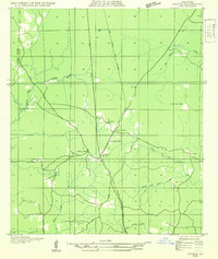
 1932 Lake Charles NE1932 Print · USGSCalcasieu Parish at the start of the 1930s shows an intricate landscape of prairie agriculture and vital rail connections. Genealogists and historians can trace old homesteads and community hubs like Chloe, Bon Air, and the Holmwood Sch.
 - 1932 Map of New Orleans SW
 1932 New Orleans SW1932 Print · USGSCoastal Louisiana marshes near the Jefferson and St. Charles Parish line are captured in the early thirties as dredging and canals reshaped the delta. Researchers can trace the original courses of Bayou Segnette and Bayou Couba near Woods Place.
 - 1932 Map of Lac Des Allemands SE
 1932 Lac Des Allemands SE1932 Print · USGSLafourche Parish and the surrounding marshlands are captured in the early 1930s as modern transit began following old rail lines. Researchers can trace the legacy of the sugar and transport economy through landmarks like Roux, the Godchaux Canal, and St Lawrence Ch.
 - 1932 Map of Lac Des Allemands SW
 1932 Lac Des Allemands SW1932 Print · USGSLafourche Parish is captured in the early thirties as a productive landscape of sugar plantations and bayou settlements. Researchers can locate family landmarks like Webster Plantation, trace the route of the Southern Pacific railroad, or find local institutions such as Bush Grove Ch.
 - 1932 Map of Colfax NE
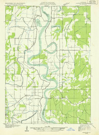
 1932 Colfax NE1932 Print · USGSGrant Parish was undergoing significant forestry management and rural development in the early 1930s. Genealogists and historians can locate the Williana Sch, Zion Hill Ch, and trace the path of the Louisiana and Arkansas railroad.
 - 1932 Map of Abbeville SE
 1932 Abbeville SE1932 Print · USGSThe Vermilion Parish marshlands in the early 1930s reveal a landscape defined by the Intracostal Waterway and tidal bayous. Historians can trace early routes like the Pirogue Trail and remote sites such as Caldwell Camp.
 - 1932 Map of Moss Lake
 1932 Moss Lake1932 Print · USGSCoastal Calcasieu Parish comes to life in the early 1930s as the Intracoastal Waterway begins to reshape the landscape. Researchers can trace family roots at Hackberry or locate the historic Dutch Cove Cemetery and Ellender Ferry crossings.
 - 1932 Map of Houma SW
 1932 Houma SW1932 Print · USGSCoastal Louisiana at the height of the early thirties shows a region defined by its water-bound industry and growing infrastructure. Genealogists and historians can trace family-named sites like Southdown and Ashland, or locate rural landmarks such as Jerusalem Ch and the Bayou Cane Sch.
 - 1932 Map of Abbeville NE
 1932 Abbeville NE1932 Print · USGSVermilion Parish comes into focus during the early 1930s, showing a landscape defined by the Southern Pacific rail line and the winding Vermilion Bayou. Genealogists and historians can trace family roots through markers like Landry Cem, Rose Hill Ch, and the rural community of Erath.
 - 1932 Map of Hosston NE
 1932 Hosston NE1932 Print · USGSThe Red River floodplain in Northwest Louisiana was a landscape of ferries and oxbow lakes in the early 1930s. Researchers can trace rural life through landmarks like Missionary Ferry, Miller Bluff Ch, and the town of Hosston.
 - 1932 Map of Houma NE
 1932 Houma NE1932 Print · USGSLafourche Parish in the early thirties reveals a landscape defined by the serpentine path of Bayou Lafourche and its thriving waterway communities. You can trace early 20th-century life at Lockport and Raceland, or find vanished school sites like Prairie Sch.2 unique versions available
 - 1932 Map of Thibodaux NE
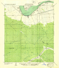 1932 Thibodaux NE1932 Print · USGSSt. James Parish at the height of the plantation era shows the intricate relationship between the river and the swamp. Genealogists can trace family footprints near Jefferson College or local schools like Peties Sch and Chegby Sch.
Showing maps 1-25 of 246
Top cities of Louisiana
- New Orleans historical maps
- Baton Rouge historical maps
- Shreveport historical maps
- Metairie historical maps
- Lafayette historical maps
- Saint George historical maps
See more
Top parishes of Louisiana
- Jefferson Parish historical maps
- Orleans Parish historical maps
- Caddo Parish historical maps
- St. Tammany Parish historical maps
- Lafayette Parish historical maps
- Calcasieu Parish historical maps
See more
Frequently asked questions
- What are the different types of historical maps available for Louisiana?
- What is the oldest map of Louisiana?
- Where can I purchase historical maps of Louisiana for my home or office?
- Where can I download high-res historical maps of Louisiana?
- Are there historical topographic maps available for Louisiana?
- Is there historical aerial imagery available for Louisiana?
- Where are historical maps of Louisiana sourced from?