
Historical Maps of Albuquerque, New Mexico
What stories do these 100 old maps tell about Albuquerque's past? From 1888 to present day, these maps reveal the evolution of streets, neighborhoods, iconic landmarks, and natural features in stunning high-res detail. Whether you're a history enthusiast, genealogist, or professional in education, environmental work, or architecture, these maps are perfect for exploration, research, and discovery.
Discover Albuquerque's history through maps:
- Trace Albuquerque's growth: Explore earlier and latest maps and editions to uncover how the region changed over time.
- Examine technical details: Each map includes its creators, publishers, scale, dimensions, and full source information.
- Layer maps with modern tools & imagery: Compare historical maps to modern-day with high-resolution satellite imagery and detailed LiDAR layers.
- Sourced from trusted archives: Carefully preserved and digitized by institutions like the United Stated Geological Survey and the US Library of Congress.
- Access in any format: View and explore in high resolution, download for offline use, or order a museum-quality print for yourself or a loved one.
Begin your journey into Albuquerque's history with these remarkable must-see maps.
Albuquerque, NM maps
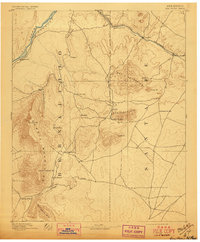
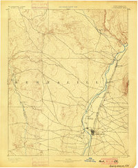
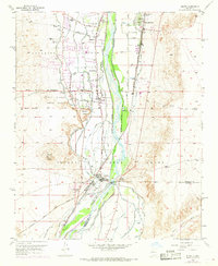
(100)- 1888 Map of Bernalillo, 1951 Print
 1888 Bernalillo1951 Print · USGSCovers Albuquerque, including Rio Rancho, South Valley, and other nearby areas
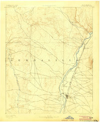
 - 1889 Map of Albuquerque
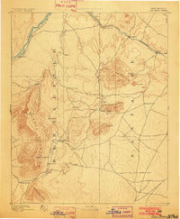
 1889 Albuquerque1889 Print · USGSCovers Albuquerque, including Rio Rancho, South Valley, and other nearby areas
 - 1892 Map of San Pedro
 1892 San Pedro1892 Print · USGSCovers Albuquerque, including Edgewood, Moriarty, and other nearby areas
 - 1892 Map of San Pedro, 1897 Print
 1892 San Pedro1897 Print · USGSCovers Albuquerque, including Edgewood, Moriarty, and other nearby areas
 - 1892 Map of San Pedro, 1902 Print
 1892 San Pedro1902 Print · USGSCovers Albuquerque, including Edgewood, Moriarty, and other nearby areas
 - 1892 Map of San Pedro, 1910 Print
 1892 San Pedro1910 Print · USGSCovers Albuquerque, including Edgewood, Moriarty, and other nearby areas
 - 1892 Map of San Pedro, 1944 Print
 1892 San Pedro1944 Print · USGSCovers Albuquerque, including Edgewood, Moriarty, and other nearby areas
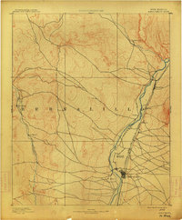
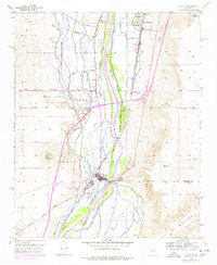
 - 1893 Map of Albuquerque
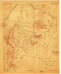
 1893 Albuquerque1893 Print · USGSCovers Albuquerque, including Rio Rancho, South Valley, and other nearby areas
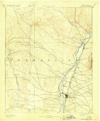
 - 1893 Map of Albuquerque, 1900 Print
 1893 Albuquerque1900 Print · USGSCovers Albuquerque, including Rio Rancho, South Valley, and other nearby areas
 - 1893 Map of Albuquerque, 1904 Print
 1893 Albuquerque1904 Print · USGSCovers Albuquerque, including Rio Rancho, South Valley, and other nearby areas
 - 1893 Map of Albuquerque, 1914 Print
 1893 Albuquerque1914 Print · USGSCovers Albuquerque, including Rio Rancho, South Valley, and other nearby areas
 - 1893 Map of Albuquerque, 1932 Print
 1893 Albuquerque1932 Print · USGSCovers Albuquerque, including Rio Rancho, South Valley, and other nearby areas
 - 1934 Map of Alameda
 1934 Alameda1934 Print · USGSCovers Albuquerque, including Corrales, Los Ranchos de Albuquerque, and other nearby areas
 - 1934 Map of West Albuquerque
 1934 West Albuquerque1934 Print · USGSCovers Albuquerque, including South Valley, Bernalillo County, and other nearby areas
 - 1934 Map of Griegos
 1934 Griegos1934 Print · USGSCovers Albuquerque, including Rio Rancho, Corrales, and other nearby areas
 - 1934 Map of East Albuquerque
 1934 East Albuquerque1934 Print · USGSCovers Albuquerque, including Oñate, La Mesa, and other nearby areas
 - 1938 Map of Albuquerque
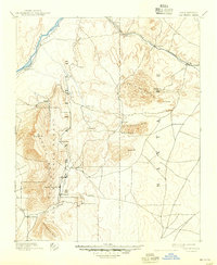
 1938 Albuquerque1938 Print · USGSCovers Albuquerque, including Rio Rancho, South Valley, and other nearby areas
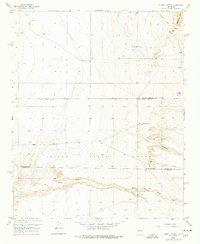
 - 1952 Map of Hubbell Spring, 1953 Print
 1952 Hubbell Spring1953 Print · USGSCovers Albuquerque, including Bernalillo County, Valencia County, and other nearby areas
 - 1952 Map of Isleta, 1954 Print
 1952 Isleta1954 Print · USGSCovers Albuquerque, including Isleta, Barr, and other nearby areas
 - 1952 Map of Hubbell Spring, 1966 Print
 1952 Hubbell Spring1966 Print · USGSCovers Albuquerque, including Bernalillo County, Valencia County, and other nearby areas
 - 1952 Map of Hubbell Spring, 1969 Print
 1952 Hubbell Spring1969 Print · USGSCovers Albuquerque, including Bernalillo County, Valencia County, and other nearby areas
 - 1952 Map of Isleta, 1969 Print
 1952 Isleta1969 Print · USGSCovers Albuquerque, including Isleta, Barr, and other nearby areas
 - 1952 Map of Hubbell Spring, 1978 Print
 1952 Hubbell Spring1978 Print · USGSCovers Albuquerque, including Bernalillo County, Valencia County, and other nearby areas
 - 1952 Map of Isleta, 1978 Print
 1952 Isleta1978 Print · USGSCovers Albuquerque, including Isleta, Barr, and other nearby areas
 - 1954 Map of Sandia Crest, 1955 Print
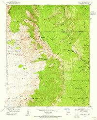 1954 Sandia Crest1955 Print · USGSCovers Albuquerque, including Cedar Crest, Evergreen Hills Subdivision, and other nearby areas
Showing maps 1-25 of 100
Top neighborhoods in Albuquerque
- Singing Arrow historical maps
- High Desert historical maps
- Cibola historical maps
- Coronado Terrace (HOA) historical maps
- Oso Grande historical maps
- Eastrange-Piedra Vista historical maps
See more
Frequently asked questions
- What are the different types of historical maps available for Albuquerque?
- What is the oldest map of Albuquerque?
- Where can I purchase historical maps of Albuquerque for my home or office?
- Where can I download high-res historical maps of Albuquerque?
- Are there historical topographic maps available for Albuquerque?
- Is there historical aerial imagery available for Albuquerque?
- Where are historical maps of Albuquerque sourced from?