
Historical Maps of McCurtain County, Oklahoma
What stories do these 163 old maps tell about McCurtain County's past? From 1890 to present day, these maps reveal the evolution of streets, neighborhoods, iconic landmarks, and natural features in stunning high-res detail. Whether you're a history enthusiast, genealogist, or professional in education, environmental work, or architecture, these maps are perfect for exploration, research, and discovery.
Discover McCurtain County's history through maps:
- Trace McCurtain County's growth: Explore earlier and latest maps and editions to uncover how the region changed over time.
- Examine technical details: Each map includes its creators, publishers, scale, dimensions, and full source information.
- Layer maps with modern tools & imagery: Compare historical maps to modern-day with high-resolution satellite imagery and detailed LiDAR layers.
- Sourced from trusted archives: Carefully preserved and digitized by institutions like the United Stated Geological Survey and the US Library of Congress.
- Access in any format: View and explore in high resolution, download for offline use, or order a museum-quality print for yourself or a loved one.
Begin your journey into McCurtain County's history with these remarkable must-see maps.
McCurtain County, OK maps
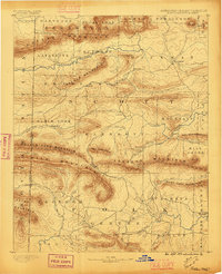
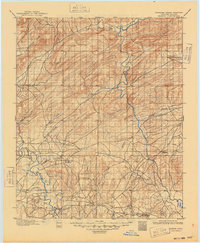
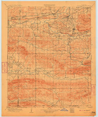
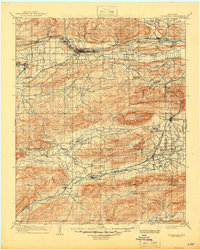
(163)- 1890 Map of Poteau Mountain
 1890 Poteau Mountain1890 Print · USGSCovers McCurtain County, including Mena, Waldron, and other nearby areas
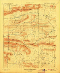
 - 1890 Map of Poteau Mountain, 1896 Print
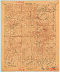
 1890 Poteau Mountain1896 Print · USGSCovers McCurtain County, including Mena, Waldron, and other nearby areas
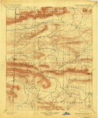
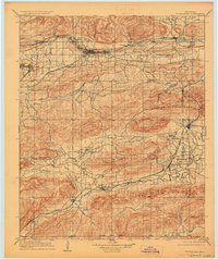
 - 1899 Map of Poteau Mountain
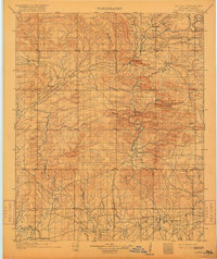
 1899 Poteau Mountain1899 Print · USGSCovers McCurtain County, including Mena, Waldron, and other nearby areas
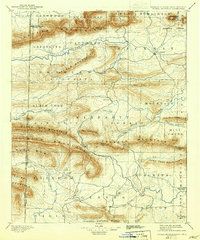
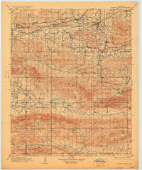
 - 1899 Map of Poteau Mountain, 1908 Print
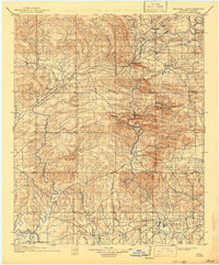
 1899 Poteau Mountain1908 Print · USGSCovers McCurtain County, including Mena, Waldron, and other nearby areas
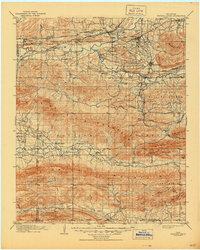
 - 1899 Map of Poteau Mountain, 1919 Print
 1899 Poteau Mountain1919 Print · USGSCovers McCurtain County, including Mena, Waldron, and other nearby areas
 - 1899 Map of Poteau Mountain, 1924 Print
 1899 Poteau Mountain1924 Print · USGSCovers McCurtain County, including Mena, Waldron, and other nearby areas
 - 1899 Map of Poteau Mountain, 1942 Print
 1899 Poteau Mountain1942 Print · USGSCovers McCurtain County, including Mena, Waldron, and other nearby areas
 - 1899 Map of Poteau Mountain, 1948 Print
 1899 Poteau Mountain1948 Print · USGSCovers McCurtain County, including Mena, Waldron, and other nearby areas
 - 1900 Map of Winding Stair
 1900 Winding Stair1900 Print · USGSCovers McCurtain County, including Poteau, Heavener, and other nearby areas
 - 1901 Map of Tuskahoma
 1901 Tuskahoma1901 Print · USGSCovers McCurtain County, including Wilburton, Talihina, and other nearby areas
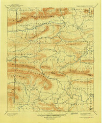
 - 1901 Map of Alikchi
 1901 Alikchi1901 Print · USGSCovers McCurtain County, including Hugo, Wright City, and other nearby areas
 - 1901 Map of Alikchi, 1915 Print
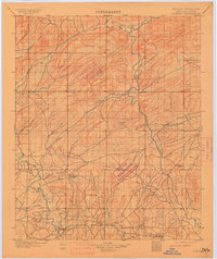 1901 Alikchi1915 Print · USGSCovers McCurtain County, including Hugo, Wright City, and other nearby areas
 - 1901 Map of Alikchi, 1915 Print
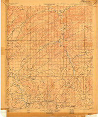 1901 Alikchi1915 Print · USGSCovers McCurtain County, including Hugo, Wright City, and other nearby areas
 - 1901 Map of Alikchi, 1926 Print
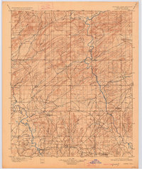 1901 Alikchi1926 Print · USGSCovers McCurtain County, including Hugo, Wright City, and other nearby areas
 - 1901 Map of Alikchi, 1949 Print
 1901 Alikchi1949 Print · USGSCovers McCurtain County, including Hugo, Wright City, and other nearby areas
 - 1902 Map of Lukfata
 1902 Lukfata1902 Print · USGSCovers McCurtain County, including Broken Bow, Wright City, and other nearby areas
 - 1902 Map of Lukfata, 1917 Print
 1902 Lukfata1917 Print · USGSCovers McCurtain County, including Broken Bow, Wright City, and other nearby areas
 - 1902 Map of Lukfata, 1942 Print
 1902 Lukfata1942 Print · USGSCovers McCurtain County, including Broken Bow, Wright City, and other nearby areas
 - 1908 Map of Tuskahoma, 1964 Print
 1908 Tuskahoma1964 Print · USGSCovers McCurtain County, including Wilburton, Talihina, and other nearby areas
 - 1909 Map of Tuskahoma
 1909 Tuskahoma1909 Print · USGSCovers McCurtain County, including Wilburton, Talihina, and other nearby areas
 - 1909 Map of Winding Stair
 1909 Winding Stair1909 Print · USGSCovers McCurtain County, including Poteau, Heavener, and other nearby areas
 - 1909 Map of Tuskahoma, 1928 Print
 1909 Tuskahoma1928 Print · USGSCovers McCurtain County, including Wilburton, Talihina, and other nearby areas
 - 1909 Map of Winding Stair, 1928 Print
 1909 Winding Stair1928 Print · USGSCovers McCurtain County, including Poteau, Heavener, and other nearby areas
 - 1909 Map of Winding Stair, 1944 Print
 1909 Winding Stair1944 Print · USGSCovers McCurtain County, including Poteau, Heavener, and other nearby areas
 - 1909 Map of Tuskahoma, 1945 Print
 1909 Tuskahoma1945 Print · USGSCovers McCurtain County, including Wilburton, Talihina, and other nearby areas
Showing maps 1-25 of 163
Top cities in McCurtain County
- Idabel historical maps
- Broken Bow historical maps
- Wright City historical maps
- Valliant historical maps
- Millerton historical maps
- Haworth historical maps
See more
Frequently asked questions
- What are the different types of historical maps available for McCurtain County?
- What is the oldest map of McCurtain County?
- Where can I purchase historical maps of McCurtain County for my home or office?
- Where can I download high-res historical maps of McCurtain County?
- Are there historical topographic maps available for McCurtain County?
- Is there historical aerial imagery available for McCurtain County?
- Where are historical maps of McCurtain County sourced from?