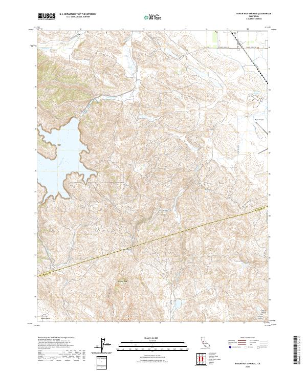
2021 Map of Byron Hot Springs
USGS Topo · Published 2021About this map
Byron Hot Springs sits at the transition between the rising slopes of the Diablo Range and the western edge of the San Joaquin Valley. This landscape is defined by the sharp contrast between the rugged terrain of Brushy Peak and the flat expanses of the Central Valley. The map highlights a network of watercourses, including Marsh Cr and Kellogg Cr, which have historically shaped the drainage of these foothills. Contemporary land use is evident in the presence of the Byron Airport and an extensive system of recreational paths like the Brushy Peak Loop Trl and Tamcan Trl, illustrating the area's evolution from a thermal spring destination to a modern regional hub for outdoor activity. Significant roadways such as Vasco Rd and Camino Diablo Rd navigate the complex topography, connecting the isolated hills of eastern Contra Costa County to the broader agricultural valley floor.
Find a feature on this map
33 named features on this map. Tap any name to fly to it.
Don’t see what you’re looking for? This feature index may not catch every label — zoom into the map to look around manually.
Map Details
Editions of this 2021 Byron Hot Springs Map
This is the sole edition of this map. No revisions or reprints were ever made.
Other maps of this area

1896 · Mt. Diablo
USGS Topo · 1:62,500

1898 · Mt. Diablo
USGS Topo · 1:62,500

1906 · Pleasanton
USGS Topo · 1:62,500

1907 · Tesla
USGS Topo · 1:62,500

1911 · Byron Hot Springs
USGS Topo · 1:31,680

1913 · Woodward Island
USGS Topo · 1:31,680

1914 · Brentwood
USGS Topo · 1:31,680

1914 · Bethany
USGS Topo · 1:31,680

1916 · Lone Tree Valley
USGS Topo · 1:31,680

1916 · Byron Hot Springs
USGS Topo · 1:31,680