1940s Maps of Kansas
Explore 76 historic maps of Kansas from the 1940s. These maps offer a rare glimpse into what life looked like during the 1940s — showing old roads, neighborhoods, homes, and landmarks that have changed or disappeared over time.
Whether you're researching your family's past, planning a metal detecting trip, or studying how Kansas's landscape evolved across the 1940s, these high-resolution maps are a powerful tool for exploring the history of this region.
- Focus on a specific era: All maps on this page are from the 1940s, giving you a focused view of this time period.
- See what’s changed: Compare century-old streets, trails, and buildings to today's modern landscape using overlays and satellite layers.
- Research with precision: Use these maps for genealogy, historical research, land use analysis, or educational projects.
- View, download, or print: Maps are fully viewable online in high resolution, and can be downloaded or printed for your own records.
Start exploring Kansas's history through authentic maps from the 1940s. This is your window into the past.
Kansas maps
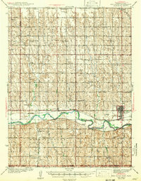
(76)- 1940 Map of Kansas City
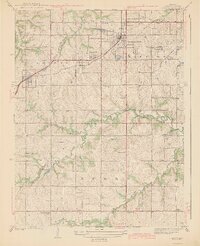
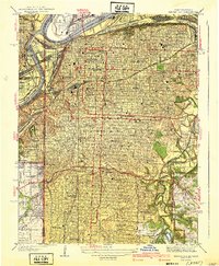 1940 Kansas City1940 Print · USGSKansas City's urban landscape is shown in remarkable detail just before the war, highlighting its massive rail yards and industrial riverfront. Genealogists and historians can trace neighborhood schools like Longfellow Sch, Central High Schools, and the resting places at Calvary Cemetery.3 unique versions available
 - 1940 Map of Scott City
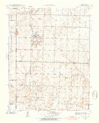
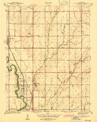
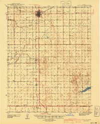 1940 Scott City1940 Print · USGSWestern Kansas agriculture and early energy development intersect in the late 1930s. Genealogists can trace rural school districts like Buffalo Sch and Lone Valley Sch or locate ancestors in the Scott City Cem.
 - 1940 Map of Bonner Springs
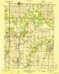
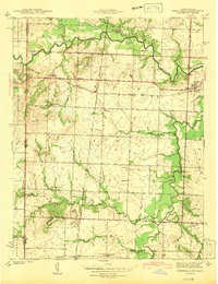
 1940 Bonner Springs1940 Print · USGSThe Kansas and Missouri rivers converge near these busy rail corridors just before the Second World War. Researchers can trace rural life through dozens of named schools like Mission Sch and the community center at Elm Grove Community Hall.3 unique versions available
 - 1940 Map of North Kansas City
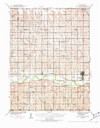
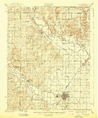
 1940 North Kansas City1940 Print · USGSThe industrial riverfront and Clay County uplands are documented here during the mid-1930s as the regional transport network matured. Genealogists and researchers can locate family landmarks like New Stark Cem, Bethel Ch, and the many rural schoolhouses serving Gashland and Barry.2 unique versions available
 - 1940 Map of Worland
 1940 Worland1940 Print · USGSBates County, Missouri, was a landscape of bustling rail towns and schoolhouse districts just before the Second World War. Genealogists can trace family footprints through numerous rural cemeteries like Woodfin Cem and local school sites such as Johnson Sch and Standish Sch.2 unique versions available
 - 1940 Map of Red Cloud, 1954 Print
 1940 Red Cloud1954 Print · USGSSouthern Nebraska at the end of the Great Depression is characterized by its close-knit rural school districts and river-valley rail lines. Genealogists can trace family roots through numerous landmarks like Catherton Cem, St Stevens Ch, and the Poor Farm Sch.2 unique versions available
 - 1940 Map of Hume, 1954 Print
 1940 Hume1954 Print · USGSThe Missouri-Kansas borderlands come to life in this late-depression era survey centered on Hume. Genealogists and local historians can trace family roots through numerous rural landmarks like Hume Cem, Union Chapel, and the settlement of Amos.3 unique versions available
 - 1941 Map of Severy
 1941 Severy1941 Print · USGSGreenwood and Elk Counties are shown here just before the Second World War, centered on the busy rail junction at Severy. Researchers can trace dozens of rural schoolhouses and cemeteries, including the Lone Star Cem, Antioch Ch, and the vanished settlement at Ashley.3 unique versions available
 - 1941 Map of Maize
 1941 Maize1941 Print · USGSSedgwick County prairie life is captured here just before the war, showing the area's transition into a major rail and river hub. Local historians can trace early schools like Prairie Queen Sch and the unique route of the Arkansas Valley Interurban Electric.
 - 1941 Map of Valley Center
 1941 Valley Center1941 Print · USGSSedgwick County agricultural lands and growing townships are captured here at the start of the 1940s. Local historians can trace the foundations of Valley Center and Keehi alongside vanished landmarks like the Stearns Race Track and Hoss Sch.
 - 1941 Map of Modoc
 1941 Modoc1941 Print · USGSWichita and Scott counties are shown just before the war, when the rural school system and the Missouri Pacific railroad anchored the High Plains economy. Researchers can locate numerous local landmarks including St Marys Cem, Lydia Ch, and schools like Prairie Bell Sch.
 - 1941 Map of Pence
 1941 Pence1941 Print · USGSWestern Kansas high plains life is preserved here during the late Depression era, showing the intersection of Logan, Wichita, and Scott counties. Genealogists can trace early 20th-century rural life through landmarks like Pence Cem and a network of schools including Lone Corner Sch and High Prairie Sch.2 unique versions available
 - 1942 Map of Hume
 1942 Hume1942 Print · USGSThe Missouri-Kansas border area near Hume is captured here just before the mid-century, showing a landscape tightly woven with railroads and rural school districts. Genealogists can locate family landmarks like Lawrence Cem, Union Chapel, and the now-vanished rail stop at Amos.2 unique versions available
 - 1942 Map of Richards
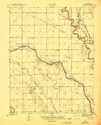
 1942 Richards1942 Print · USGSThe Missouri-Kansas borderlands in the late 1930s were defined by the crossing of major rail lines and the winding Little Osage River. Researchers can trace old township schoolhouses like Enoch Sch and local burial sites including Turley Cem and East Liberty Cem.3 unique versions available
 - 1942 Map of Salina
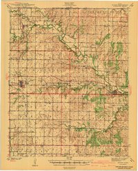
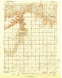
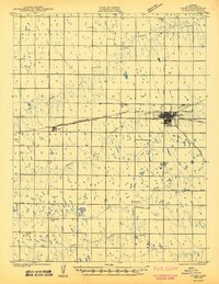
 1942 Salina1942 Print · USGSCentral Kansas during the early 1940s reveals a landscape transitioning between its deep agricultural roots and a massive new wartime footing. Researchers can trace the development of the Military Reservation and locate small rail-side settlements like Terra Cotta and Smolan.
 - 1942 Map of Red Cloud
 1942 Red Cloud1942 Print · USGSRed Cloud and the surrounding Republican River valley are shown here just before the mid-century, when the rural school system remained remarkably intact. Researchers can trace family roots through numerous sites like New Virginia Cem, Poor Farm Sch, and Inavale.
 - 1942 Map of Valley Center
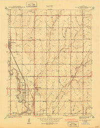
 1942 Valley Center1942 Print · USGSNorth of Wichita just before the war, this area shows a landscape defined by the Little Arkansas River and a busy intersection of four major railroads. Genealogists can locate numerous country schoolhouses like Riverview Sch and Hillside Grove Sch, as well as the MARBLE GROVE CEM and the old STEARNS RACE TRACK.
 - 1942 Map of Deerfield
 1942 Deerfield1942 Print · USGSThe Missouri-Kansas border comes into focus in the early 1940s, showing a rural landscape defined by the Marmaton River and the Kansas City Southern railroad. Researchers can locate numerous country schools like Lone Elm Sch and Sunny Slope Sch or trace the small settlements of Deerfield and Eve.2 unique versions available
 - 1942 Map of Fredonia
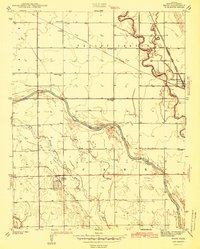
 1942 Fredonia1942 Print · USGSThe rail crossroads at Fredonia and the winding river valleys of Wilson County are captured here just before the mid-century. Genealogists can trace rural life through dozens of local landmarks like Old Taylor Cem, Coyville, and the Needmore Sch.
 - 1942 Map of Sandon
 1942 Sandon1942 Print · USGSWestern Kansas at the end of the Depression era reveals a landscape shaped by both deep canyon drainages and the arrival of organized recreation and preservation. Genealogists can locate family-named landmarks and rural school sites like Goodluck Sch and Zanobia Sch, or trace the historical Pueblo Ruins Monument near McBride.
 - 1942 Map of Maize
 1942 Maize1942 Print · USGSSedgwick County at the start of the 1940s reveals a landscape of thriving rural schools and critical rail junctions. Genealogists can locate family landmarks like the Maize Cem or trace the early paths of the St Louis San Francisco railroad through Valley Center and Maize.2 unique versions available
 - 1942 Map of Lake Mc Bride
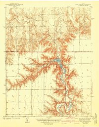 1942 Lake Mc Bride1942 Print · USGSWestern Kansas at the dawn of the 1940s reveals a unique intersection of ancient history and New Deal-era public works. Researchers can trace rural school locations like State Park Sch and explore landmarks like El Quartelejo Pueblo Ruins Monument.5 unique versions available
 - 1942 Map of St. Francis, 1943 Print
 1942 St. Francis1943 Print · USGSCheyenne County and the Nebraska-Kansas border appear in the early 1940s as a landscape of rural schools and river-fed agriculture. Genealogists can locate family landmarks such as German Plains Sch, St Francis Cem, and the Zion Ch.
 - 1943 Map of Lenexa
 1943 Lenexa1943 Print · USGSJohnson County was transitioning from a rural rail corridor to a suburban landscape in the years surrounding the Second World War. Researchers can trace early family-named school districts like Walnut Grove Sch and the grounds of the Mission Valley Hunt Club.2 unique versions available
 - 1943 Map of Colby
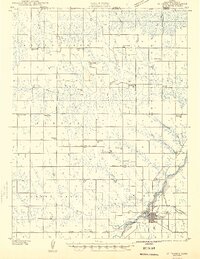
 1943 Colby1943 Print · USGSThomas County during the early 1940s reveals a productive agricultural landscape centered on the railway junction at Colby. Genealogists and researchers can trace a vanished network of rural schoolhouses like Green Plain Sch and Star Sch along the South Fork Solomon River.2 unique versions available
Showing maps 1-25 of 76
Top cities of Kansas
- Wichita historical maps
- Overland Park historical maps
- Kansas City historical maps
- Olathe historical maps
- Topeka historical maps
- Lawrence historical maps
See more
Top counties of Kansas
- Johnson County historical maps
- Sedgwick County historical maps
- Shawnee County historical maps
- Wyandotte County historical maps
- Douglas County historical maps
- Riley County historical maps
See more
Frequently asked questions
- What are the different types of historical maps available for Kansas?
- What is the oldest map of Kansas?
- Where can I purchase historical maps of Kansas for my home or office?
- Where can I download high-res historical maps of Kansas?
- Are there historical topographic maps available for Kansas?
- Is there historical aerial imagery available for Kansas?
- Where are historical maps of Kansas sourced from?