1980s Maps of Kansas
Explore 143 historic maps of Kansas from the 1980s. These maps offer a rare glimpse into what life looked like during the 1980s — showing old roads, neighborhoods, homes, and landmarks that have changed or disappeared over time.
Whether you're researching your family's past, planning a metal detecting trip, or studying how Kansas's landscape evolved across the 1980s, these high-resolution maps are a powerful tool for exploring the history of this region.
- Focus on a specific era: All maps on this page are from the 1980s, giving you a focused view of this time period.
- See what’s changed: Compare century-old streets, trails, and buildings to today's modern landscape using overlays and satellite layers.
- Research with precision: Use these maps for genealogy, historical research, land use analysis, or educational projects.
- View, download, or print: Maps are fully viewable online in high resolution, and can be downloaded or printed for your own records.
Start exploring Kansas's history through authentic maps from the 1980s. This is your window into the past.
Kansas maps
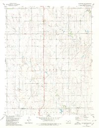
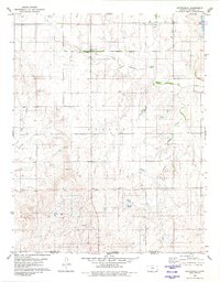
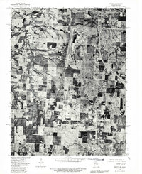
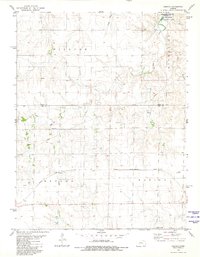
(143)- 1980 Map of Nescatunga Creek North
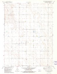
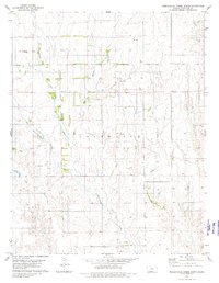 1980 Nescatunga Creek North1980 Print · USGSComanche County during the late 1970s is shown here as a landscape of deep creek drainages and quiet prairie settlements. Researchers can locate the Nescatunga Cem, an isolated Grave, and numerous rural energy markers like a Gas Well or Drill Hole.
 - 1980 Map of Protection SW
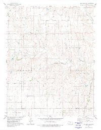
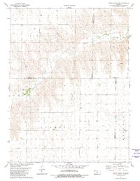
 1980 Protection SW1980 Print · USGSComanche County during the late 1970s reveals a prairie landscape shaped by historic demarcations and river systems. Genealogists and historians can trace the Old Indian Treaty Boundary and locate the Mennonite Cem near the banks of Cavalry Creek.
 - 1980 Map of Protection
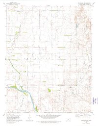
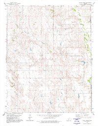
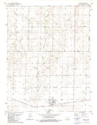
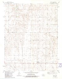
 1980 Protection1980 Print · USGSThe town of Protection was a well-established rail and prairie hub when this survey was completed in the late 1970s. Researchers can trace the local infrastructure from the Protection Cem and Municipal Airport to the southern Oil Field and the Atchison Topeka and Santa Fe line.
 - 1980 Map of Wilmore
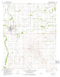
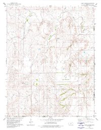
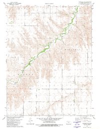
 1980 Wilmore1980 Print · USGSWilmore and the surrounding Comanche County prairies are captured here during the late twentieth century, showing a landscape defined by ranching and energy. Genealogists can locate the Township Cem and follow the Atchison Topeka and Santa Fe rail line through Wilmore.
 - 1980 Map of Coldwater NE
 1980 Coldwater NE1980 Print · USGSThe high plains of south-central Kansas are captured here as the energy economy and old frontier lines intersect in the early 1980s. Researchers can trace the Old Indian Treaty Boundary and locate small landmarks like the settlement at Harold or several Gas Well sites.
 - 1980 Map of Iron Mountain
 1980 Iron Mountain1980 Print · USGSThe high plains of Kiowa and Comanche Counties are captured here in the late twentieth century as energy exploration reshaped the prairie. Trace the Old Indian Treaty Boundary and explore the rail corridor of the Atchison Topeka and Santa Fe near Iron Mountain.
 - 1980 Map of Indian Creek
 1980 Indian Creek1980 Print · USGSComanche and Barber Counties are shown here during a peak era of energy extraction in the 1980s. Researchers can locate specific energy infrastructure and rural landmarks such as the Gas Field, Mule Creek, and local Oil Wells.
 - 1980 Map of Fancy Canyon
 1980 Fancy Canyon1980 Print · USGSIn the grasslands of southwest Kansas during the late 1970s, the landscape remained defined by long-standing territory lines and river forks. Researchers can trace the Old Indian Treaty Boundary and locate early energy infrastructure like a Pipeline and various Gas Wells.
 - 1980 Map of Buttermilk
 1980 Buttermilk1980 Print · USGSSouthern Kansas and the Oklahoma borderlands are mapped here in the late seventies, showing a landscape defined by ranching and historic lines. Genealogists and researchers can trace the Old Indian Treaty Boundary and find local landmarks like Antioch Ch and the settlement of Buttermilk.
 - 1980 Map of Mc Cracken NE, 1981 Print
 1980 Mc Cracken NE1981 Print · USGSWestern Kansas rangeland meets industrial expansion in the late 1970s at the junction of four counties. Researchers can trace the development of the Smoky Hill Oil Field and locate localized operations like the Landing Strip and Claypit.
 - 1980 Map of St. Joseph South, 1981 Print
 1980 St. Joseph South1981 Print · USGSThe southern fringes of St Joseph and the surrounding Buchanan County farmlands are seen here in the early eighties. Genealogists and local historians can trace the rural landscape around Saxton and Willow Brook or follow the path of Contrary Creek.
 - 1980 Map of Ransom, 1981 Print
 1980 Ransom1981 Print · USGSRansom sat at a crossroads of rail and prairie in the late 1970s, anchoring a landscape of wind-swept townships and creek branches. Researchers can trace the Missouri Pacific line through town, locate the Ransom Cem, and find industrial markers like local Quarries and Oil Well sites.
 - 1980 Map of Halls, 1981 Print
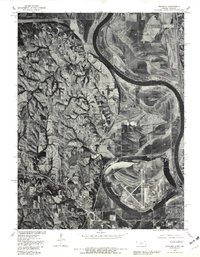
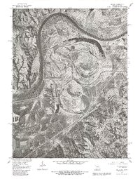 1980 Halls1981 Print · USGSThe Missouri-Kansas borderlands are captured here in the early 1980s, documenting the river's influence on the landscape south of St Joseph. Genealogists and researchers can trace local landmarks like the settlement of Halls and the prominent Lake Contrary.2 unique versions available
 - 1980 Map of Belton, 1981 Print
 1980 Belton1981 Print · USGSThe Missouri-Kansas borderlands in the 1980s are captured here during a period of significant military and suburban expansion. Genealogists and historians can trace the development of Belton and Grandview alongside the massive Richards-Gebaur Air Force Base.
 - 1980 Map of Wathena, 1981 Print
 1980 Wathena1981 Print · USGSThe Missouri River floodplain comes into sharp focus during the early 1980s, revealing the complex relationship between the water and the land. Local historians can trace the development of Wathena and Elwwod alongside natural features like Browning Lake.
 - 1980 Map of Brownell, 1981 Print
 1980 Brownell1981 Print · USGSThe community of Brownell and the surrounding prairie are captured here during the early eighties, as energy exploration and the railroad shaped the landscape. Genealogists and historians can trace the Missouri Pacific rail line and landmarks like Round House Rock and Big Timber Creek.
 - 1980 Map of St. Joseph North, 1981 Print
 1980 St. Joseph North1981 Print · USGSSt. Joseph's northern reaches and rural Buchanan County are captured in the early eighties as suburban development meets traditional farmland. Trace the winding One Hundred and Two River or locate homes in Country Club Village.
 - 1980 Map of Osgood, 1981 Print
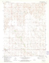
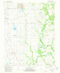
 1980 Osgood1981 Print · USGSThe Ness County plains and Smoly Hill River drainage are captured here during the 1980s, centered on the railroad stop of Osgood. Researchers can trace early family sites at Cyrus Cem, locate active Oil Wells, and explore the shoreline of the Cedar Bluff Reservoir.
 - 1980 Map of Joplin West, 1982 Print
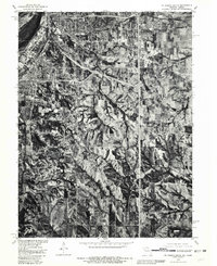
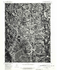
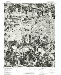 1980 Joplin West1982 Print · USGSThe Missouri-Kansas borderlands come into sharp focus in this early 1980s aerial survey, revealing the urban expansion of the Joplin area. Genealogists and historians can trace the exact building footprints and property lines in Joplin, Central City, and Galena.
 - 1981 Map of Asbury
 1981 Asbury1981 Print · USGSJasper County and the Kansas borderlands appear in the early eighties as a hub of rail lines and river confluences. Genealogists and local historians can trace the paths of the Kansas City Southern through Asbury or locate the Georgia City Cem near Galesburg.
 - 1981 Map of Butler
 1981 Butler1981 Print · USGSWestern Missouri and eastern Kansas settlements are documented here in the early eighties, as the river valleys were transitioning into major wildlife management areas. Genealogists can locate family names near Greenlawn Cem or trace the development of towns like Butler, Osawatomie, and Appleton City.
 - 1981 Map of Bird City South NW
 1981 Bird City South NW1981 Print · USGSThe High Plains of Cheyenne County are captured here in the early eighties, showing a landscape defined by industrial agriculture and township grids. Researchers can locate Wheeler Cem, St Pauls Cem, and sand extraction sites along Sand Creek.
 - 1981 Map of Dewey Ranch SW
 1981 Dewey Ranch SW1981 Print · USGSThe high plains of Northwest Kansas are captured here in the early 1980s, where the corners of four different counties meet. Genealogists and historians can locate remote landmarks like Fairview Cem, Central Ch, and the workings of the Llanos Oil Field.
 - 1981 Map of Arnold
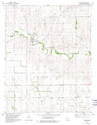
 1981 Arnold1981 Print · USGSNear the Trego and Ness County border in the late 1970s, this area centered on the rural community of Arnold. Researchers can trace local genealogy at the Amish Cem and Arnold Cem or follow the historic Missouri Pacific rail line.
 - 1981 Map of Chardon NW
 1981 Chardon NW1981 Print · USGSThe High Plains of Rawlins County are captured here in the late seventies, showing a land of organized townships and winding creek beds. Researchers can trace rural landmarks like Stevens Chapel and the courses of Beaver Creek and North Fork Sappa Creek.
Showing maps 1-25 of 143
Top cities of Kansas
- Wichita historical maps
- Overland Park historical maps
- Kansas City historical maps
- Olathe historical maps
- Topeka historical maps
- Lawrence historical maps
See more
Top counties of Kansas
- Johnson County historical maps
- Sedgwick County historical maps
- Shawnee County historical maps
- Wyandotte County historical maps
- Douglas County historical maps
- Riley County historical maps
See more
Frequently asked questions
- What are the different types of historical maps available for Kansas?
- What is the oldest map of Kansas?
- Where can I purchase historical maps of Kansas for my home or office?
- Where can I download high-res historical maps of Kansas?
- Are there historical topographic maps available for Kansas?
- Is there historical aerial imagery available for Kansas?
- Where are historical maps of Kansas sourced from?