
Historical Maps of Huron County, Ohio
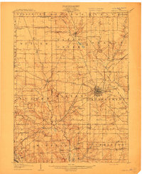
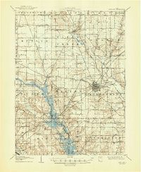
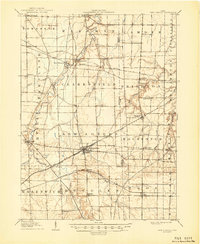
What stories do these 88 old maps tell about Huron County's past? From 1901 to present day, these maps reveal the evolution of streets, neighborhoods, iconic landmarks, and natural features in stunning high-res detail. Whether you're a history enthusiast, genealogist, or professional in education, environmental work, or architecture, these maps are perfect for exploration, research, and discovery.
Discover Huron County's history through maps:
- Trace Huron County's growth: Explore earlier and latest maps and editions to uncover how the region changed over time.
- Examine technical details: Each map includes its creators, publishers, scale, dimensions, and full source information.
- Layer maps with modern tools & imagery: Compare historical maps to modern-day with high-resolution satellite imagery and detailed LiDAR layers.
- Sourced from trusted archives: Carefully preserved and digitized by institutions like the United Stated Geological Survey and the US Library of Congress.
- Access in any format: View and explore in high resolution, download for offline use, or order a museum-quality print for yourself or a loved one.
Begin your journey into Huron County's history with these remarkable must-see maps.
Huron County, OH maps
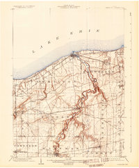
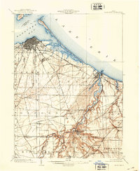
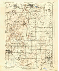
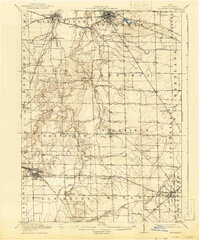
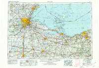
(88)- 1901 Map of Bellevue, 1958 Print
 1901 Bellevue1958 Print · USGSCovers Huron County, including Sandusky, Clyde, and other nearby areas
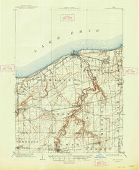
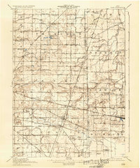
 - 1903 Map of Vermilion, 1932 Print
 1903 Vermilion1932 Print · USGSCovers Huron County, including Lorain, Amherst, and other nearby areas
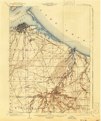
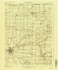
 - 1903 Map of Bellevue, 1942 Print
 1903 Bellevue1942 Print · USGSCovers Huron County, including Sandusky, Clyde, and other nearby areas
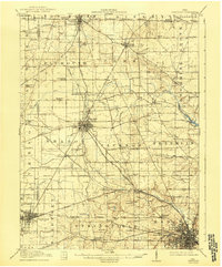
 - 1903 Map of Vermilion, 1948 Print
 1903 Vermilion1948 Print · USGSCovers Huron County, including Lorain, Amherst, and other nearby areas
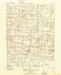
 - 1904 Map of Sandusky, 1941 Print
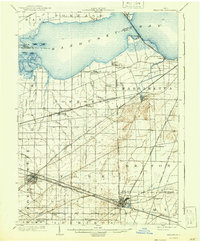
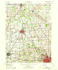
 1904 Sandusky1941 Print · USGSCovers Huron County, including Sandusky, Norwalk, and other nearby areas
 - 1904 Map of Sandusky, 1941 Print
 1904 Sandusky1941 Print · USGSCovers Huron County, including Sandusky, Norwalk, and other nearby areas
 - 1904 Map of Sandusky, 1941 Print
 1904 Sandusky1941 Print · USGSCovers Huron County, including Sandusky, Norwalk, and other nearby areas
 - 1908 Map of Ashland
 1908 Ashland1908 Print · USGSCovers Huron County, including Mansfield, Ashland, and other nearby areas
 - 1908 Map of Ashland, 1948 Print
 1908 Ashland1948 Print · USGSCovers Huron County, including Mansfield, Ashland, and other nearby areas
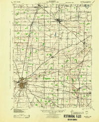
 - 1908 Map of New London, 1948 Print
 1908 New London1948 Print · USGSCovers Huron County, including Wellington, New London, and other nearby areas
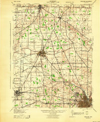
 - 1915 Map of Norwalk, 1936 Print
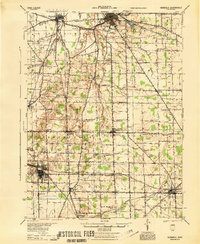
 1915 Norwalk1936 Print · USGSCovers Huron County, including Norwalk, Willard, and other nearby areas
 - 1915 Map of Siam, 1936 Print
 1915 Siam1936 Print · USGSCovers Huron County, including Scipio, Attica, and other nearby areas
 - 1915 Map of Bucyrus, 1940 Print
 1915 Bucyrus1940 Print · USGSCovers Huron County, including Bucyrus, Galion, and other nearby areas
 - 1915 Map of Crestline, 1943 Print
 1915 Crestline1943 Print · USGSCovers Huron County, including Mansfield, Galion, and other nearby areas
 - 1915 Map of Norwalk, 1943 Print
 1915 Norwalk1943 Print · USGSCovers Huron County, including Norwalk, Willard, and other nearby areas
 - 1915 Map of Siam, 1951 Print
 1915 Siam1951 Print · USGSCovers Huron County, including Scipio, Attica, and other nearby areas
 - 1943 Map of Bucyrus
 1943 Bucyrus1943 Print · USGSCovers Huron County, including Bucyrus, Galion, and other nearby areas
 - 1943 Map of Crestline
 1943 Crestline1943 Print · USGSCovers Huron County, including Mansfield, Galion, and other nearby areas
 - 1943 Map of Crestline, 1961 Print
 1943 Crestline1961 Print · USGSCovers Huron County, including Mansfield, Galion, and other nearby areas
 - 1944 Map of Norwalk
 1944 Norwalk1944 Print · USGSCovers Huron County, including Norwalk, Willard, and other nearby areas
 - 1950 Map of Marion
 1950 Marion1950 Print · USGSCovers Huron County, including Columbus, Newark, and other nearby areas
 - 1956 Map of Toledo, 1968 Print
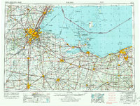
 1956 Toledo1968 Print · USGSCovers Huron County, including Toledo, Lorain, and other nearby areas
 - 1956 Map of Toledo, 1972 Print
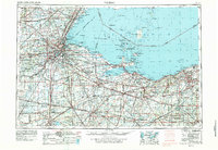
 1956 Toledo1972 Print · USGSCovers Huron County, including Toledo, Lorain, and other nearby areas
 - 1956 Map of Toledo, 1979 Print
 1956 Toledo1979 Print · USGSCovers Huron County, including Toledo, Lorain, and other nearby areas
 - 1956 Map of Toledo, 1979 Print
 1956 Toledo1979 Print · USGSCovers Huron County, including Toledo, Lorain, and other nearby areas
Showing maps 1-25 of 88
Top cities in Huron County
Frequently asked questions
- What are the different types of historical maps available for Huron County?
- What is the oldest map of Huron County?
- Where can I purchase historical maps of Huron County for my home or office?
- Where can I download high-res historical maps of Huron County?
- Are there historical topographic maps available for Huron County?
- Is there historical aerial imagery available for Huron County?
- Where are historical maps of Huron County sourced from?