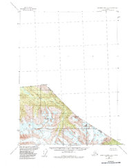
1955 Map of Bradfield Canal C-5
USGS Topo · Published 1986About this map
The international boundary between British Columbia and Alaska defines the northern and eastern limits of this mid-century topographic survey. This triangle of land within the Tongass National Forest is dominated by the glacial drainages of the Katete River, which flows southwestward from the high peaks of the Coast Mountains. The map documents the specific locations of international boundary monuments such as Mon 56 3114 and Mon 55 2865 along the ridge lines.
Find a feature on this map
9 named features on this map. Tap any name to fly to it.
Don’t see what you’re looking for? This feature index may not catch every label — zoom into the map to look around manually.
Map Details
Editions of this 1955 Bradfield Canal C-5 Map
2 editions found
Other maps of this area

1951 · Bradfield Canal
USGS Topo · 1:250,000

1954 · Bradfield Canal
USGS Topo · 1:250,000

1955 · Bradfield canal B-5
USGS Topo · 1:63,360

1955 · Bradfield canal B-4
USGS Topo · 1:63,360

1955 · Bradfield canal D-6
USGS Topo · 1:63,360

1955 · Bradfield canal C-6
USGS Topo · 1:63,360

1955 · Bradfield canal B-6
USGS Topo · 1:63,360
1955 · Bradfield Canal C-5
USGS Topo · 1:63,360

1955 · Bradfield Canal
USGS Topo · 1:250,000
2000 · Bradfield Canal B-6
USGS Topo · 1:63,360