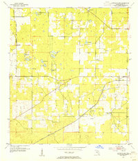
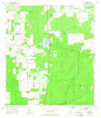
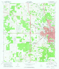
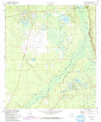
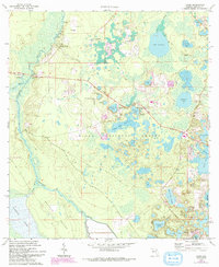
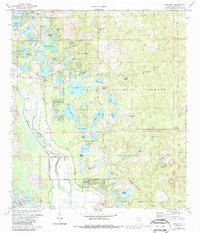
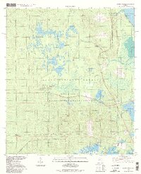
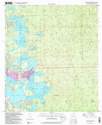
1954 Map of Cotton Plant
USGS Topo · Published 1955This historical map portrays the area of Cotton Plant in 1954, primarily covering Marion County. Featuring a scale of 1:24000, this map provides a highly detailed snapshot of the terrain, roads, buildings, counties, and historical landmarks in the Cotton Plant region at the time. Published in 1955, it is one of 2 known editions of this map due to revisions or reprints.
Find a feature on this map
29 named features on this map. Tap any name to fly to it.
Don’t see what you’re looking for? This feature index may not catch every label — zoom into the map to look around manually.
Map Details
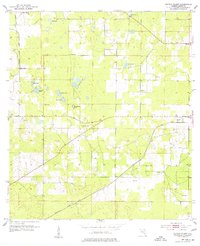
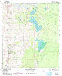
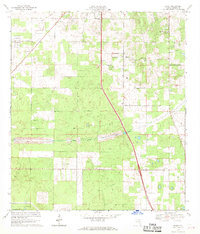
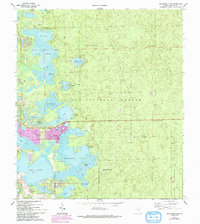
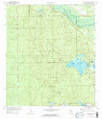
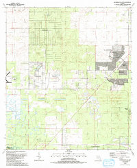
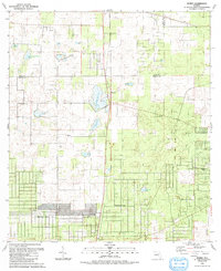
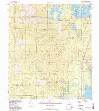
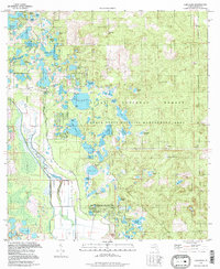
Editions of this 1954 Cotton Plant Map
2 editions found
Historical Maps of Early Bird Through Time
34 maps found

1893 Citra
Marion County, FL
1895 Citra
Marion County, FL
1954 Cotton Plant
Marion County, FL
1954 Dunnellon SE
Marion County, FL
1954 Romeo
Marion County, FL
1967 Anthony
Marion County, FL
1967 Citra
Marion County, FL

1967 Ocala East
Marion County, FL
1968 Fairfield
Marion County, FL
1968 Ocala West
Marion County, FL
1968 Shady
Marion County, FL
1969 Flemington
Marion County, FL
1970 Eureka Dam
Marion County, FL
1970 Fort Mc Coy
Marion County, FL
1970 Halfmoon Lake
Marion County, FL
1970 Lake Delancy
Marion County, FL
1970 Lake Weir
Marion County, FL
1970 Lynne
Marion County, FL
1970 Salt Springs
Marion County, FL
1972 Farles Lake
Marion County, FL
1972 Juniper Springs
Marion County, FL
1972 Lake Mary
Marion County, FL

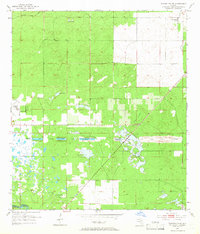
1991 Cotton Plant
Marion County, FL
1991 Dunnellon SE
Marion County, FL

1991 Ocala East
Marion County, FL

1991 Ocala West
Marion County, FL
1991 Romeo
Marion County, FL

1991 Shady
Marion County, FL
1994 Farles Lake
Marion County, FL
1994 Juniper Springs
Marion County, FL
1994 Lake Mary
Marion County, FL
1994 Salt Springs
Marion County, FL
1999 Fort Mc Coy
Marion County, FL
1999 Halfmoon Lake
Marion County, FL