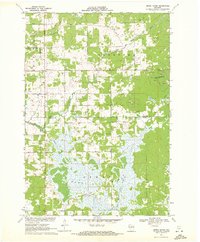
1970 Map of Dewey Marsh
USGS Topo · Published 1972About this map
Dewey Marsh dominates the southern half of this landscape, creating a complex wetland environment where the Eau Claire River and Little Eau Claire River converge. At the start of the 1970s, the area shows a distinct transition from the dense, swampy lowlands containing the curiously named Philippine Islands to the higher ground of the northern section. This northern terrain is defined by the elevation of Blackberry Hill and its associated Blackberry Hill Tower, overlooking several Quarries that suggest local resource extraction. The small community of Rocky Corners and the vicinity of Ashley anchor the rural settlement pattern, connected by a network of gravel and improved roads like Locker Road and Sandy Creek Rd. The presence of a Pipeline and a local Townhall reflect the infrastructure and civic life of these Guenther and Knowlton townships.
Find a feature on this map
22 named features on this map. Tap any name to fly to it.
Don’t see what you’re looking for? This feature index may not catch every label — zoom into the map to look around manually.
Map Details
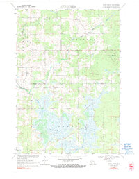
Editions of this 1970 Dewey Marsh Map
2 editions found
Other maps of this area

1899 · Wausau
USGS Topo · 1:125,000

1902 · Wausau
USGS Topo · 1:125,000

1953 · Wausau
USGS Topo · 1:48,000

1953 · Hatley
USGS Topo · 1:48,000

1955 · Rosholt
USGS Topo · 1:48,000

1955 · Green Bay
USGS Topo · 1:250,000

1956 · Stevens Point
USGS Topo · 1:48,000

1963 · Wausau
USGS Topo · 1:62,500

1964 · Hatley
USGS Topo · 1:62,500

1969 · Rosholt NW
USGS Topo · 1:24,000