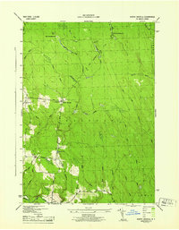
1944 Map of North Osceola
USGS Topo · Published 1944About this map
North Osceola and its surrounding uplands in the town of Osceola appear here during the mid-1940s, revealing a landscape defined by isolated homesteads and a dense network of mountain streams. The settlement pattern reflects the area's timber and agricultural roots, with rural education centers like School No 7 and School No 4 serving the scattered population. Higher elevations near Wards Hill show the traces of earlier habitations, specifically Old Campbellwood and New Campbellwood, connected by the Martinsburg Old Trail. The topography is heavily carved by the Salmon River and its numerous tributaries, including the West Fork Salmon River and Fall Brook. This survey, produced by the Tennessee Valley Authority for the War Department, provides an unusually precise look at the backcountry roads like Potter Road and Cummings Road before modern reforestation and development altered the local character.
Find a feature on this map
38 named features on this map. Tap any name to fly to it.
Don’t see what you’re looking for? This feature index may not catch every label — zoom into the map to look around manually.
Map Details
Editions of this 1944 North Osceola Map
This is the sole edition of this map. No revisions or reprints were ever made.
Other maps of this area

1903 · Orwell
USGS Topo · 1:62,500

1905 · Orwell
USGS Topo · 1:62,500

1905 · Taberg
USGS Topo · 1:62,500

1906 · Highmarket
USGS Topo · 1:62,500

1906 · Kasoag
USGS Topo · 1:62,500

1942 · Redfield
USGS Topo · 1:24,000

1943 · Redfield
USGS Topo · 1:31,680

1943 · Westdale
USGS Topo · 1:31,680

1943 · East Florence
USGS Topo · 1:31,680
1943 · Worth Center
USGS Topo · 1:31,680