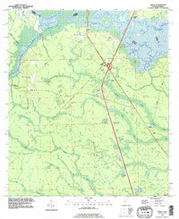
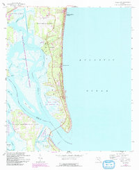
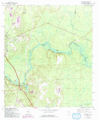
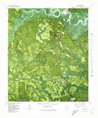
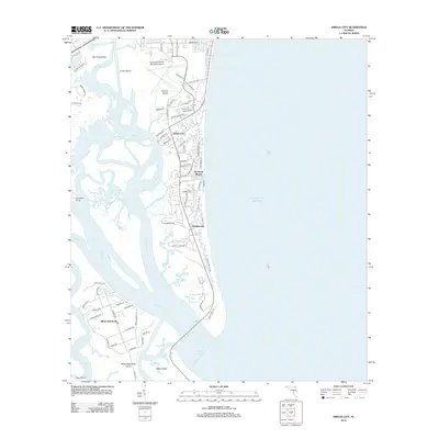
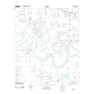
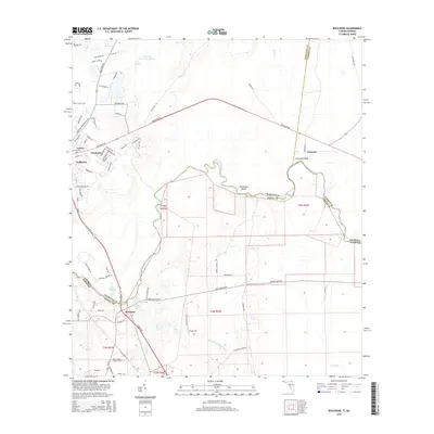
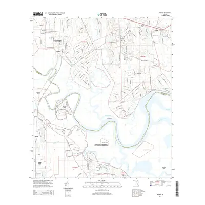
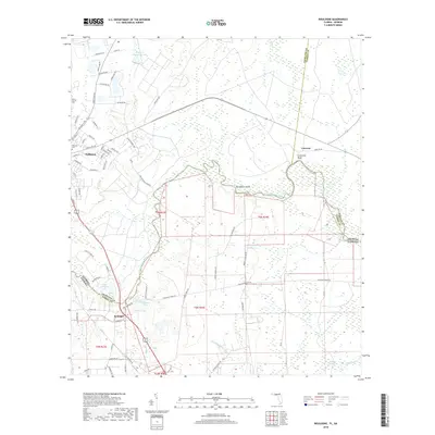
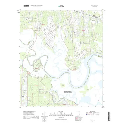
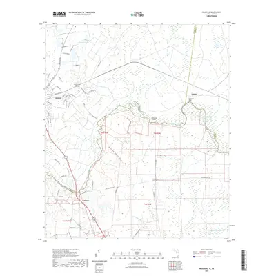
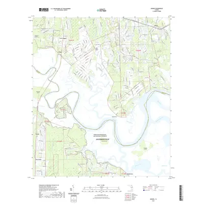
1993 Map of Gross
USGS Topo · Published 1995About this map
The St Marys River carves a winding path along the border of Georgia and Florida, defining the northern edge of this Nassau County landscape. In the early 1990s, the small communities of Gross and Becker stand as points of settlement amidst a terrain dominated by significant wetlands like White Oak Swamp, Tom Mann Swamp, and Bumper Swamp. The survey captures the transition of the local economy and infrastructure, showing the intersection of major transit corridors with older rural routes like Owens Road and Crandall Road.
Find a feature on this map
29 named features on this map. Tap any name to fly to it.
Don’t see what you’re looking for? This feature index may not catch every label — zoom into the map to look around manually.
Map Details
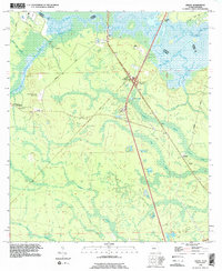
Editions of this 1993 Gross Map
2 editions found
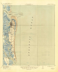
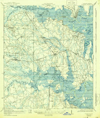
Historical Maps of St. Marys Through Time
57 maps found

1918 St Marys
Nassau County, FL
1919 Fernandina
Nassau County, FL
1919 St Marys
Nassau County, FL

1944 Fernandina
Nassau County, FL
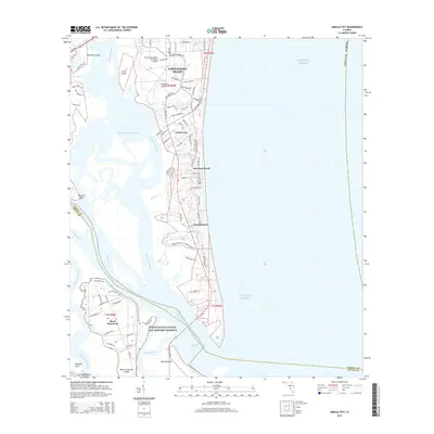
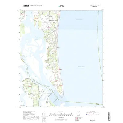
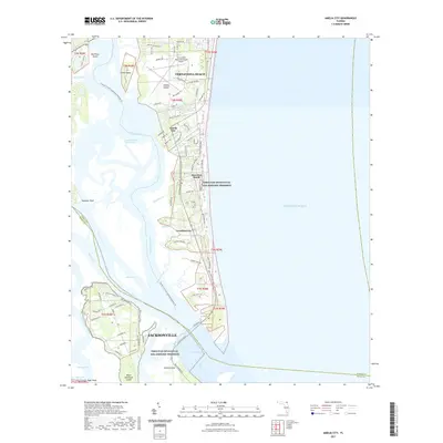
1958 Amelia City
Nassau County, FL
1958 Gross
Nassau County, FL
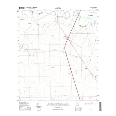
1958 Hedges
Nassau County, FL
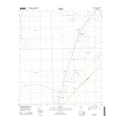
1964 Bryceville
Nassau County, FL
1970 Boulogne
Nassau County, FL
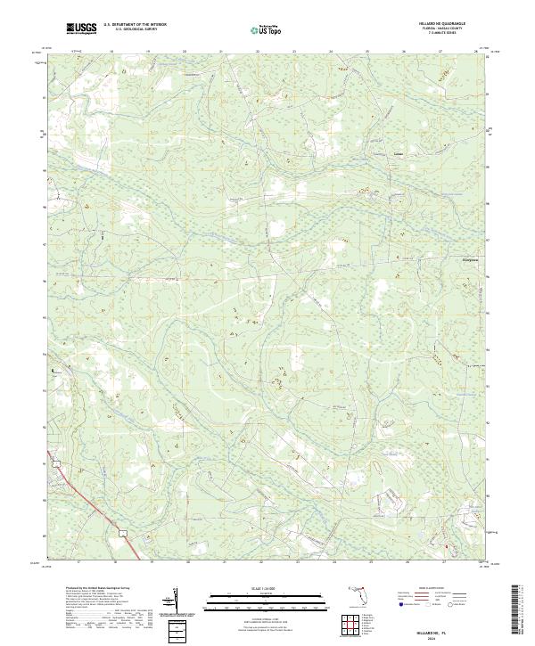
1970 Hilliard NE
Nassau County, FL
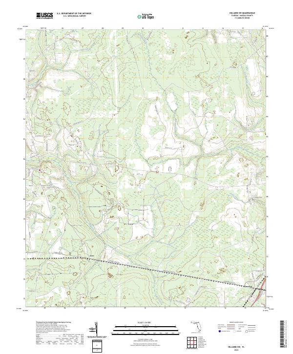
1970 Hilliard SW
Nassau County, FL
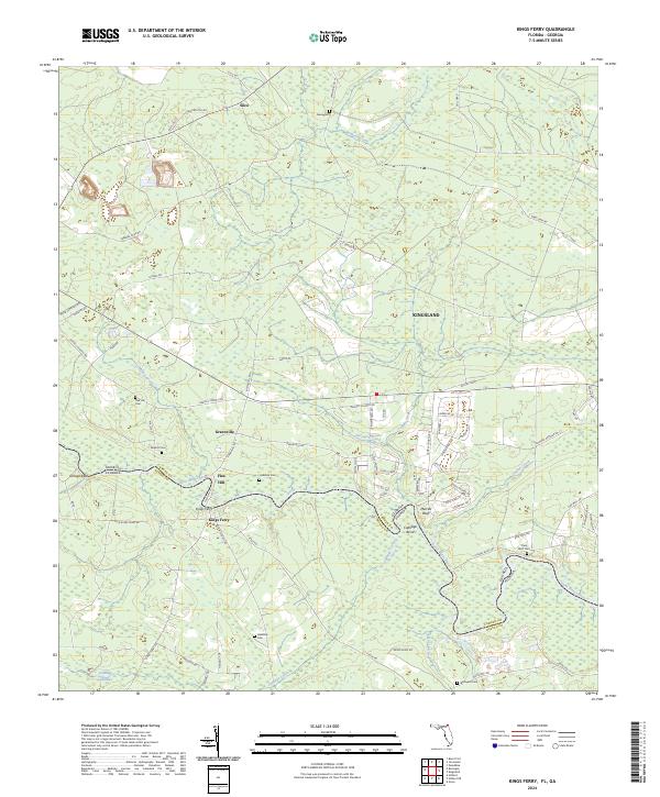
1970 Kings Ferry
Nassau County, FL
1979 Gross
Nassau County, FL
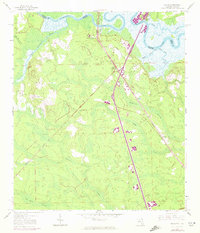
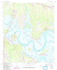
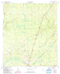
1993 Gross
Nassau County, FL
2011 Boulogne
Nassau County, FL
2011 Gross
Nassau County, FL
2011 Kings Ferry
Nassau County, FL
2012 Amelia City
Nassau County, FL
2012 Boulogne
Nassau County, FL
2012 Bryceville
Nassau County, FL
2012 Gross
Nassau County, FL
2012 Hedges
Nassau County, FL
2012 Hilliard NE
Nassau County, FL
2012 Hilliard SW
Nassau County, FL
2012 Kings Ferry
Nassau County, FL
2015 Amelia City
Nassau County, FL
2015 Boulogne
Nassau County, FL
2015 Bryceville
Nassau County, FL
2015 Gross
Nassau County, FL
2015 Hedges
Nassau County, FL
2015 Hilliard NE
Nassau County, FL
2015 Hilliard SW
Nassau County, FL
2015 Kings Ferry
Nassau County, FL
2018 Amelia City
Nassau County, FL
2018 Boulogne
Nassau County, FL
2018 Bryceville
Nassau County, FL
2018 Gross
Nassau County, FL
2018 Hedges
Nassau County, FL
2018 Hilliard NE
Nassau County, FL
2018 Hilliard SW
Nassau County, FL
2018 Kings Ferry
Nassau County, FL
2021 Amelia City
Nassau County, FL
2021 Boulogne
Nassau County, FL
2021 Bryceville
Nassau County, FL
2021 Gross
Nassau County, FL
2021 Hedges
Nassau County, FL
2021 Hilliard NE
Nassau County, FL
2021 Hilliard SW
Nassau County, FL
2021 Kings Ferry
Nassau County, FL
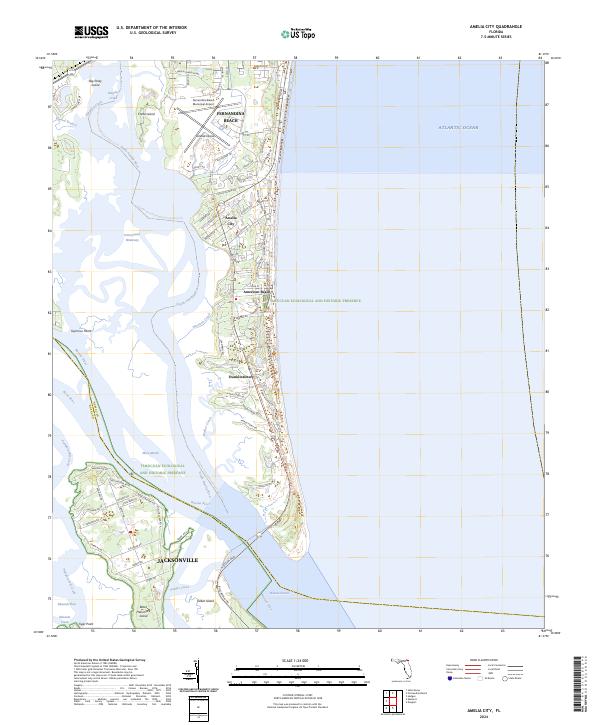
2024 Amelia City
Nassau County, FL
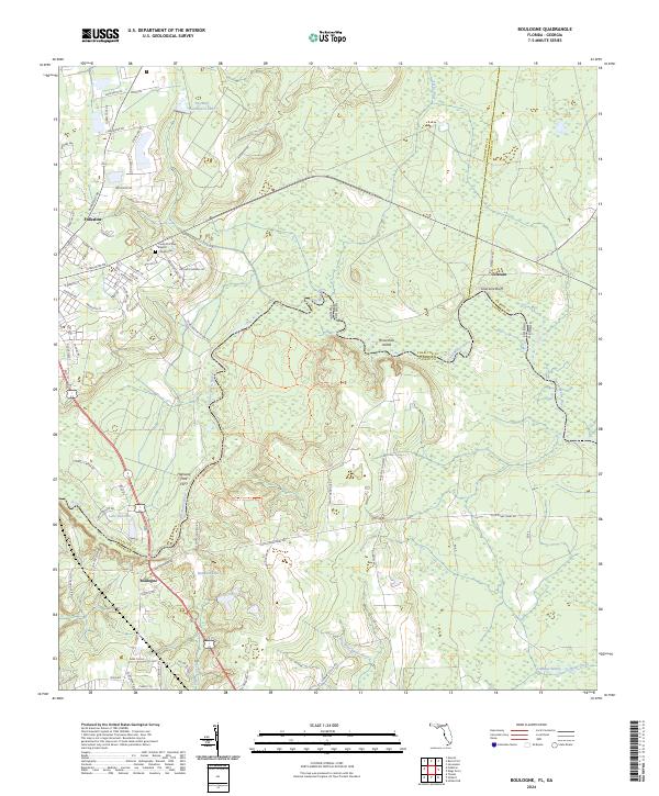
2024 Boulogne
Nassau County, FL

2024 Bryceville
Nassau County, FL
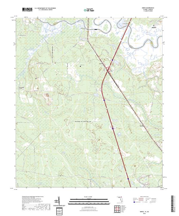
2024 Gross
Nassau County, FL
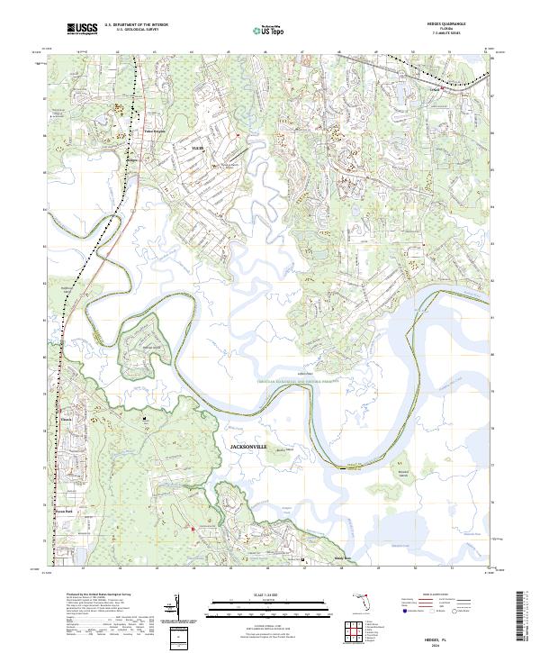
2024 Hedges
Nassau County, FL
2024 Hilliard NE
Nassau County, FL
2024 Hilliard SW
Nassau County, FL
2024 Kings Ferry
Nassau County, FL