
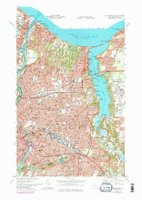
2023 Map of Braddock Heights
USGS Topo · Published 2023About this map
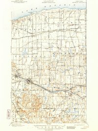
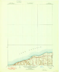
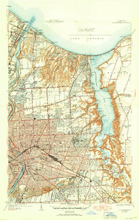
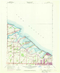
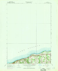
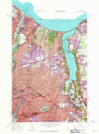
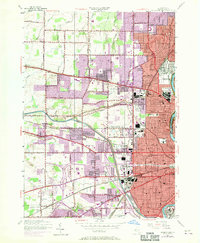
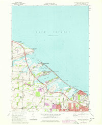
Lake Ontario defines the northern edge of this Monroe County landscape, where a series of large coastal ponds and bays create a distinctive amphibious terrain. Waterfront settlements like Payne Beach, Manitou Beach, and Crescent Beach are clustered along the barrier bars and shorelines, connected by the Lake Ontario State Pkwy. The hydrology is remarkably complex, with Braddock Bay acting as a central basin for drainage from Salmon Creek and Buttonwood Creek, while Cranberry Pond, Long Pond, and Buck Pond form a chain of protected waters to the southeast. Further inland, the residential character of North Greece and Mount Read contrasts with the marshy lowlands. Significant elevation is found at Frisbee Hill and Paddy Hill, offering a vertical break from the flat coastal plain. This 2023 survey illustrates the modern configuration of these fragile lakefront communities and the established road network including Manitou Beach Rd and Edgemere Dr.
Find a feature on this map
131 named features on this map. Tap any name to fly to it.
Don’t see what you’re looking for? This feature index may not catch every label — zoom into the map to look around manually.
Map Details
Editions of this 2023 Braddock Heights Map
This is the sole edition of this map. No revisions or reprints were ever made.
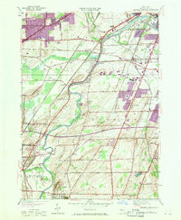
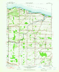
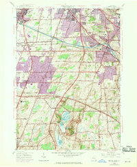
Historical Maps of Monroe County Through Time
51 maps found

1895 Ontario Beach
Monroe County, NY

1899 Bergen
Monroe County, NY
1899 Hamlin
Monroe County, NY
1899 Ontario Beach
Monroe County, NY
1900 Macedon
Monroe County, NY

1912 Ontario Beach
Monroe County, NY

1931 Mendon Ponds
Monroe County, NY

1931 Rochester East
Monroe County, NY

1931 Rochester West
Monroe County, NY

1932 Hamlin
Monroe County, NY

1932 Webster
Monroe County, NY
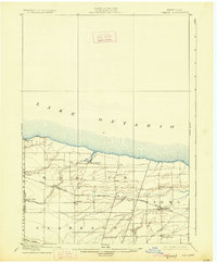
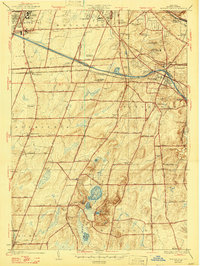
1934 Braddock Heights
Monroe County, NY

1934 Clifton
Monroe County, NY
1934 Ninemile Point
Monroe County, NY
1934 Webster
Monroe County, NY
1935 Genesee Junction
Monroe County, NY
1935 Hamlin
Monroe County, NY
1935 Mendon Ponds
Monroe County, NY
1935 Rochester East
Monroe County, NY
1935 Rochester West
Monroe County, NY
1950 Clifton
Monroe County, NY
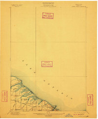
1952 Braddock Heights
Monroe County, NY
1952 Genesee Junction
Monroe County, NY
1952 Hamlin
Monroe County, NY
1952 Mendon Ponds
Monroe County, NY
1952 Ninemile Point
Monroe County, NY
1952 Rochester East
Monroe County, NY
1952 Rochester West
Monroe County, NY
1952 Webster
Monroe County, NY
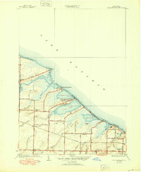
1971 Braddock Heights
Monroe County, NY
1971 Clifton
Monroe County, NY

1971 Hamlin
Monroe County, NY
1971 Ninemile Point
Monroe County, NY
1971 Pittsford
Monroe County, NY
1971 Rochester East
Monroe County, NY
1971 Rochester West
Monroe County, NY

1971 Webster
Monroe County, NY
1971 West Henrietta
Monroe County, NY

1978 Hamlin
Monroe County, NY
1994 Pittsford
Monroe County, NY

1994 Rochester West
Monroe County, NY
2023 Braddock Heights
Monroe County, NY

2023 Clifton
Monroe County, NY

2023 Hamlin
Monroe County, NY

2023 Ninemile Point
Monroe County, NY

2023 Pittsford
Monroe County, NY

2023 Rochester East
Monroe County, NY

2023 Rochester East OE N
Monroe County, NY

2023 Rochester West
Monroe County, NY

2023 Webster
Monroe County, NY

2023 West Henrietta
Monroe County, NY