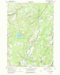
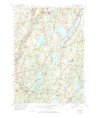
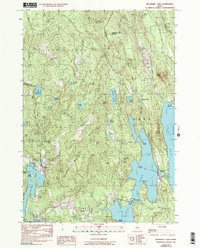
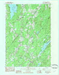
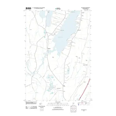
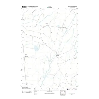
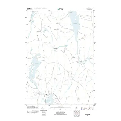
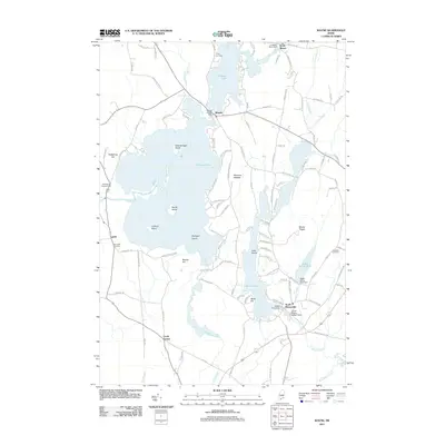
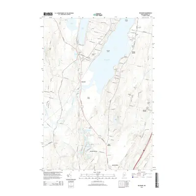
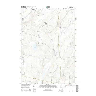
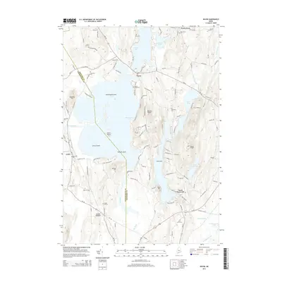
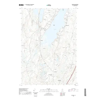
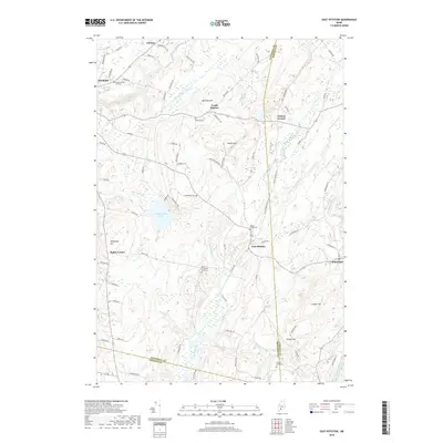
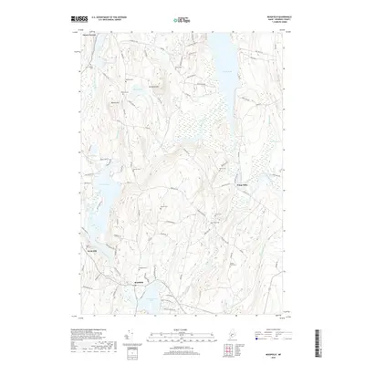
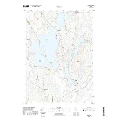
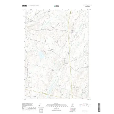
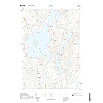
1970 Map of East Pittston
USGS Topo · Published 1989About this map
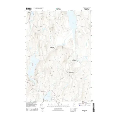
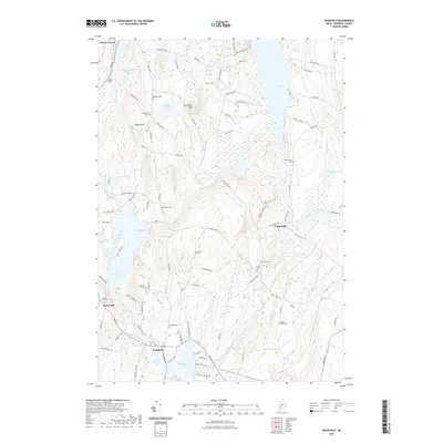
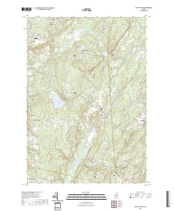
East Pittston serves as a central hub in this Kennebec County landscape, situated at the confluence of Kimball Brook and the winding Eastern River. The 1970 field survey reveals a rural network of small settlements and crossroads, including North Pittston, Bailey Corner, and Trainor Corner, linked by local routes like Kelly Road and Blinn Hill Road. The terrain is defined by prominent elevations such as Beech Hill and Telegraph Hill, while the eastern edge of the quadrangle is marked by the course of the Sheepscot River. Local history is preserved through several family and community burial grounds, such as Putnam Cem, Goodspeed Cem, and Maple Grove Cem. The presence of a tidal flat along the Eastern River near Palmer Brook suggests a landscape transitioning from freshwater streams to coastal influence, providing a detailed look at the agricultural and natural layout of the region before late-century development.
Find a feature on this map
39 named features on this map. Tap any name to fly to it.
Don’t see what you’re looking for? This feature index may not catch every label — zoom into the map to look around manually.
Map Details
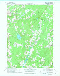
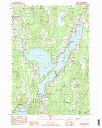
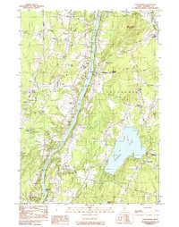
Editions of this 1970 East Pittston Map
2 editions found
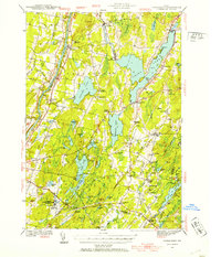
Historical Maps of Pittston Through Time
113 maps found
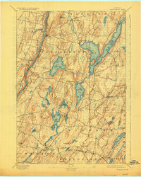
1893 Vassalboro
Kennebec County, ME

1898 Vassalboro
Kennebec County, ME
1941 Vassalboro
Kennebec County, ME

1943 Vassalboro
Kennebec County, ME
1956 Vassalboro
Kennebec County, ME
1966 Fayette
Kennebec County, ME
1966 Wayne
Kennebec County, ME
1970 East Pittston
Kennebec County, ME

1975 Burnham SW
Kennebec County, ME

1975 Norridgewock SE
Kennebec County, ME

1975 Norridgewock SW
Kennebec County, ME

1975 Vassalboro NE
Kennebec County, ME

1975 Vassalboro NW
Kennebec County, ME

1975 Vassalboro SE
Kennebec County, ME

1975 Vassalboro SW
Kennebec County, ME

1975 Waterville NE
Kennebec County, ME

1975 Waterville SE
Kennebec County, ME

1975 Waterville SW
Kennebec County, ME
1980 Belgrade
Kennebec County, ME

1980 Purgatory
Kennebec County, ME

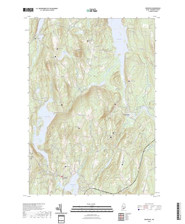
1980 Readfield
Kennebec County, ME

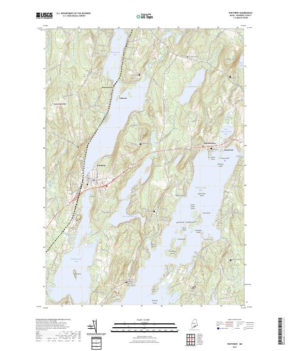
1980 Winthrop
Kennebec County, ME

1982 Albion
Kennebec County, ME
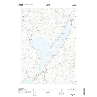
1982 Belgrade Lakes
Kennebec County, ME
1982 Clinton
Kennebec County, ME
1982 Fairfield
Kennebec County, ME

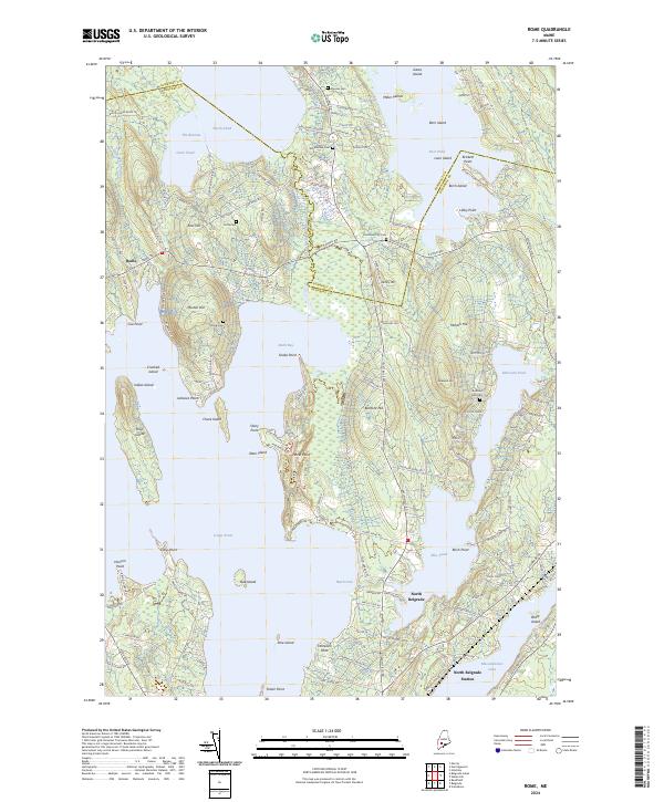
1982 Rome
Kennebec County, ME
1982 Togus Pond
Kennebec County, ME
1982 Weeks Mills
Kennebec County, ME
1983 China Lake
Kennebec County, ME
1983 Vassalboro
Kennebec County, ME

2000 Readfield
Kennebec County, ME

2000 Winthrop
Kennebec County, ME
2011 Albion
Kennebec County, ME
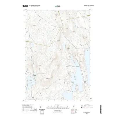
2011 Belgrade
Kennebec County, ME
2011 Belgrade Lakes
Kennebec County, ME
2011 China Lake
Kennebec County, ME
2011 Clinton
Kennebec County, ME
2011 East Pittston
Kennebec County, ME
2011 Fairfield
Kennebec County, ME
2011 Fayette
Kennebec County, ME
2011 Purgatory
Kennebec County, ME
2011 Readfield
Kennebec County, ME
2011 Rome
Kennebec County, ME
2011 Togus Pond
Kennebec County, ME
2011 Vassalboro
Kennebec County, ME
2011 Wayne
Kennebec County, ME
2011 Weeks Mills
Kennebec County, ME
2011 Winthrop
Kennebec County, ME
2014 Albion
Kennebec County, ME
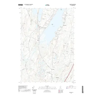
2014 Belgrade
Kennebec County, ME
2014 Belgrade Lakes
Kennebec County, ME
2014 China Lake
Kennebec County, ME
2014 Clinton
Kennebec County, ME
2014 East Pittston
Kennebec County, ME
2014 Fairfield
Kennebec County, ME
2014 Fayette
Kennebec County, ME
2014 Purgatory
Kennebec County, ME
2014 Readfield
Kennebec County, ME
2014 Rome
Kennebec County, ME
2014 Togus Pond
Kennebec County, ME
2014 Vassalboro
Kennebec County, ME
2014 Wayne
Kennebec County, ME
2014 Weeks Mills
Kennebec County, ME
2014 Winthrop
Kennebec County, ME
2018 Albion
Kennebec County, ME
2018 Belgrade
Kennebec County, ME
2018 Belgrade Lakes
Kennebec County, ME
2018 China Lake
Kennebec County, ME
2018 Clinton
Kennebec County, ME
2018 East Pittston
Kennebec County, ME
2018 Fairfield
Kennebec County, ME
2018 Fayette
Kennebec County, ME
2018 Purgatory
Kennebec County, ME
2018 Readfield
Kennebec County, ME
2018 Rome
Kennebec County, ME
2018 Togus Pond
Kennebec County, ME
2018 Vassalboro
Kennebec County, ME
2018 Wayne
Kennebec County, ME
2018 Weeks Mills
Kennebec County, ME
2018 Winthrop
Kennebec County, ME
2021 Albion
Kennebec County, ME
2021 Belgrade
Kennebec County, ME
2021 Belgrade Lakes
Kennebec County, ME
2021 China Lake
Kennebec County, ME
2021 Clinton
Kennebec County, ME
2021 East Pittston
Kennebec County, ME
2021 Fairfield
Kennebec County, ME
2021 Fayette
Kennebec County, ME
2021 Purgatory
Kennebec County, ME
2021 Readfield
Kennebec County, ME
2021 Rome
Kennebec County, ME
2021 Togus Pond
Kennebec County, ME
2021 Vassalboro
Kennebec County, ME
2021 Wayne
Kennebec County, ME
2021 Weeks Mills
Kennebec County, ME
2021 Winthrop
Kennebec County, ME
2024 Albion
Kennebec County, ME
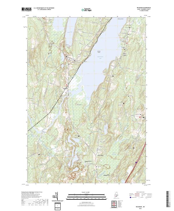
2024 Belgrade
Kennebec County, ME
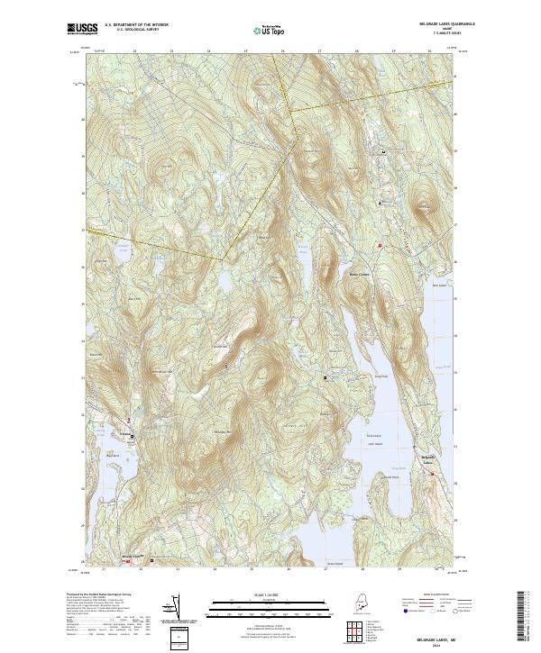
2024 Belgrade Lakes
Kennebec County, ME
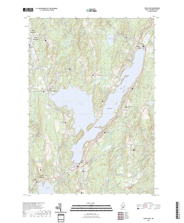
2024 China Lake
Kennebec County, ME
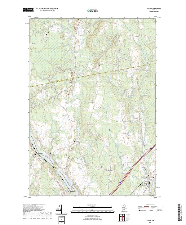
2024 Clinton
Kennebec County, ME
2024 East Pittston
Kennebec County, ME
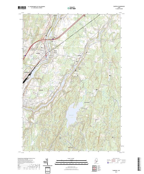
2024 Fairfield
Kennebec County, ME
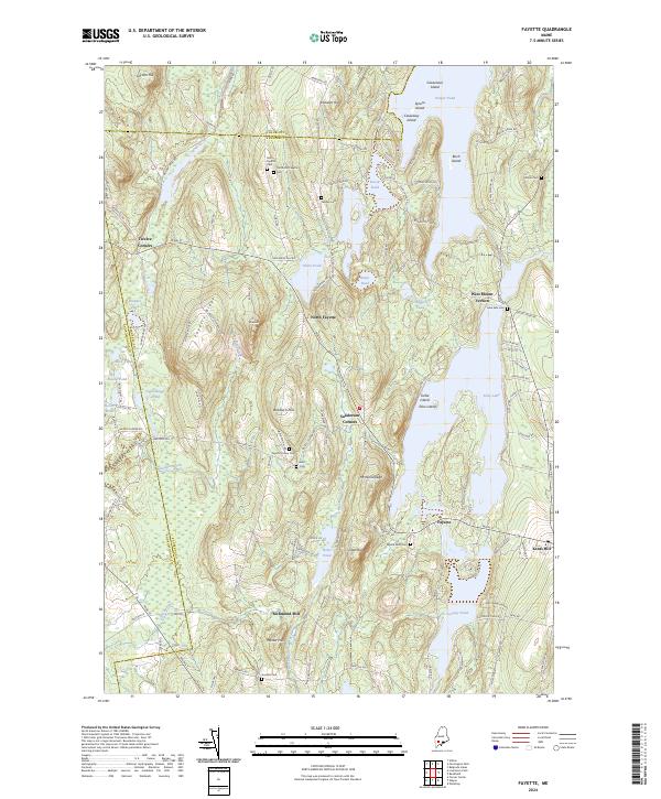
2024 Fayette
Kennebec County, ME
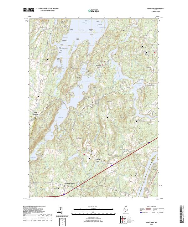
2024 Purgatory
Kennebec County, ME
2024 Readfield
Kennebec County, ME
2024 Rome
Kennebec County, ME

2024 Togus Pond
Kennebec County, ME
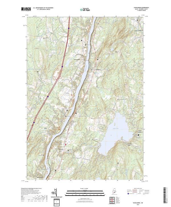
2024 Vassalboro
Kennebec County, ME
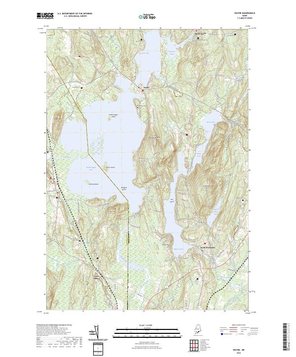
2024 Wayne
Kennebec County, ME

2024 Weeks Mills
Kennebec County, ME
2024 Winthrop
Kennebec County, ME