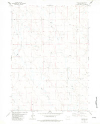
1982 Map of Fairview
USGS Topo · Published 1982About this map
Fairview and the surrounding drainage basins of the Powder River country are detailed in this study based on mid-1970s aerial photography. The landscape is defined by the winding paths of Deep Creek and the bifurcated Hay Creek, which splits into the East Fork and West Fork. This area of Weston County shows a pattern of resource exploration, evidenced by numerous Drill Holes and several Wells scattered across the rangeland.
Find a feature on this map
14 named features on this map. Tap any name to fly to it.
Don’t see what you’re looking for? This feature index may not catch every label — zoom into the map to look around manually.
Map Details
Editions of this 1982 Fairview Map
This is the sole edition of this map. No revisions or reprints were ever made.
Other maps of this area

1955 · Newcastle
USGS Topo · 1:250,000

1958 · Newcastle
USGS Topo · 1:250,000

1979 · Newcastle
USGS Topo · 1:100,000

1982 · Clareton
USGS Topo · 1:24,000
1982 · Sheep Canyon Creek West
USGS Topo · 1:24,000
1982 · Wildlife Draw East
USGS Topo · 1:24,000
1982 · Darlington Draw East
USGS Topo · 1:24,000
1982 · Sheep Canyon Creek East
USGS Topo · 1:24,000
1982 · West Fork Buffalo Creek
USGS Topo · 1:24,000
1982 · Lassen Creek
USGS Topo · 1:24,000