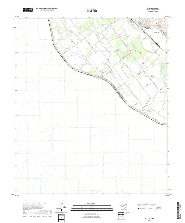
2022 Map of Isla
USGS Topo · Published 2022About this map
The Rio Grande marks the international boundary between the United States and Mexico in this riverine section of El Paso County. The landscape is defined by an intricate network of irrigation and drainage infrastructure essential to valley agriculture, including the Hansen Lateral, Guadalupe Lateral, and the Fabens Waste Channel. These man-made watercourses crisscross the alluvial plain, creating distinct land areas such as San Elizario Island and Lower Island. For those tracing local family histories, the map identifies two significant burial sites: La Isla Cem and Our Lady Of Guadalupe Cem. Transportation in this borderland is anchored by the Tornillo Spur railroad and a grid of rural routes like Wingo Reserve Rd and Tornillo Guadalupe Rd, which provide access to the dispersed farmsteads and agricultural plots along the river.
Find a feature on this map
41 named features on this map. Tap any name to fly to it.
Don’t see what you’re looking for? This feature index may not catch every label — zoom into the map to look around manually.
Map Details
Editions of this 2022 Isla Map
This is the sole edition of this map. No revisions or reprints were ever made.
Other maps of this area

1896 · El Paso
USGS Topo · 1:125,000

1896 · Rio Grande
USGS Topo · 1:125,000

1908 · El Paso
USGS Topo · 1:125,000

1939 · Ysleta
USGS Topo · 1:62,500

1941 · Clint
USGS Topo · 1:62,500

1941 · Ysleta
USGS Topo · 1:62,500

1941 · Tornillo
USGS Topo · 1:62,500

1945 · Ysleta
USGS Topo · 1:62,500
1945 · Clint
USGS Topo · 1:62,500
1945 · Tornillo
USGS Topo · 1:62,500