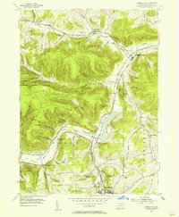
1954 Map of Kenneyville
USGS Topo · Published 1956About this map
Crooked Creek and Marsh Creek define the geography of this mid-1950s Tioga County landscape, where narrow valley floors support the region's primary transportation and settlements. The New York Central railroad tracks parallel the watercourses, linking Middlebury Center (Middlebury Sta) and Niles Valley to the industrial hub at Wellsboro Junction. The highland areas of Chatham and Middlebury are marked by a dense network of forest trails, including the Bark Slide Trail and Plantation Trail, hinting at the area's timber history and recreational use.
Find a feature on this map
60 named features on this map. Tap any name to fly to it.
Don’t see what you’re looking for? This feature index may not catch every label — zoom into the map to look around manually.
Map Details
Editions of this 1954 Kenneyville Map
3 editions found
Other maps of this area

1900 · Tioga
USGS Topo · 1:62,500

1900 · Elkland
USGS Topo · 1:62,500

1902 · Tioga
USGS Topo · 1:62,500

1925 · Blossburg
USGS Topo · 1:62,500

1927 · Blossburg
USGS Topo · 1:62,500

1944 · Blossburg
USGS Topo · 1:62,500

1946 · Tiadaghton
USGS Topo · 1:24,000

1946 · Antrim
USGS Topo · 1:62,500

1946 · Antrim
USGS Topo · 1:24,000

1948 · Antrim
USGS Topo · 1:24,000
Featured Places
- Wellsboro, PA
- Stokesdale, Delmar Township
- Keeneyville, Middlebury Township
- Shortsville, Chatham Township
- Middlebury Township, PA