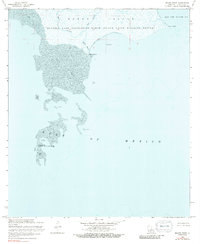
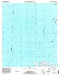
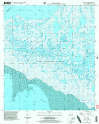
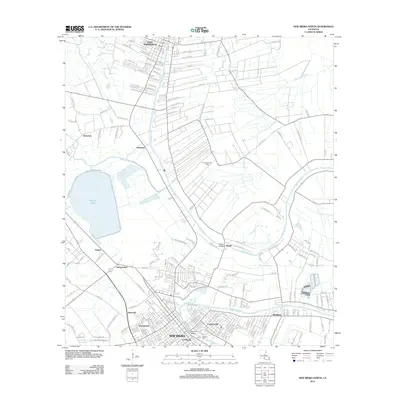
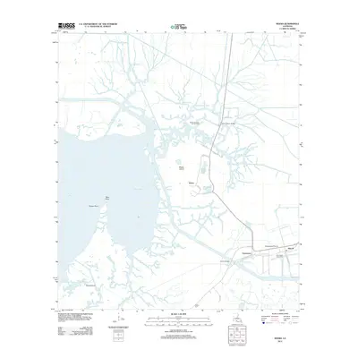
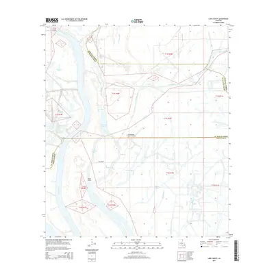
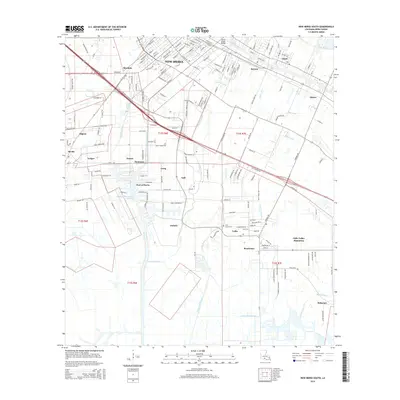
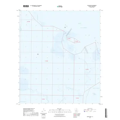
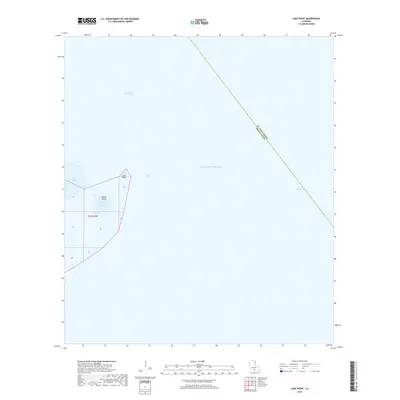
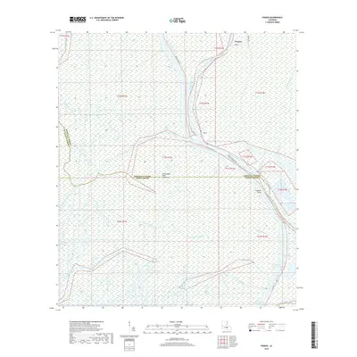
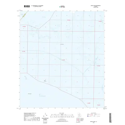
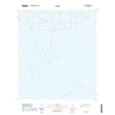
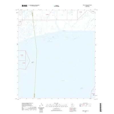
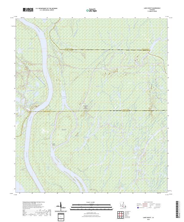
1970 Map of Lake Chicot
USGS Topo · Published 1980About this map
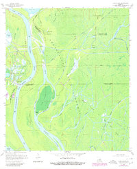
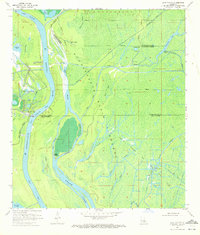
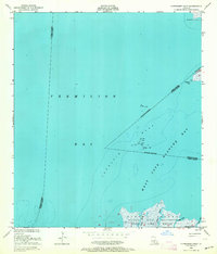
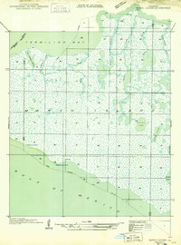
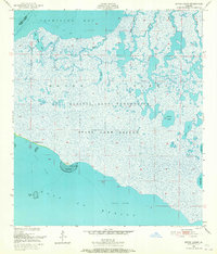
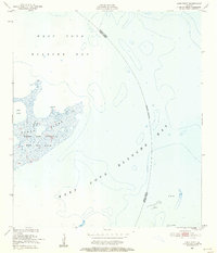
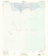
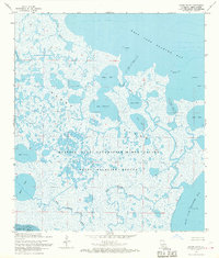
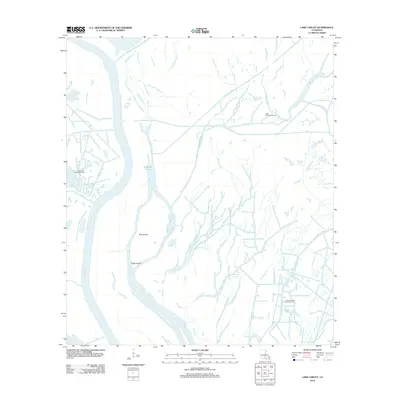
The Atchafalaya Basin dominates this landscape, showing the complex aquatic network of south Louisiana as it existed in the 1970s. The Main Channel of the Atchafalaya River carves through the western portion of the sheet, defined by numerous named features such as Mile Point and the sheltered Crossing Cove. A distinct labyrinth of passes and bayous, including Hog Island Pass and Keelboat Pass, surrounds significant landmasses like Hog Island, Eagle Island, and Turkey Island.
Find a feature on this map
39 named features on this map. Tap any name to fly to it.
Don’t see what you’re looking for? This feature index may not catch every label — zoom into the map to look around manually.
Map Details
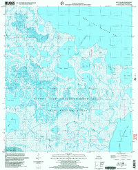
Editions of this 1970 Lake Chicot Map
2 editions found
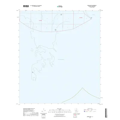
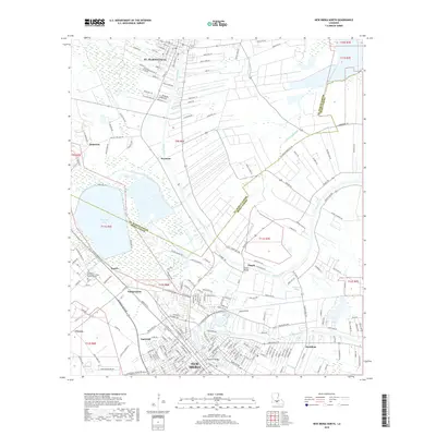
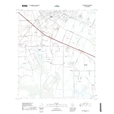
Historical Maps of Iberia Parish Through Time
86 maps found
1932 Bayou Blanc
Iberia Parish, LA

1937 Derouen
Iberia Parish, LA
1948 Bayou Blanc
Iberia Parish, LA
1948 Cypremort Point
Iberia Parish, LA
1949 Bayou Lucien
Iberia Parish, LA
1951 Bayou Lucien
Iberia Parish, LA
1951 Lake Point
Iberia Parish, LA
1951 Mound Point
Iberia Parish, LA

1963 Derouen
Iberia Parish, LA
1963 New Iberia South
Iberia Parish, LA
1963 Tigre Lagoon
Iberia Parish, LA
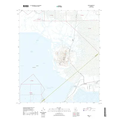
1963 Weeks
Iberia Parish, LA

1966 Derouen
Iberia Parish, LA
1968 Bayou Blanc
Iberia Parish, LA
1968 Bayou Lucien
Iberia Parish, LA
1968 Cypremort Point
Iberia Parish, LA
1968 Marsh Island
Iberia Parish, LA
1968 Mound Point
Iberia Parish, LA
1969 Pigeon
Iberia Parish, LA
1970 Lake Chicot
Iberia Parish, LA
1970 Lake Point
Iberia Parish, LA
1983 New Iberia North
Iberia Parish, LA
1994 Cypremort Point
Iberia Parish, LA
1994 New Iberia South
Iberia Parish, LA
1994 Tigre Lagoon
Iberia Parish, LA
1994 Weeks
Iberia Parish, LA
1998 Bayou Lucien
Iberia Parish, LA
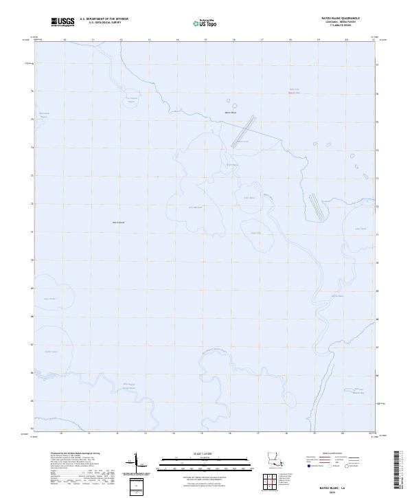
1999 Bayou Blanc
Iberia Parish, LA
2012 Bayou Blanc
Iberia Parish, LA
2012 Bayou Lucien
Iberia Parish, LA
2012 Cypremort Point
Iberia Parish, LA
2012 Lake Chicot
Iberia Parish, LA
2012 Lake Point
Iberia Parish, LA
2012 Mound Point
Iberia Parish, LA
2012 New Iberia North
Iberia Parish, LA
2012 New Iberia South
Iberia Parish, LA
2012 Pigeon
Iberia Parish, LA
2012 Tigre Lagoon
Iberia Parish, LA
2012 Weeks
Iberia Parish, LA
2015 Bayou Blanc
Iberia Parish, LA
2015 Bayou Lucien
Iberia Parish, LA
2015 Cypremort Point
Iberia Parish, LA
2015 Lake Chicot
Iberia Parish, LA
2015 Lake Point
Iberia Parish, LA
2015 Mound Point
Iberia Parish, LA
2015 New Iberia North
Iberia Parish, LA
2015 New Iberia South
Iberia Parish, LA
2015 Pigeon
Iberia Parish, LA
2015 Tigre Lagoon
Iberia Parish, LA
2015 Weeks
Iberia Parish, LA
2018 Bayou Blanc
Iberia Parish, LA
2018 Bayou Lucien
Iberia Parish, LA
2018 Cypremort Point
Iberia Parish, LA
2018 Lake Chicot
Iberia Parish, LA
2018 Lake Point
Iberia Parish, LA
2018 Mound Point
Iberia Parish, LA
2018 New Iberia North
Iberia Parish, LA
2018 New Iberia South
Iberia Parish, LA
2018 Pigeon
Iberia Parish, LA
2018 Tigre Lagoon
Iberia Parish, LA
2018 Weeks
Iberia Parish, LA
2020 Bayou Blanc
Iberia Parish, LA
2020 Bayou Lucien
Iberia Parish, LA
2020 Cypremort Point
Iberia Parish, LA
2020 Lake Chicot
Iberia Parish, LA
2020 Lake Point
Iberia Parish, LA
2020 Mound Point
Iberia Parish, LA
2020 New Iberia North
Iberia Parish, LA
2020 New Iberia South
Iberia Parish, LA
2020 Pigeon
Iberia Parish, LA
2020 Tigre Lagoon
Iberia Parish, LA
2020 Weeks
Iberia Parish, LA
2024 Bayou Blanc
Iberia Parish, LA

2024 Bayou Lucien
Iberia Parish, LA
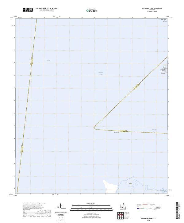
2024 Cypremort Point
Iberia Parish, LA
2024 Lake Chicot
Iberia Parish, LA
2024 Lake Point
Iberia Parish, LA
2024 Mound Point
Iberia Parish, LA
2024 New Iberia North
Iberia Parish, LA
2024 New Iberia South
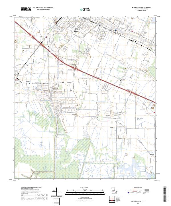
Iberia Parish, LA
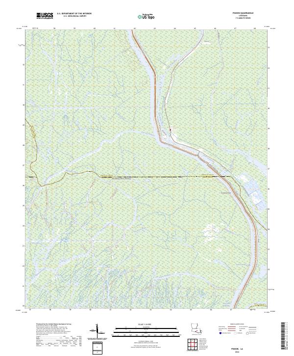
2024 Pigeon
Iberia Parish, LA
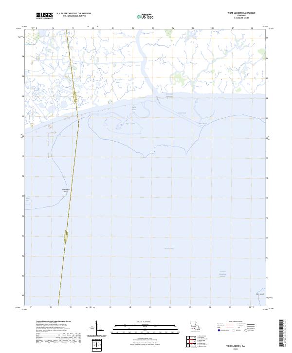
2024 Tigre Lagoon
Iberia Parish, LA
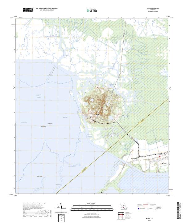
2024 Weeks
Iberia Parish, LA
2025 Bayou Lucien
Iberia Parish, LA
2025 Lake Point
Iberia Parish, LA
2025 Mound Point
Iberia Parish, LA