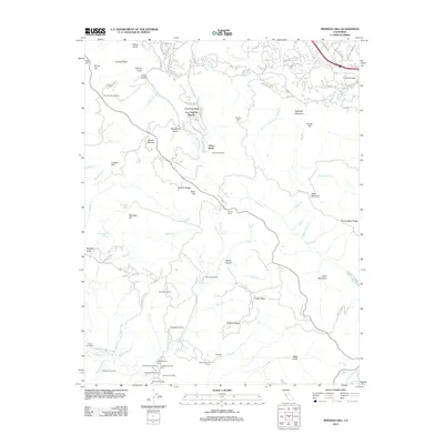
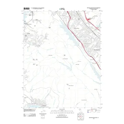
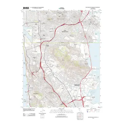
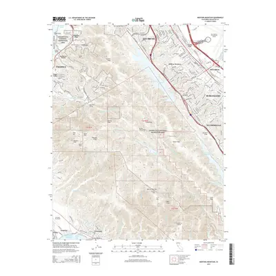
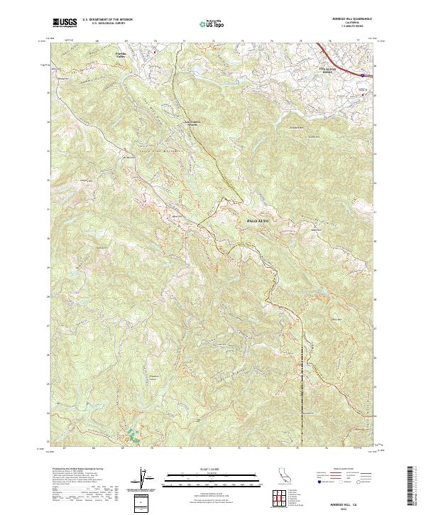
1961 Map of Mindego Hill
USGS Topo · Published 1980About this map
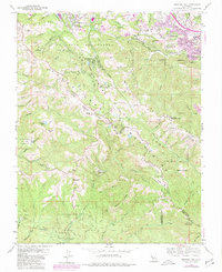
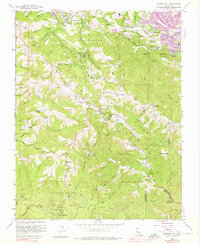
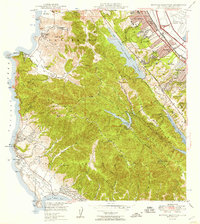
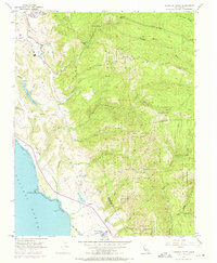
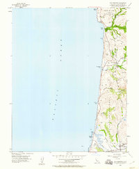
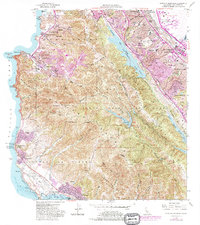
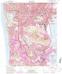
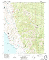
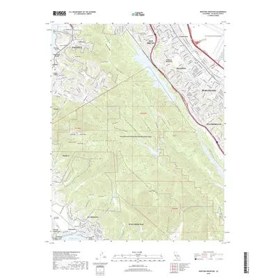
Portola Valley and Los Altos Hills anchor this 1961 survey, which captures the Santa Cruz Mountains as suburban expansion began to reach the ridges. The landscape is defined by the sharp divide of the San Mateo Co Santa Clara Co line, where the residential clusters of Los Trancos Woods give way to the wooded drainages of Corte Madera Creek and Stevens Creek. Historical land use is visible in the presence of the Coal Mine and a Quarry, while institutional landmarks like Foothill College and the San Francisco Log Cabin Boys School show the region's mid-century development. In the south, the terrain becomes increasingly complex around Portola State Park and Mindego Hill, where numerous small ranching operations like Horseshoe Ranch and Big Dipper Ranch were established among the canyons. The network of winding routes, including Skyline Blvd and Alpine Road, illustrates the transition from rural ranching to a scenic residential corridor.
Find a feature on this map
84 named features on this map. Tap any name to fly to it.
Don’t see what you’re looking for? This feature index may not catch every label — zoom into the map to look around manually.
Map Details
Editions of this 1961 Mindego Hill Map
5 editions found
Historical Maps of Palo Alto Through Time
68 maps found

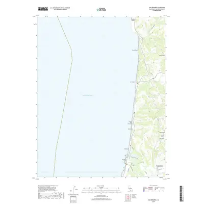
1940 Ano Nuevo
San Mateo County, CA
1940 Halfmoon Bay
San Mateo County, CA

1941 Ano Nuevo Pt.
San Mateo County, CA
1942 Ano Nuevo
San Mateo County, CA

1943 Halfmoon Bay
San Mateo County, CA

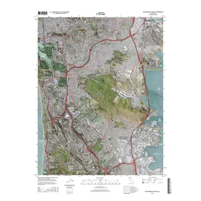
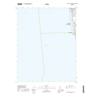
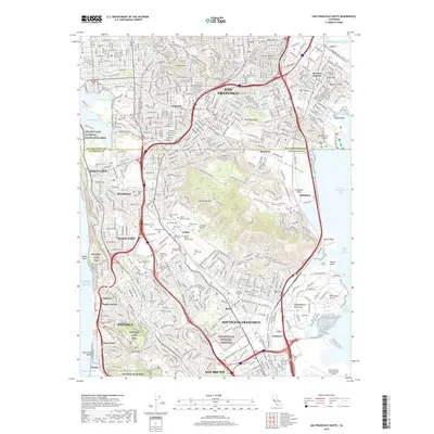
1947 San Francisco South
San Mateo County, CA
1948 Ano Nuevo
San Mateo County, CA

1948 Redwood Point
San Mateo County, CA
1949 Montara Mountain
San Mateo County, CA

1950 San Francisco South
San Mateo County, CA
1955 Franklin Point
San Mateo County, CA
1955 Mindego Hill
San Mateo County, CA
1955 Pigeon Point
San Mateo County, CA
1955 San Gregorio
San Mateo County, CA
1956 Montara Mountain
San Mateo County, CA
1956 San Francisco South
San Mateo County, CA
1959 Redwood Point
San Mateo County, CA
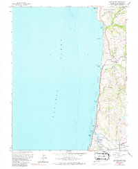
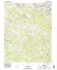
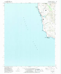
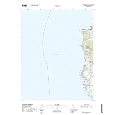
1961 Mindego Hill
San Mateo County, CA
1961 San Gregorio
San Mateo County, CA
1991 Franklin Point
San Mateo County, CA
1991 Mindego Hill
San Mateo County, CA
1991 Pigeon Point
San Mateo County, CA

1991 San Gregorio
San Mateo County, CA

1993 Montara Mountain
San Mateo County, CA

1993 Redwood Point
San Mateo County, CA

1993 San Francisco South
San Mateo County, CA

1995 San Francisco South
San Mateo County, CA

1997 Mindego Hill
San Mateo County, CA

1997 Montara Mountain
San Mateo County, CA

1997 San Gregorio
San Mateo County, CA

1998 Franklin Point
San Mateo County, CA
1998 Pigeon Point
San Mateo County, CA
2012 Franklin Point
San Mateo County, CA
2012 Mindego Hill
San Mateo County, CA
2012 Montara Mountain OE W
San Mateo County, CA
2012 Montara Mountain
San Mateo County, CA
2012 Pigeon Point
San Mateo County, CA
2012 Redwood Point
San Mateo County, CA
2012 San Francisco South OE W
San Mateo County, CA
2012 San Francisco South
San Mateo County, CA
2012 San Gregorio
San Mateo County, CA
2015 Franklin Point
San Mateo County, CA

2015 Mindego Hill
San Mateo County, CA
2015 Montara Mountain OE W
San Mateo County, CA
2015 Montara Mountain
San Mateo County, CA
2015 Pigeon Point
San Mateo County, CA
2015 Redwood Point
San Mateo County, CA
2015 San Francisco South OE W
San Mateo County, CA
2015 San Francisco South
San Mateo County, CA
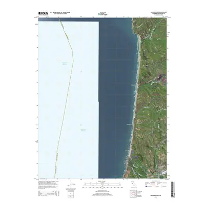
2015 San Gregorio
San Mateo County, CA
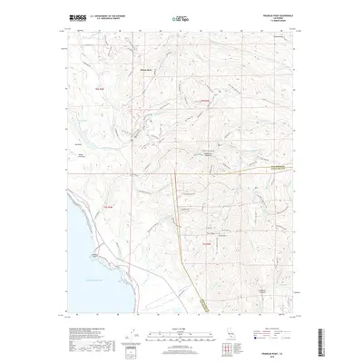
2018 Franklin Point
San Mateo County, CA
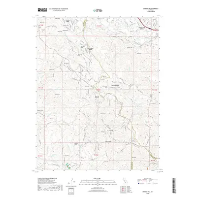
2018 Mindego Hill
San Mateo County, CA
2018 Montara Mountain OE W
San Mateo County, CA
2018 Montara Mountain
San Mateo County, CA
2018 Pigeon Point
San Mateo County, CA
2018 Redwood Point
San Mateo County, CA
2018 San Francisco South OE W
San Mateo County, CA
2018 San Francisco South
San Mateo County, CA
2018 San Gregorio
San Mateo County, CA
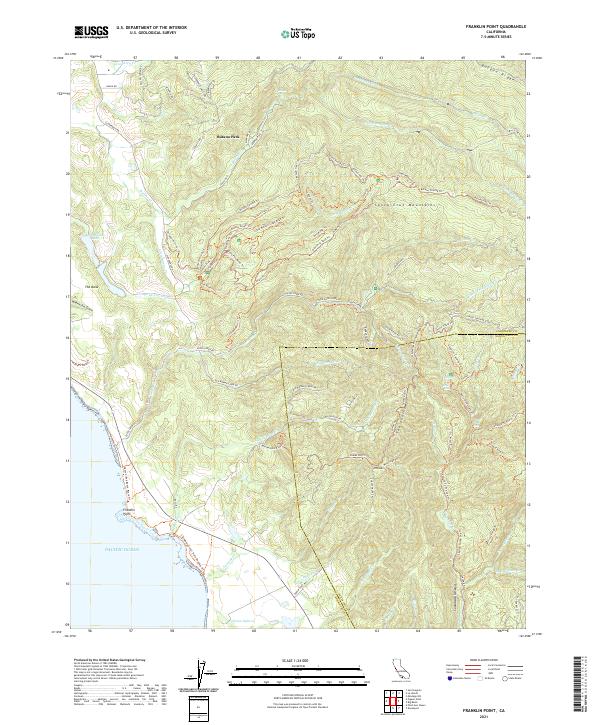
2021 Franklin Point
San Mateo County, CA
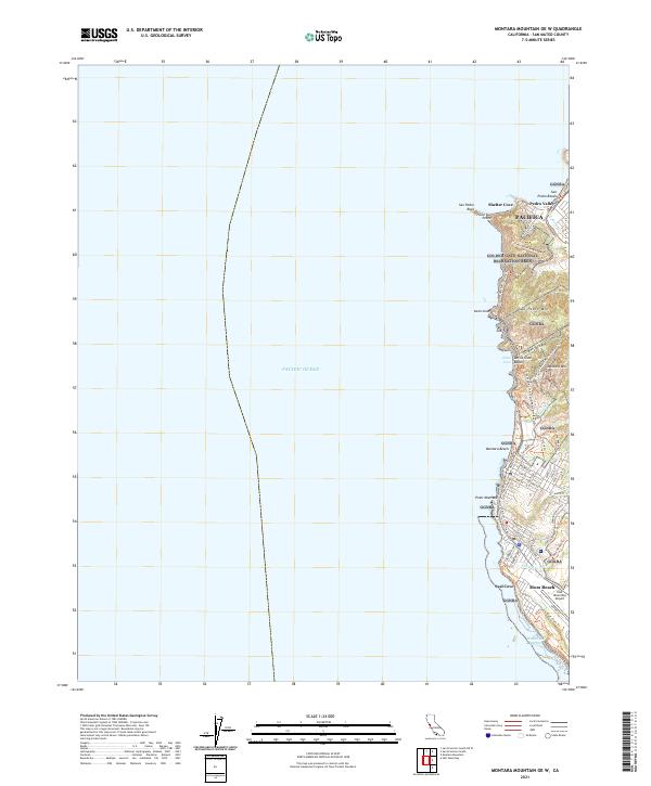
2021 Montara Mountain OE W
San Mateo County, CA
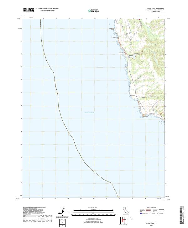
2021 Pigeon Point
San Mateo County, CA
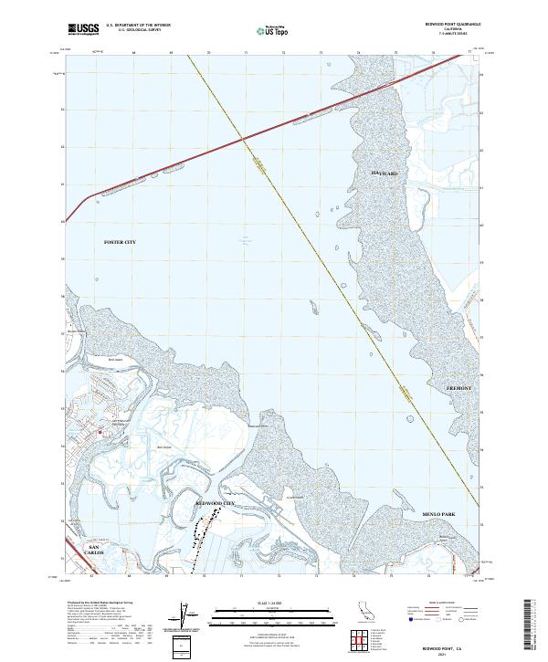
2021 Redwood Point
San Mateo County, CA
2021 San Francisco South OE W
San Mateo County, CA

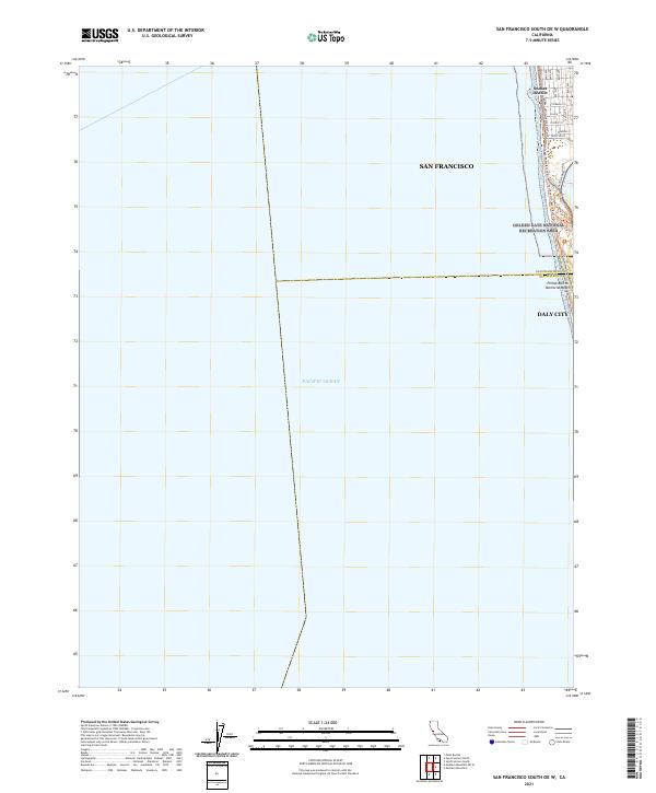
2021 San Francisco South
San Mateo County, CA
2022 Mindego Hill
San Mateo County, CA
2022 Montara Mountain
San Mateo County, CA
2022 San Gregorio
San Mateo County, CA