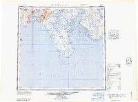
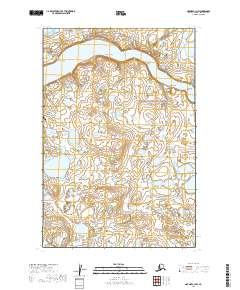
2019 Map of Naknek D-4 SW
USGS Topo · Published 2019About this map
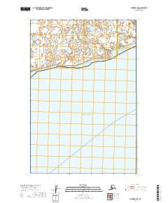
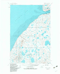
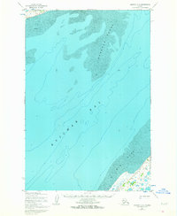
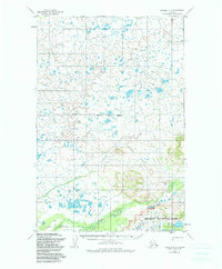
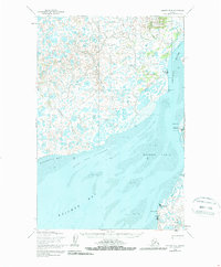
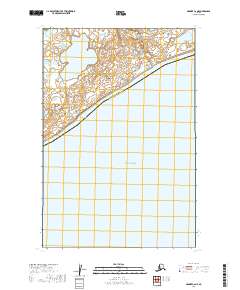
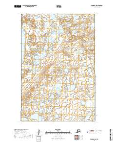
The vast waters of Kvichak Bay dominate this coastal section of Southwest Alaska, where the landscape transitions from the open sea to a marshy, lake-dotted shoreline. The northern coast is defined by the winding course of Copenhagen Creek and the sheltered indentation of Halfmoon Bay. This 2019 survey documents a sparsely populated but geographically significant intersection of administrative lines, including the boundary between the Bristol Bay Borough and the Lake and Peninsula Borough. A notable feature for maritime history and navigation is the Gravel Spit Anchorage, which suggests the area's ongoing importance for seasonal fishing and transport in the Bristol Bay region. The map provides a clear look at the intricate hydrography of the Alaskan tundra before it meets the tidal flats of the bay.
Find a feature on this map
10 named features on this map. Tap any name to fly to it.
Don’t see what you’re looking for? This feature index may not catch every label — zoom into the map to look around manually.
Map Details
Editions of this 2019 Naknek D-4 SW Map
This is the sole edition of this map. No revisions or reprints were ever made.
Historical Maps of Unorganized Borough Through Time
25 maps found

1945 Nushagak Bay
Bristol Bay Borough, AK

1949 Nushagak Bay
Bristol Bay Borough, AK
1951 Nushagak Bay
Bristol Bay Borough, AK
1952 Naknek C-2
Bristol Bay Borough, AK
1952 Naknek C-3
Bristol Bay Borough, AK
1952 Naknek C-4
Bristol Bay Borough, AK
1952 Naknek C-5
Bristol Bay Borough, AK
1952 Naknek D-2
Bristol Bay Borough, AK

1952 Naknek D-3
Bristol Bay Borough, AK
1952 Naknek D-4
Bristol Bay Borough, AK
1964 Nushagak Bay
Bristol Bay Borough, AK
2019 Naknek C-2 NE
Bristol Bay Borough, AK
2019 Naknek C-2 NW
Bristol Bay Borough, AK
2019 Naknek C-3 NE
Bristol Bay Borough, AK
2019 Naknek C-3 NW
Bristol Bay Borough, AK
2019 Naknek C-4 NE
Bristol Bay Borough, AK
2019 Naknek C-4 NW
Bristol Bay Borough, AK
2019 Naknek C-5 NW
Bristol Bay Borough, AK
2019 Naknek C-6 NE
Bristol Bay Borough, AK
2019 Naknek D-2 SE
Bristol Bay Borough, AK
2019 Naknek D-2 SW
Bristol Bay Borough, AK
2019 Naknek D-3 SE
Bristol Bay Borough, AK
2019 Naknek D-3 SW
Bristol Bay Borough, AK
2019 Naknek D-4 SE
Bristol Bay Borough, AK
2019 Naknek D-4 SW
Bristol Bay Borough, AK