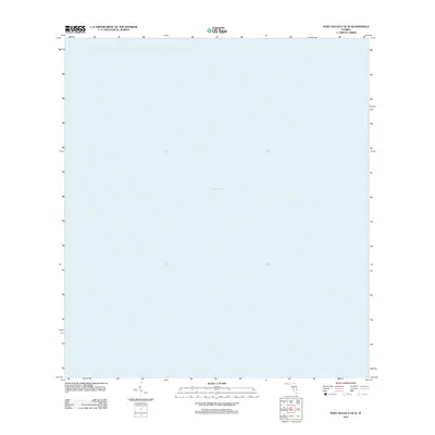
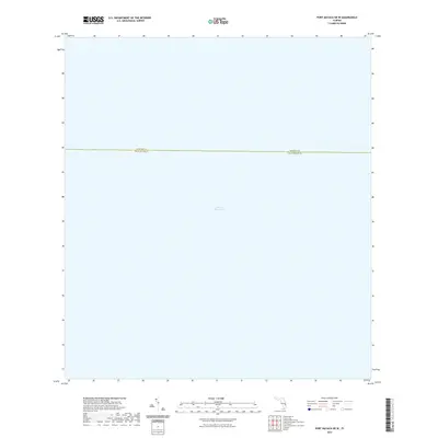
2024 Map of Port Mayaca OE W
USGS Topo · Published 2024About this map
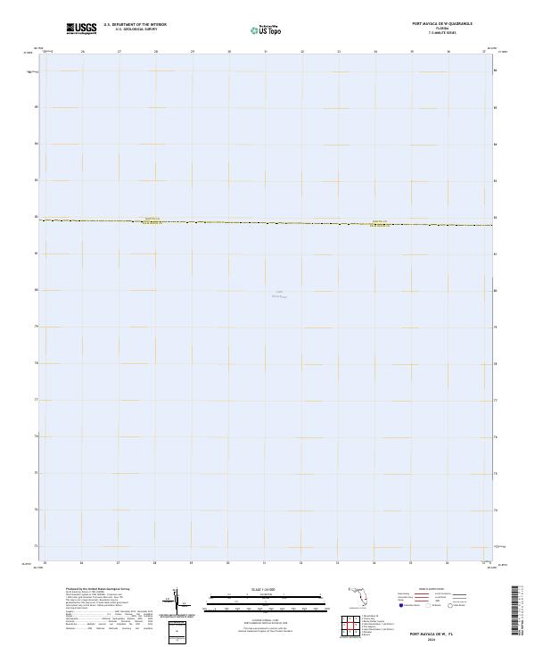
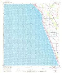
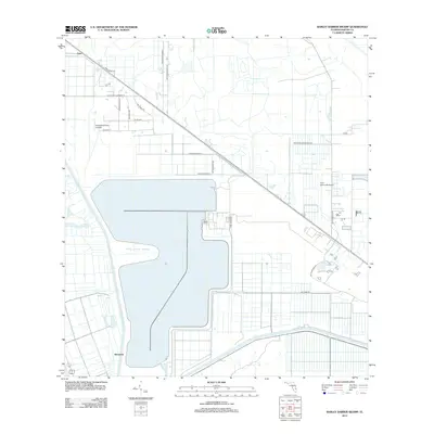
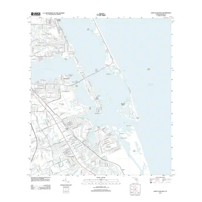
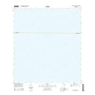
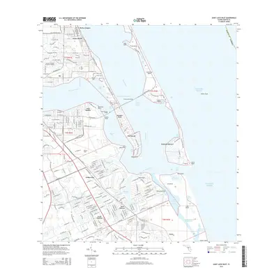
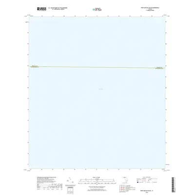
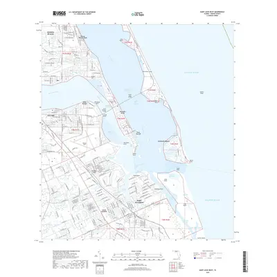
Lake Okeechobee dominates this expanse of the Florida interior, where the vast surface of the state’s largest freshwater lake meets the jurisdictional line between two prominent South Florida counties. The map illustrates a nearly singular environment of open water, highlighting the intersection of Martin Co and Palm Beach Co near the lake’s eastern shore. This 2024 edition documents the modern aquatic boundaries of the region, providing a clear view of the water bodies that define the geography west of Port Mayaca. While devoid of terrestrial landmarks, the sheet serves as a focused study of the lake's reach and the political divisions that span its waters.
Find a feature on this map
2 named features on this map. Tap any name to fly to it.
Don’t see what you’re looking for? This feature index may not catch every label — zoom into the map to look around manually.
Map Details
Editions of this 2024 Port Mayaca OE W Map
This is the sole edition of this map. No revisions or reprints were ever made.
Historical Maps of Palm Beach County Through Time
49 maps found
1948 Gomez
Martin County, FL
1948 St. Lucie Inlet
Martin County, FL
1949 Gomez
Martin County, FL
1950 St. Lucie Inlet
Martin County, FL
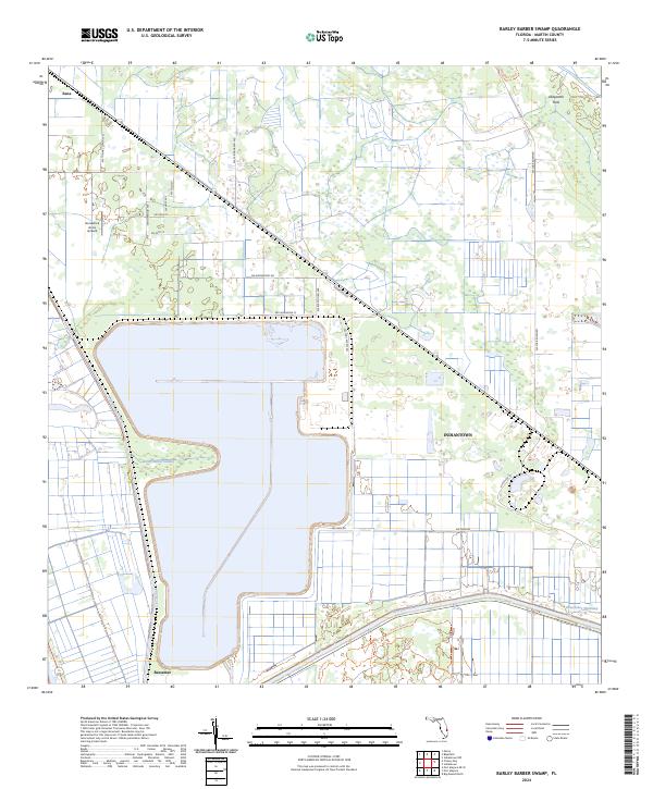
1953 Barley Barber Swamp
Martin County, FL
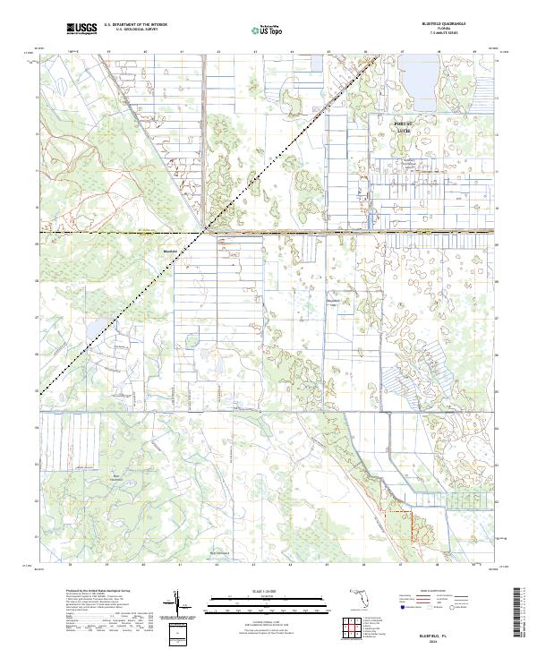
1953 Bluefield
Martin County, FL
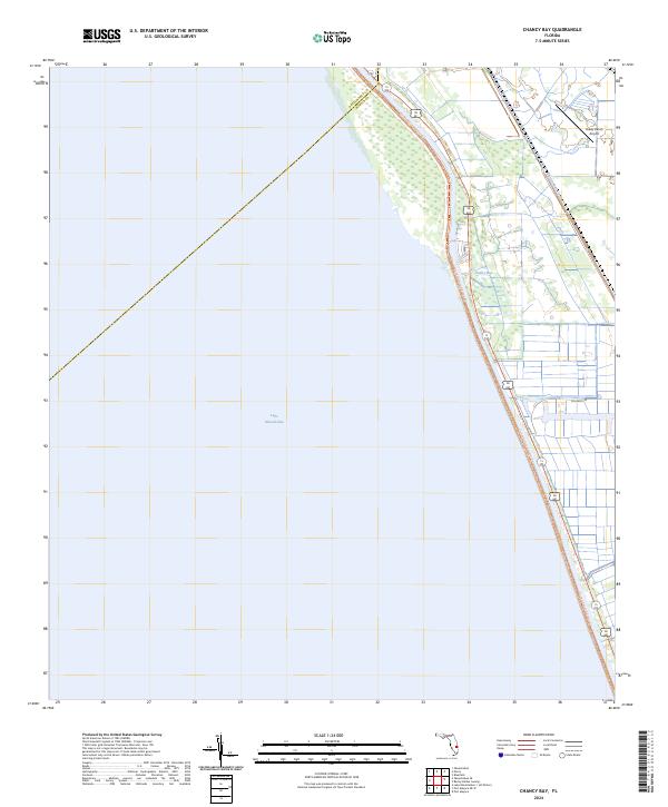
1953 Chaney Bay
Martin County, FL
1953 Indiantown NW
Martin County, FL
1953 Indiantown SE
Martin County, FL
2012 Barley Barber Swamp
Martin County, FL
2012 Bluefield
Martin County, FL

2012 Chancy Bay
Martin County, FL
2012 Gomez
Martin County, FL
2012 Indiantown NW
Martin County, FL
2012 Indiantown SE
Martin County, FL
2012 Port Mayaca OE W
Martin County, FL
2012 Saint Lucie Inlet
Martin County, FL
2015 Barley Barber Swamp
Martin County, FL
2015 Bluefield
Martin County, FL
2015 Chancy Bay
Martin County, FL
2015 Gomez
Martin County, FL
2015 Indiantown NW
Martin County, FL
2015 Indiantown SE
Martin County, FL
2015 Port Mayaca OE W
Martin County, FL
2015 Saint Lucie Inlet
Martin County, FL
2018 Barley Barber Swamp
Martin County, FL
2018 Bluefield
Martin County, FL
2018 Chancy Bay
Martin County, FL
2018 Gomez
Martin County, FL
2018 Indiantown NW
Martin County, FL
2018 Indiantown SE
Martin County, FL
2018 Port Mayaca OE W
Martin County, FL
2018 Saint Lucie Inlet
Martin County, FL

2021 Barley Barber Swamp
Martin County, FL
2021 Bluefield
Martin County, FL
2021 Chancy Bay
Martin County, FL
2021 Gomez
Martin County, FL
2021 Indiantown NW
Martin County, FL
2021 Indiantown SE
Martin County, FL
2021 Port Mayaca OE W
Martin County, FL

2021 Saint Lucie Inlet
Martin County, FL
2024 Barley Barber Swamp
Martin County, FL
2024 Bluefield
Martin County, FL
2024 Chancy Bay
Martin County, FL
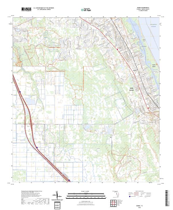
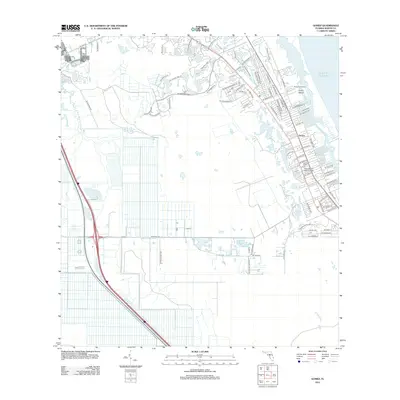
2024 Gomez
Martin County, FL
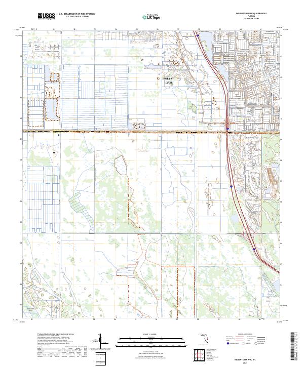
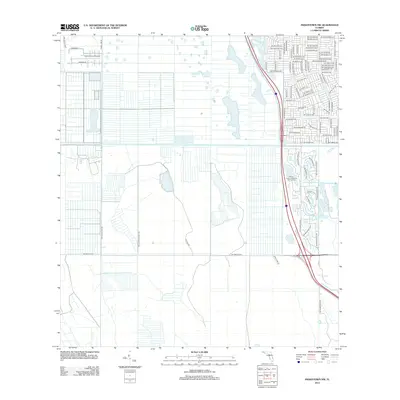
2024 Indiantown NW
Martin County, FL
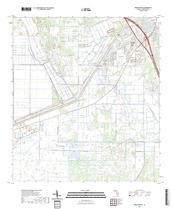
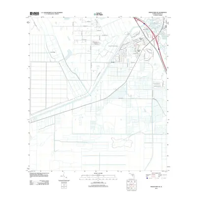
2024 Indiantown SE
Martin County, FL
2024 Port Mayaca OE W
Martin County, FL
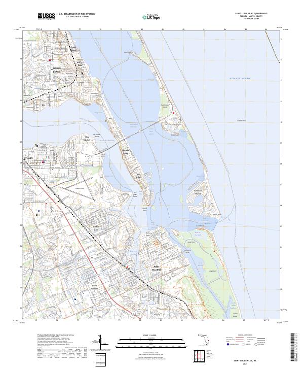
2024 Saint Lucie Inlet
Martin County, FL