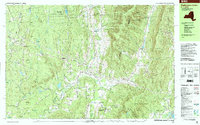
1998 Map of Stephentown Center
USGS Topo · Published 2000About this map
The Taconic Range dominates the eastern half of this borderland survey, forming a natural wall between New York and Massachusetts. The settlement pattern follows the lower elevations of the Kinderhook Creek valley, where several small villages including Stephentown, Garfield, and Stephentown Center are situated. The landscape reflects a legacy of small-scale agriculture and early industry, evidenced by multiple Gravel Pits and family-named cemeteries like Presbyterian Hill Cem. To the north, the Capital District Wildlife Management Area and Cherry Plain State Park preserve large tracts of timberland. On the Massachusetts side, the terrain rises sharply toward Brodie Mountain and Jiminy Peak, where the drainage of the West Branch Green River carves through the heights of the Pittsfield State Forest.
Find a feature on this map
79 named features on this map. Tap any name to fly to it.
Don’t see what you’re looking for? This feature index may not catch every label — zoom into the map to look around manually.
Map Details
Editions of this 1998 Stephentown Center Map
This is the sole edition of this map. No revisions or reprints were ever made.
Other maps of this area

1886 · Greylock
USGS Topo · 1:62,500

1886 · Becket
USGS Topo · 1:62,500

1888 · Becket
USGS Topo · 1:62,500

1888 · Berlin
USGS Topo · 1:62,500

1888 · Pittsfield
USGS Topo · 1:62,500

1890 · Pittsfield
USGS Topo · 1:62,500

1890 · Berlin
USGS Topo · 1:62,500

1891 · Greylock
USGS Topo · 1:62,500

1893 · Troy
USGS Topo · 1:62,500

1893 · Becket
USGS Topo · 1:62,500