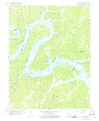
1959 Map of Bollinger Creek
USGS Topo · Published 1975About this map
Lake of the Ozarks dominates this landscape, showing the complex shoreline of the reservoir as it fills the deep valleys of the Osage River basin. The map documents the intricate geography of the region's prominent peninsulas, including Coffman Bend, Wilson Bend, and Ivy Bend, which are defined by high ridges and steep hollows. The presence of several family-named burial sites, such as Parish Cem, Wilson Cem, and Woolery Cem, provides a detailed record of the rural communities that lived here before and during the development of the lake. While much of the terrain is submerged or high-relief forest, a Landing Field near Brown Bend and the Spillway 659 mark the modern infrastructure of the mid-20th century. The intricate network of tributary hollows, like Wildcat Hollow and Polly Hollow, demonstrates how the rising waters transformed once-dry creek beds into winding coves.
Find a feature on this map
35 named features on this map. Tap any name to fly to it.
Don’t see what you’re looking for? This feature index may not catch every label — zoom into the map to look around manually.
Map Details
Editions of this 1959 Bollinger Creek Map
3 editions found
Other maps of this area

1887 · Warsaw
USGS Topo · 1:125,000

1888 · Versailles
USGS Topo · 1:125,000

1893 · Versailles
USGS Topo · 1:125,000

1894 · Warsaw
USGS Topo · 1:125,000

1904 · Gravois Mills
USGS Topo · 1:62,500

1934 · Purvis
USGS Topo · 1:24,000

1934 · Irontown Ferry
USGS Topo · 1:24,000

1934 · Green Bay Terrace
USGS Topo · 1:24,000

1935 · Gravois Mills
USGS Topo · 1:24,000

1935 · Barnumton
USGS Topo · 1:24,000