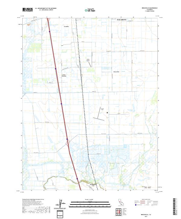
2021 Map of Bruceville
USGS Topo · Published 2021About this map
Franklin and Point Pleasant anchor this portion of the Sacramento Valley, where the landscape is defined by an intricate network of waterways and agricultural grids. The southern reaches of the map are dominated by the confluence of the Mokelumne River and Cosumnes River, a region dense with complex hydrology including Snodgrass Slough, Grizzly Slough, and Bear Slough. This area at the border of Sacramento and San Joaquin counties reflects a highly managed floodplain, with numerous levees such as Levee Rd protecting the fertile lowlands. Local aviation is represented by Franklin Field and the Flying B Ranch Airport, while the settlement of Bruceville serves as a central landmark within this rural expanse. The map traces the transition from the open waters of Stone Lake in the northwest to the riparian corridors that weave through the Central Valley.
Find a feature on this map
42 named features on this map. Tap any name to fly to it.
Don’t see what you’re looking for? This feature index may not catch every label — zoom into the map to look around manually.
Map Details
Editions of this 2021 Bruceville Map
This is the sole edition of this map. No revisions or reprints were ever made.
Other maps of this area

1894 · Lodi
USGS Topo · 1:125,000

1908 · Courtland
USGS Topo · 1:62,500

1909 · Elk Grove
USGS Topo · 1:31,680

1909 · Florin
USGS Topo · 1:31,680

1910 · New Hope
USGS Topo · 1:31,680

1910 · Woodbridge
USGS Topo · 1:31,680

1910 · Bruceville
USGS Topo · 1:31,680

1910 · Galt
USGS Topo · 1:31,680

1910 · Isleton
USGS Topo · 1:31,680

1916 · Vorden
USGS Topo · 1:31,680