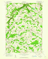
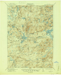
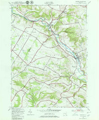
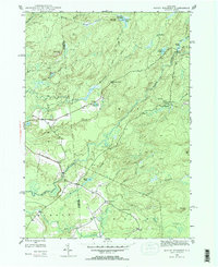
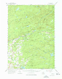
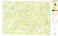
1943 Map of Millers Mills
USGS Topo · Published 1960This historical map portrays the area of Millers Mills in 1943, primarily covering Herkimer County as well as portions of Otsego County. Featuring a scale of 1:24000, this map provides a highly detailed snapshot of the terrain, roads, buildings, counties, and historical landmarks in the Millers Mills region at the time. Published in 1960, it is one of 2 known editions of this map due to revisions or reprints.
Find a feature on this map
57 named features on this map. Tap any name to fly to it.
Don’t see what you’re looking for? This feature index may not catch every label — zoom into the map to look around manually.
Map Details
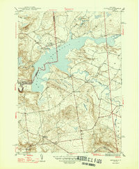
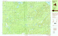
Editions of this 1943 Millers Mills Map
2 editions found
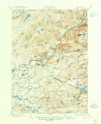
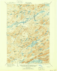
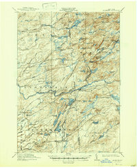
Historical Maps of Dennison Corners Through Time
41 maps found

1900 Wilmurt
Herkimer County, NY
1902 Wilmurt
Herkimer County, NY
1903 Big Moose
Herkimer County, NY
1912 Mc Keever
Herkimer County, NY

1912 Number Four
Herkimer County, NY
1915 Number Four
Herkimer County, NY
1943 Herkimer
Herkimer County, NY
1943 Jordanville
Herkimer County, NY
1943 Millers Mills
Herkimer County, NY
1943 Newport
Herkimer County, NY

1943 Utica East
Herkimer County, NY
1943 Van Hornesville
Herkimer County, NY

1945 Herkimer
Herkimer County, NY

1945 Jordanville
Herkimer County, NY

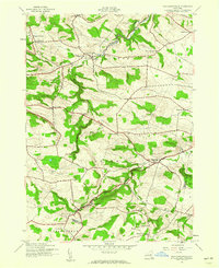
1945 Millers Mills
Herkimer County, NY

1945 Newport
Herkimer County, NY
1945 Salisbury
Herkimer County, NY

1945 Utica East
Herkimer County, NY

1945 Van Hornesville
Herkimer County, NY
1946 Hinckley
Herkimer County, NY

1946 Millers Mills
Herkimer County, NY
1946 North Wilmurt
Herkimer County, NY

1946 Salisbury
Herkimer County, NY
1947 Hinckley
Herkimer County, NY
1947 North Wilmurt
Herkimer County, NY

1949 Herkimer
Herkimer County, NY

1949 Millers Mills
Herkimer County, NY
1954 Big Moose
Herkimer County, NY
1954 Ohio
Herkimer County, NY
1955 Utica East
Herkimer County, NY
1957 Number Four
Herkimer County, NY
1958 Mc Keever
Herkimer County, NY

1982 Newport
Herkimer County, NY

1983 Utica East
Herkimer County, NY

1989 Beavers River
Herkimer County, NY
1989 Honnedaga Lake
Herkimer County, NY

1989 Mc Keever
Herkimer County, NY

1989 Morehouseville
Herkimer County, NY
1989 Number Four
Herkimer County, NY

1989 Ohio
Herkimer County, NY

1989 Stillwater
Herkimer County, NY