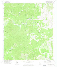
1971 Map of Jo Jan Van Camp
USGS Topo · Published 1974About this map
Jo Jan Van Camp sits amidst a complex network of canyons and springs in Real County, documented here in the early 1970s. The landscape is defined by the winding course of Bullhead Creek and New Creek, which are fed by numerous named water sources such as Flynn Springs, Lynn Spring, and Pecan Springs. This map reveals a terrain where water was the primary driver of naming and movement, evident in the density of hollows like Holmes Hollow and Hog Pen Hollow that carve into the Edwards Plateau. Notable peaks such as Echo Mountain and Turkey Peak provide significant relief above the drainages. Human activity is marked by scattered jeep trails and specific sites like Two Acre Flat and the Ice Waterhole Spr, suggesting a remote ranching or recreational landscape where navigation relied on distinctive natural landmarks and seasonal water holes like Pflether Lake.
Find a feature on this map
50 named features on this map. Tap any name to fly to it.
Don’t see what you’re looking for? This feature index may not catch every label — zoom into the map to look around manually.
Map Details
Editions of this 1971 Jo Jan Van Camp Map
This is the sole edition of this map. No revisions or reprints were ever made.
Other maps of this area

1893 · Nueces
USGS Topo · 1:125,000

1896 · Nueces
USGS Topo · 1:125,000

1944 · Barksdale
USGS Topo · 1:62,500

1947 · Hackberry
USGS Topo · 1:62,500

1954 · San Antonio
USGS Topo · 1:250,000

1957 · San Antonio
USGS Topo · 1:250,000

1957 · York Hollow
USGS Topo · 1:62,500

1958 · Del Rio
USGS Topo · 1:250,000

1964 · Del Rio
USGS Topo · 1:250,000
1971 · Leakey
USGS Topo · 1:24,000