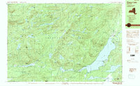
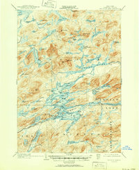
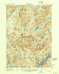
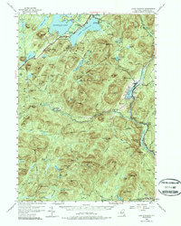
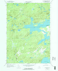
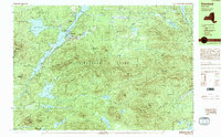
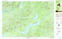
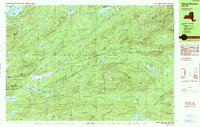
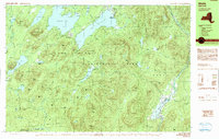
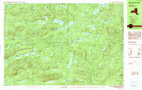
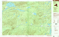
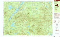
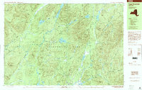
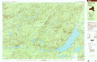
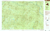
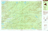
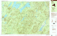
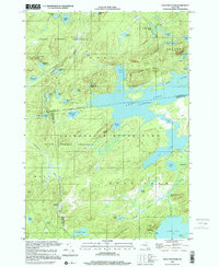
1990 Map of Piseco Lake
USGS Topo · Published 1990This historical map portrays the area of Piseco Lake in 1990, primarily covering Hamilton County. Featuring a scale of 1:25000, this map provides a highly detailed snapshot of the terrain, roads, buildings, counties, and historical landmarks in the Piseco Lake region at the time. Published in 1990, it is one of 2 known editions of this map due to revisions or reprints.
Find a feature on this map
82 named features on this map. Tap any name to fly to it.
Don’t see what you’re looking for? This feature index may not catch every label — zoom into the map to look around manually.
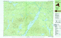
Map Details
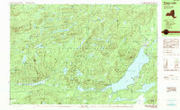
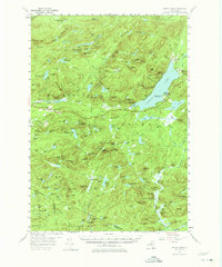
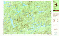
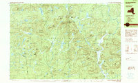
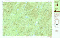
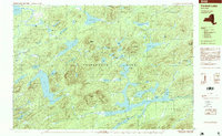
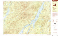
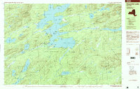
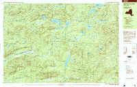
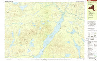
Editions of this 1990 Piseco Lake Map
2 editions found
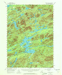
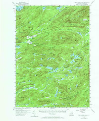
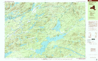
Historical Maps of Hamilton County Through Time
48 maps found

1899 Indian Lake
Hamilton County, NY

1900 Canada Lake
Hamilton County, NY
1902 Indian Lake
Hamilton County, NY
1903 Blue Mountain
Hamilton County, NY
1903 Raquette Lake
Hamilton County, NY
1903 West Canada Lakes
Hamilton County, NY

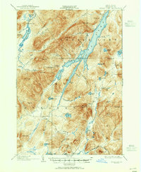
1904 Piseco Lake
Hamilton County, NY
1906 Piseco Lake
Hamilton County, NY
1907 Lake Pleasant
Hamilton County, NY

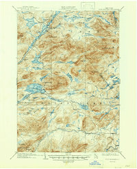
1908 Piseco Lake
Hamilton County, NY
1910 Stony Creek
Hamilton County, NY
1954 Blue Mountain
Hamilton County, NY
1954 Harrisburg
Hamilton County, NY
1954 Indian Lake
Hamilton County, NY
1954 Lake Pleasant
Hamilton County, NY
1954 Piseco Lake
Hamilton County, NY
1954 Raquette Lake
Hamilton County, NY
1954 West Canada Lakes
Hamilton County, NY
1968 Wolf Mountain
Hamilton County, NY
1979 Kempshall Mtn
Hamilton County, NY
1985 Raquette Lake
Hamilton County, NY
1989 Blue Mtn Lake
Hamilton County, NY
1989 Deerland
Hamilton County, NY
1989 Forked Lake
Hamilton County, NY
1989 Raquette Lake
Hamilton County, NY
1990 Indian Lake
Hamilton County, NY
1990 Little Tupper Lake
Hamilton County, NY
1990 Morehouse Mountain
Hamilton County, NY
1990 Page Mountain
Hamilton County, NY
1990 Piseco Lake
Hamilton County, NY
1990 Three Ponds Mountain
Hamilton County, NY
1990 Wakely Mountain
Hamilton County, NY
1990 Wells
Hamilton County, NY
1990 West Canada Lakes
Hamilton County, NY
1997 Blue Mtn Lake
Hamilton County, NY
1997 Deerland
Hamilton County, NY
1997 Forked Lake
Hamilton County, NY
1997 Indian Lake
Hamilton County, NY
1997 Page Mountain
Hamilton County, NY
1997 Piseco Lake
Hamilton County, NY
1997 Raquette Lake
Hamilton County, NY
1997 Three Ponds Mountain
Hamilton County, NY
1997 Wakely Mountain
Hamilton County, NY
1997 Wells
Hamilton County, NY
1997 West Canada Lakes
Hamilton County, NY
1999 Kempshall Mtn
Hamilton County, NY
1999 Little Tupper Lake
Hamilton County, NY
1999 Wolf Mountain
Hamilton County, NY