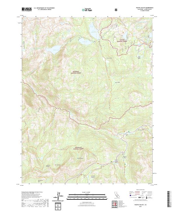
2021 Map of Pacific Valley
USGS Topo · Published 2021About this map
Toiyabe National Forest, Eldorado National Forest, and Stanislaus National Forest converge in this high-altitude region of Alpine County. The landscape is defined by the headwaters of major waterways, including the N Fork Mokelumne River and the N Fork Stanislaus River. This territory is a critical junction for historic and modern transit through the Sierra Nevada, where the Pacific Crest National Scenic Trl intersects with the legacy of the Emigrant Trl. Settlement is sparse, represented by locations like Hermit Valley and Pacific Valley, while the topography is punctuated by numerous alpine basins such as Deadwood Lake, Lower Blue Lake, and Granite Lake. The elevation reaches its peak at Pacific Grade Summit, overlooking a complex network of 4WD tracks and forest trails like the Deer Valley 4wd Trl and Sandy Mdw Trl that provide access to remote meadows such as Sandy Meadow and Cliff Meadow.
Find a feature on this map
55 named features on this map. Tap any name to fly to it.
Don’t see what you’re looking for? This feature index may not catch every label — zoom into the map to look around manually.
Map Details
Editions of this 2021 Pacific Valley Map
This is the sole edition of this map. No revisions or reprints were ever made.
Other maps of this area

1889 · Pyramid Peak
USGS Topo · 1:125,000

1889 · Markleeville
USGS Topo · 1:125,000

1891 · Markleeville
USGS Topo · 1:125,000

1891 · Big Trees
USGS Topo · 1:125,000

1891 · Pyramid Peak
USGS Topo · 1:125,000

1893 · Markleeville
USGS Topo · 1:125,000

1894 · Big Trees
USGS Topo · 1:125,000

1895 · Pyramid Peak
USGS Topo · 1:125,000

1896 · Dardanelles
USGS Topo · 1:125,000

1896 · Pyramid Peak
USGS Topo · 1:125,000