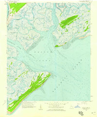
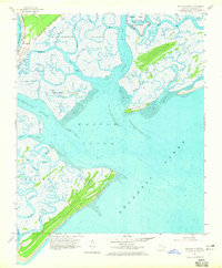
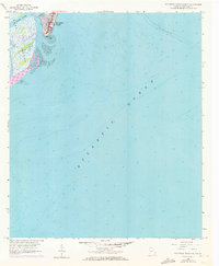
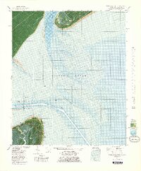
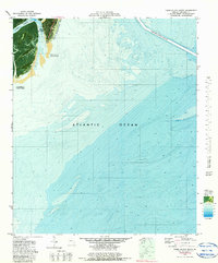
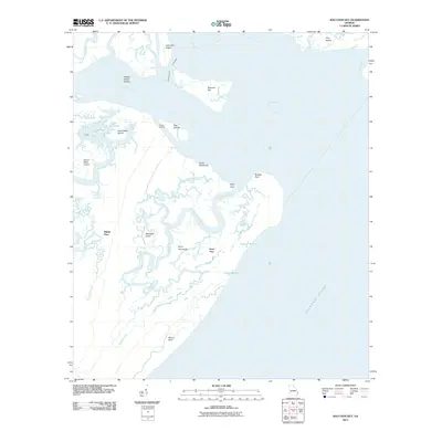
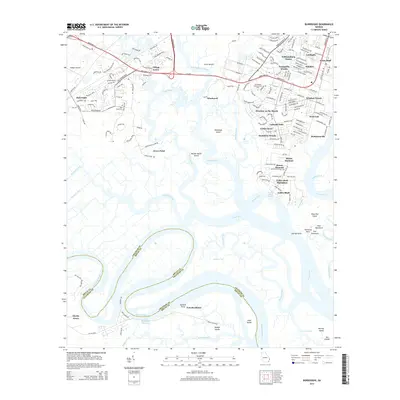
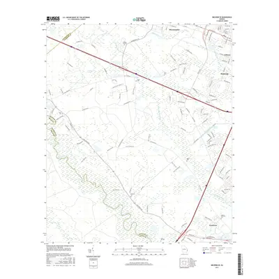
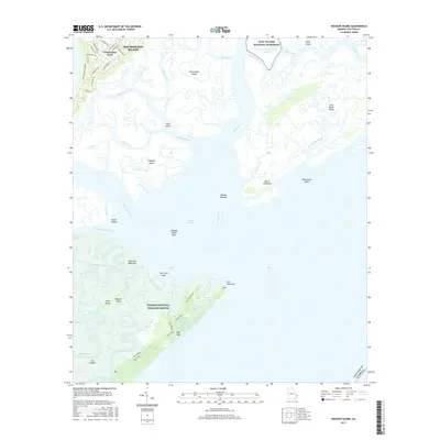
1957 Map of Wassaw Sound
USGS Topo · Published 1959About this map
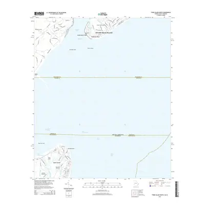
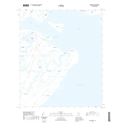
Fort Pulaski National Monument stands as a sentinel at the northern edge of this coastal landscape, where the Bull River and Lazaretto Creek converge before meeting the sea. The 1957 topography reveals a complex network of tidal waterways and marshlands, including the wide expanse of Wassaw Sound and the intricate channels of Romerly Marsh Creek. To the south, the undeveloped stretch of Wassaw Island is defined by its primary ridges and the winding Wassaw Creek, while Wilmington Island shows the early fingerprints of infrastructure along Walthour Road. This survey documents a critical moment in the Georgia coast's natural geography, capturing the shifting shape of Cabbage Spit and the numerous named hammocks and islands like Petit Chou Island before significant modern alteration. The depth soundings throughout the sound and the Atlantic Ocean provide an essential record for maritime historians and those studying coastal erosion patterns along the Tybee and Wilmington inlets.
Find a feature on this map
33 named features on this map. Tap any name to fly to it.
Don’t see what you’re looking for? This feature index may not catch every label — zoom into the map to look around manually.
Map Details
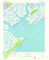
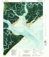
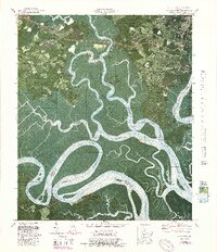
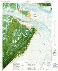
Editions of this 1957 Wassaw Sound Map
3 editions found
Historical Maps of Wilmington Through Time
59 maps found

1944 Ossabaw Island
Chatham County, GA

1945 Ossabaw Island
Chatham County, GA
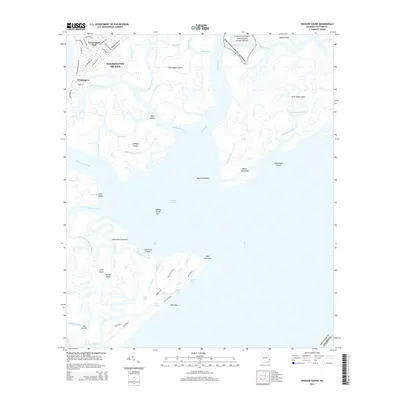
1957 Burroughs
Chatham County, GA
1957 Raccoon Key
Chatham County, GA
1957 Savannah Beach South
Chatham County, GA
1957 Wassaw Sound
Chatham County, GA
1958 Meldrim SE
Chatham County, GA
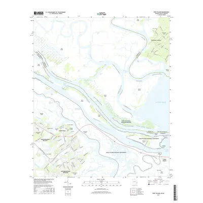
1978 Fort Pulaski
Chatham County, GA
1978 Tybee Island North
Chatham County, GA
1978 Wassaw Sound
Chatham County, GA
1979 Burroughs
Chatham County, GA
1979 Raccoon Key
Chatham County, GA
1979 Tybee Island South
Chatham County, GA
1980 Wassaw Sound
Chatham County, GA
2011 Burroughs
Chatham County, GA
2011 Fort Pulaski
Chatham County, GA
2011 Raccoon Key
Chatham County, GA

2011 Raccoon Key OE S
Chatham County, GA
2011 Tybee Island North
Chatham County, GA
2011 Tybee Island South
Chatham County, GA
2011 Wassaw Sound
Chatham County, GA

2011 Wassaw Sound OE S
Chatham County, GA

2012 Meldrim SE
Chatham County, GA
2014 Burroughs
Chatham County, GA
2014 Fort Pulaski
Chatham County, GA
2014 Meldrim SE
Chatham County, GA
2014 Raccoon Key
Chatham County, GA

2014 Raccoon Key OE S
Chatham County, GA
2014 Tybee Island North
Chatham County, GA

2014 Tybee Island South
Chatham County, GA
2014 Wassaw Sound
Chatham County, GA

2014 Wassaw Sound OE S
Chatham County, GA
2017 Burroughs
Chatham County, GA
2017 Fort Pulaski
Chatham County, GA
2017 Meldrim SE
Chatham County, GA
2017 Raccoon Key
Chatham County, GA

2017 Raccoon Key OE S
Chatham County, GA
2017 Tybee Island North
Chatham County, GA
2017 Tybee Island South
Chatham County, GA
2017 Wassaw Sound
Chatham County, GA

2017 Wassaw Sound OE S
Chatham County, GA
2020 Burroughs
Chatham County, GA
2020 Fort Pulaski
Chatham County, GA
2020 Meldrim SE
Chatham County, GA
2020 Raccoon Key
Chatham County, GA

2020 Raccoon Key OE S
Chatham County, GA
2020 Tybee Island North
Chatham County, GA

2020 Tybee Island South
Chatham County, GA
2020 Wassaw Sound
Chatham County, GA

2020 Wassaw Sound OE S
Chatham County, GA
2024 Burroughs
Chatham County, GA
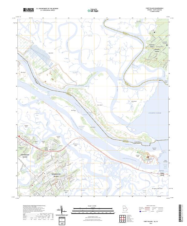
2024 Fort Pulaski
Chatham County, GA
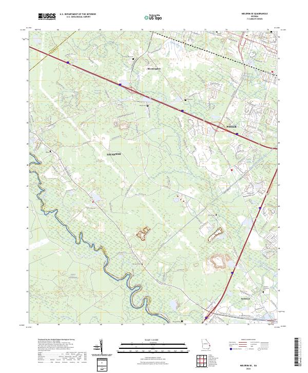
2024 Meldrim SE
Chatham County, GA
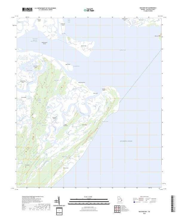
2024 Raccoon Key
Chatham County, GA
2024 Raccoon Key OE S
Chatham County, GA
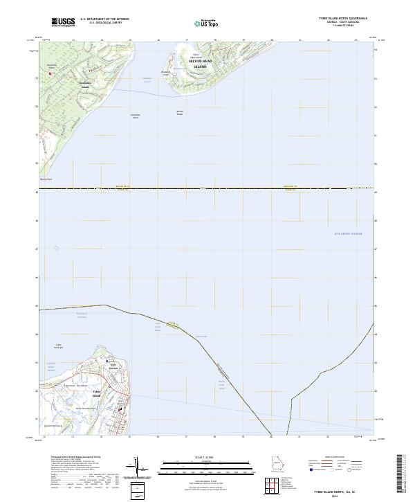
2024 Tybee Island North
Chatham County, GA
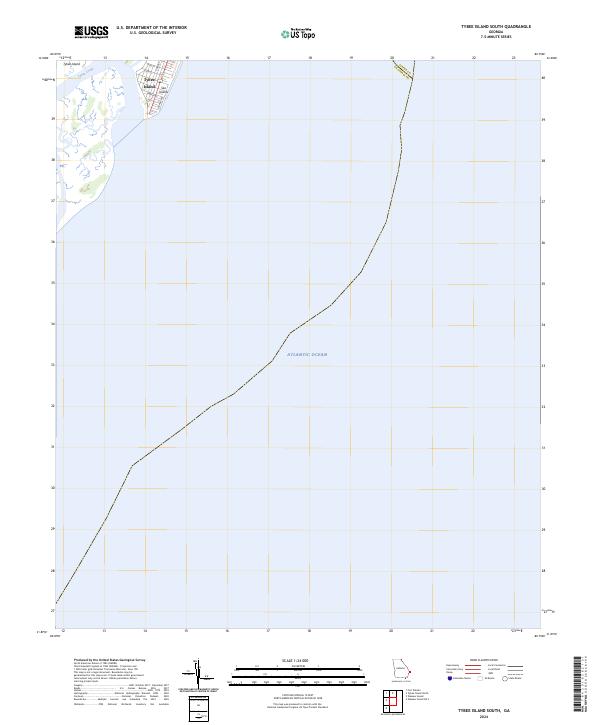
2024 Tybee Island South
Chatham County, GA
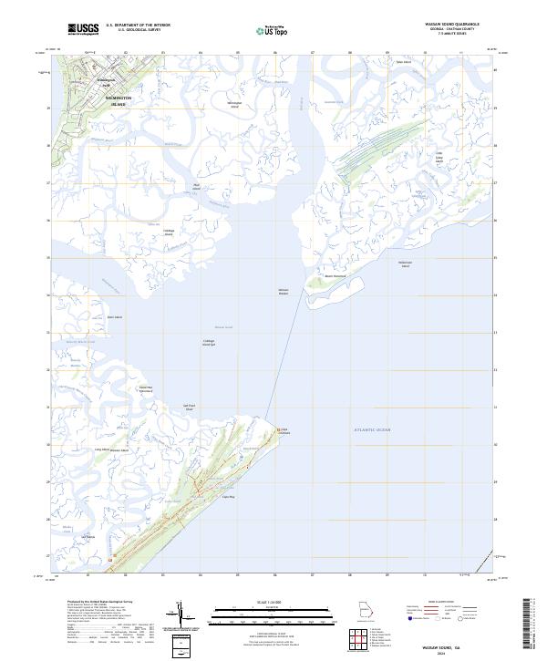
2024 Wassaw Sound
Chatham County, GA
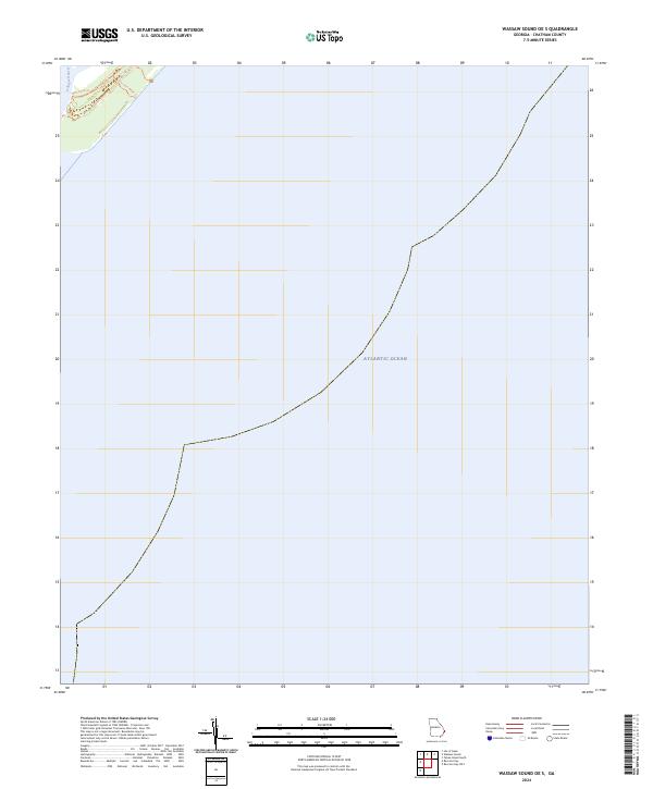
2024 Wassaw Sound OE S
Chatham County, GA