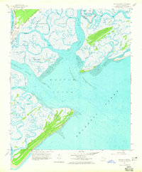
1957 Map of Wassaw Sound
USGS Topo · Published 1965About this map
Fort Pulaski National Monument commands the northern reaches of this coastal survey, situated near McQueens Island and the mouth of the Bull River. The landscape is dominated by a complex network of tidal waterways and marshlands, including the Wilmington River and Lazaretto Creek, which carve through Wilmington Island and Tybee Island. On the southern edge, the expansive Wassaw Island stands as a significant barrier landform, separated from the mainland by the broad Wassaw Sound.
Find a feature on this map
47 named features on this map. Tap any name to fly to it.
Don’t see what you’re looking for? This feature index may not catch every label — zoom into the map to look around manually.
Map Details
Editions of this 1957 Wassaw Sound Map
3 editions found
Other maps of this area

1920 · Wassaw Sound
USGS Topo · 1:62,500

1920 · Bluffton
USGS Topo · 1:62,500

1942 · Savannah
USGS Topo · 1:62,500

1944 · Ossabaw Island
USGS Topo · 1:62,500

1945 · Bluffton
USGS Topo · 1:62,500

1945 · Ossabaw Island
USGS Topo · 1:62,500

1945 · Wassaw Sound
USGS Topo · 1:62,500

1946 · Brunswick
USGS Topo · 1:250,000

1947 · Savannah
USGS Topo · 1:250,000

1948 · Brunswick
USGS Topo · 1:250,000