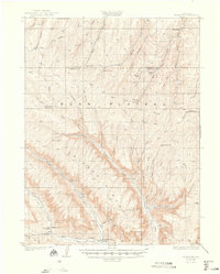
1929 Map of Highmore
USGS Topo · Published 1948About this map
The Roan Plateau dominates this late-1920s survey of western Colorado, characterized by a sparse network of homestead cabins and ranch outposts. The transition from Old Highmore to the Highmore PO settlement along the southern margin reveals the slow evolution of high-country residency. Further north, the landscape is dotted with individual dwellings like Brookners Cabin, Loves Cabin, and Shortys Cabin, while the presence of the Good Hope Shale Camp points to early industrial interest in the region's energy resources. The terrain is deeply incised by drainages such as Clear Creek, Brush Creek, and Willow Creek, which provided the necessary water for operations at Middle Ranch and Parks Ranch. Remote landmarks like the Hunting Lodge and the Carr Creek School illustrate the infrastructure supporting a scattered population of ranchers and prospectors working beneath the massive Cliffs.
Find a feature on this map
61 named features on this map. Tap any name to fly to it.
Don’t see what you’re looking for? This feature index may not catch every label — zoom into the map to look around manually.
Map Details
Editions of this 1929 Highmore Map
3 editions found
Other maps of this area

1925 · Parachute Creek
USGS Topo · 1:62,500

1927 · Parachute Creek
USGS Topo · 1:62,500

1929 · Grand Valley
USGS Topo · 1:62,500

1929 · Highmore
USGS Topo · 1:62,500

1929 · Roan Creek
USGS Topo · 1:62,500

1952 · Yankee Gulch
USGS Topo · 1:24,000

1952 · Rock School
USGS Topo · 1:24,000

1952 · Jessup Gulch
USGS Topo · 1:24,000

1956 · Grand Junction
USGS Topo · 1:250,000

1959 · Grand Junction
USGS Topo · 1:250,000