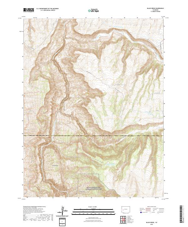
2022 Map of Black Ridge
USGS Topo · Published 2022About this map
Black Canyon of the Gunnison National Park dominates the southern reaches of this landscape, where the deeply carved terrain of the Gunnison River meets the high elevations of Black Ridge. The map illustrates a complex network of resource management and pastoral use, evidenced by the irrigation infrastructure of the Grand View Ditch and Fruitland Mesa Ditch. These systems support the flatter expanses of Fruitland Mesa, contrasting with the steep, broken country of Red Canyon and Long Gulch. Remote outposts and seasonal sites like Pitts Meadow and Pleasant Park suggest a history of grazing and high-country habitation. Traces of indigenous and early travel are preserved in routes such as the Ute Tri, while the presence of Green Mountain Reservoir Number 1 indicates the ongoing importance of water storage in this arid environment at the boundary of Delta and Montrose counties.
Find a feature on this map
36 named features on this map. Tap any name to fly to it.
Don’t see what you’re looking for? This feature index may not catch every label — zoom into the map to look around manually.
Map Details
Editions of this 2022 Black Ridge Map
This is the sole edition of this map. No revisions or reprints were ever made.
Other maps of this area

1955 · Olathe NW
USGS Topo · 1:24,000

1955 · Black Ridge
USGS Topo · 1:24,000

1955 · Olathe
USGS Topo · 1:24,000

1955 · Red Rock Canyon
USGS Topo · 1:24,000

1955 · Lazear
USGS Topo · 1:24,000

1956 · Montrose
USGS Topo · 1:250,000

1957 · Grizzly Ridge
USGS Topo · 1:24,000

1959 · Montrose
USGS Topo · 1:250,000

1960 · Montrose
USGS Topo · 1:250,000
1962 · Orchard City
USGS Topo · 1:24,000